– Lat/Long: 49.07° N 22.73° E
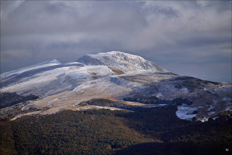
 Tarnica
Weather Forecast, PolandIssued: 2 pm Mon 03 Aug Local TimeUpdates in: hr min sUpdate imminent
Issued: 2 pm Mon 03 Aug Local Time
Updates in:
Update imminent hr min s

Issued: 2 pm Mon 03 Aug Local Time
Updates in:
Update imminent hr min s
Days 1–4 Weather SummaryLight rain (total 3mm), mostly falling on Mon night. Warm (max 27°C on Wed afternoon, min 20°C on Mon night). Wind will be generally light. | Days 5–7 Weather SummaryLight rain (total 9mm), mostly falling on Fri night. Warm (max 27°C on Thu afternoon, min 10°C on Sat night). Winds increasing (calm on Fri morning, strong winds from the NE by Sat night). | ||||||||||||||||
Mon 3 | Tuesday 4 | Wednesday 5 | Thursday 6 | Friday 7 | Saturday 8 | ||||||||||||
PM | night | AM | PM | night | AM | PM | night | AM | PM | night | AM | PM | night | AM | PM | night | |
some clouds | risk tstorm | clear | clear | clear | clear | clear | clear | clear | some clouds | rain shwrs | some clouds | clear | risk tstorm | light rain | light rain | rain shwrs | |
Cloud base (m) | 3150 | 2700 | 4300 | 4200 | 4350 | 4600 | 4300 | 4550 | 750 | 500 | 550 | 600 | |||||
km/h | |||||||||||||||||
 | 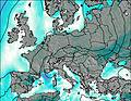 | 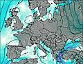 | 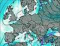 |  |  | ||||||||||||
— | — | — | — | — | — | — | — | — | — | — | — | — | — | — | — | — | |
mm | — | 3 | — | — | — | — | — | — | — | — | 0.4 | — | — | 8 | 0.8 | 0.6 | 0.1 |
max °C | 24 | 22 | 23 | 25 | 24 | 25 | 27 | 26 | 25 | 27 | 25 | 22 | 21 | 18 | 13 | 12 | 12 |
min °C | 23 | 20 | 22 | 24 | 23 | 24 | 26 | 25 | 25 | 27 | 22 | 20 | 20 | 14 | 13 | 11 | 10 |
chill °C | 23 | 20 | 22 | 24 | 23 | 24 | 26 | 25 | 25 | 27 | 22 | 20 | 20 | 12 | 11 | 8 | 6 |
Freezing level m | 4150 | 4300 | 4300 | 4350 | 4500 | 4500 | 4500 | 4600 | 4500 | 4550 | 4600 | 4450 | 4400 | 4300 | 4150 | 4000 | 4000 |
— | — | 6:03 | — | — | 6:05 | — | — | 6:07 | — | — | 6:07 | — | — | 6:09 | — | — | |
— | 9:06 | — | — | 9:04 | — | — | 9:02 | — | — | 9:00 | — | — | 9:00 | — | 8:58 | — | |
Loading...
Tarnica Weather (Days 0-3):
The weather forecast for Tarnica is: Light rain (total 3mm), mostly falling on Mon night. Warm (max 27°C on Wed afternoon, min 20°C on Mon night). Wind will be generally light.
Tarnica Weather (Days 3-6):
Light rain (total 9mm), mostly falling on Fri night. Warm (max 27°C on Thu afternoon, min 10°C on Sat night). Winds increasing (calm on Fri morning, strong winds from the NE by Sat night).
This table gives the weather forecast for Tarnica at the specific elevation of 1346 m. Our advanced weather models allow us to provide distinct weather forecasts for several elevations of Tarnica. To see the weather forecasts for the other elevations, use the tab navigation above the table. For a wider overview of the weather, consult the Weather Map of Poland.
| Weather Station | Temp. | Weather | Wind | Gusts | Cloud / Visibility |
|---|---|---|---|---|---|
lightning 22km W of Turka | |||||
lightning 27km N of Perechyn | |||||
lightning 20km SE of Ustrzyki Dolne | |||||
lightning 16km NNE of Snina | |||||
lightning 27km E of Medzilaborce | |||||
lightning 12km SSW of Podbuzh | |||||
lightning 13km SSW of Skhodnitsa | |||||
lightning 10km ESE of Lesko |
* NOTE: not all weather observatories update at the same frequency which is the reason why some locations may show data from stations that are further away than known closer ones.
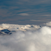
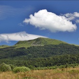
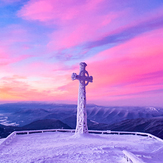
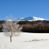
Tarnica Photos
View all
Beskids photos (76) |
Carpathian Mountains photos (366) |
photos from mountains in Poland (290) |
all photos
 Upload new photo
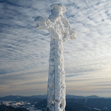

 See 16 more Tarnica photos
Tarnica, 2011.02
Tarnica
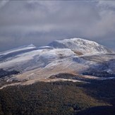
Tarnica, 2015.12.27
Tarnica
Tarnica
Rastak
Sylwester 2016