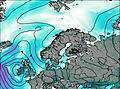
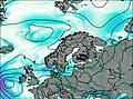
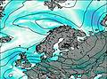
– Lat/Long: 68.17° N 16.59° E
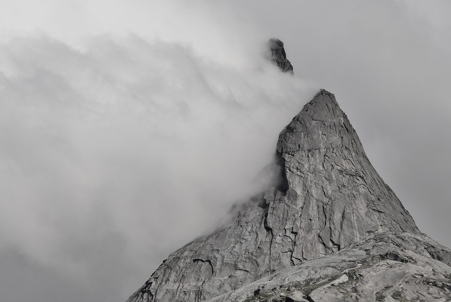
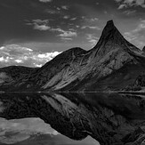
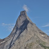
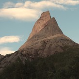
 Stetind
Weather Forecast, NorwayIssued: 1 am Wed 15 Jul Local TimeUpdates in: hr min sUpdate imminent
Issued: 1 am Wed 15 Jul Local Time
Updates in:
Update imminent hr min s

Issued: 1 am Wed 15 Jul Local Time
Updates in:
Update imminent hr min s
Days 1–3 Weather SummaryHeavy rain (total 32mm), heaviest during Wed morning. Later becoming colder with a dusting of snow on Fri morning. Freeze-thaw conditions (max 7°C on Thu morning, min -1°C on Fri night). Winds decreasing (near gales from the SW on Thu afternoon, light winds from the W by Fri night). | Days 4–6 Weather SummaryA moderate fall of snow, heaviest on Sat morning. Temperatures will be below freezing (max 0°C on Sat morning, min -5°C on Sun morning). Wind will be generally light. | |||||||||||||||||
Wednesday 15 | Thursday 16 | Friday 17 | Saturday 18 | Sunday 19 | Monday 20 | |||||||||||||
AM | PM | night | AM | PM | night | AM | PM | night | AM | PM | night | AM | PM | night | AM | PM | night | |
heavy rain | mod. rain | rain shwrs | clear | clear | light rain | light snow | cloudy | some clouds | snow shwrs | some clouds | snow shwrs | snow shwrs | light snow | snow shwrs | snow shwrs | snow shwrs | some clouds | |
km/h | ||||||||||||||||||
 |  |  |  |  |  | |||||||||||||
— | — | — | — | — | — | 1 | — | — | 1 | — | 3 | 2 | 2 | 4 | 2 | 1 | — | |
mm | 22 | 7 | 2 | — | — | 2 | — | — | — | — | — | — | — | — | — | — | — | — |
max °C | 4 | 4 | 6 | 7 | 7 | 4 | 2 | 1 | 0 | 0 | -1 | -1 | -4 | -3 | -3 | -3 | -2 | -2 |
min °C | 4 | 4 | 5 | 6 | 5 | 2 | 1 | 1 | -1 | -1 | -1 | -4 | -5 | -4 | -3 | -4 | -3 | -2 |
chill °C | -2 | -2 | -1 | 1 | -1 | -5 | -5 | -4 | -6 | -4 | -6 | -10 | -11 | -10 | -10 | -9 | -7 | -6 |
Freezing level m | 2450 | 3000 | 3450 | 3100 | 3050 | 2250 | 1500 | 1500 | 1300 | 1350 | 1250 | 950 | 850 | 950 | 900 | 950 | 1100 | 1150 |
Cloud base (m) | 250 | 300 | 450 | 1500 | 250 | 300 | 400 | 300 | 600 | 800 | 350 | 450 | 350 | 450 | 350 | 650 | 550 | |
12:00 | — | — | 12:00 | — | — | 12:00 | — | — | 12:00 | — | — | 1:08 | — | — | 1:31 | — | — | |
12:00 | — | — | 12:00 | — | — | 12:00 | — | — | 12:00 | — | — | 12:50 | — | — | 12:28 | — | — | |
Loading...
Stetind Weather (Days 0-3):
The weather forecast for Stetind is: Heavy rain (total 32mm), heaviest during Wed morning. Later becoming colder with a dusting of snow on Fri morning. Freeze-thaw conditions (max 7°C on Thu morning, min -1°C on Fri night). Winds decreasing (near gales from the SW on Thu afternoon, light winds from the W by Fri night).
Stetind Weather (Days 3-6):
A moderate fall of snow, heaviest on Sat morning. Temperatures will be below freezing (max 0°C on Sat morning, min -5°C on Sun morning). Wind will be generally light.
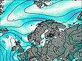
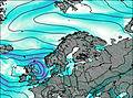
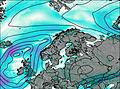
This table gives the weather forecast for Stetind at the specific elevation of 1392 m. Our advanced weather models allow us to provide distinct weather forecasts for several elevations of Stetind. To see the weather forecasts for the other elevations, use the tab navigation above the table. For a wider overview of the weather, consult the Weather Map of Norway.
| Weather Station | Temp. | Weather | Wind | Gusts | Cloud / Visibility |
|---|---|---|---|---|---|
Håfjell.Alpinservice | |||||
Rotvaer | |||||
Evenes AP | |||||
Stephan Tellaroli | |||||
* NOTE: not all weather observatories update at the same frequency which is the reason why some locations may show data from stations that are further away than known closer ones.
Stetind Photos
View all
photos (8) |
Scandinavia/European Arctic Ranges photos (16) |
photos from mountains in Norway (115) |
all photos
 Upload new photo

Beauty
Between black and white
The wall of all dreams
Before the rain
Greetings from the top