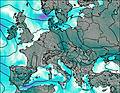
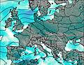
– Lat/Long: 50.21° N 16.85° E
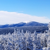
 Snieznik
Weather Forecast, PolandIssued: 1 pm Mon 03 Aug Local TimeUpdates in: hr min sUpdate imminent
Issued: 1 pm Mon 03 Aug Local Time
Updates in:
Update imminent hr min s

Issued: 1 pm Mon 03 Aug Local Time
Updates in:
Update imminent hr min s
Days 1–4 Weather SummaryLight rain (total 6mm), mostly falling on Wed night. Warm (max 29°C on Tue afternoon, min 22°C on Wed night). Winds increasing (calm on Mon night, fresh winds from the SSW by Wed morning). | Days 5–7 Weather SummaryLight rain (total 6mm), mostly falling on Thu night. Warm (max 25°C on Thu afternoon, min 12°C on Fri night). Wind will be generally light. | ||||||||||||||||
Mon 3 | Tuesday 4 | Wednesday 5 | Thursday 6 | Friday 7 | Saturday 8 | ||||||||||||
PM | night | AM | PM | night | AM | PM | night | AM | PM | night | AM | PM | night | AM | PM | night | |
clear | clear | clear | clear | clear | clear | some clouds | risk tstorm | some clouds | rain shwrs | risk tstorm | light rain | light rain | clear | clear | clear | clear | |
Cloud base (m) | 4050 | 4450 | 3000 | 4200 | 4950 | 2550 | 6000 | 1550 | 2400 | 8850 | 9000 | 2250 | |||||
km/h | |||||||||||||||||
 |  |  |  |  |  | ||||||||||||
— | — | — | — | — | — | — | — | — | — | — | — | — | — | — | — | — | |
mm | — | — | — | — | — | — | — | 6 | — | 0.2 | 3 | 0.8 | 2 | — | — | — | — |
max °C | 27 | 25 | 25 | 29 | 28 | 26 | 27 | 23 | 24 | 25 | 20 | 16 | 15 | 15 | 14 | 17 | 15 |
min °C | 24 | 23 | 24 | 27 | 25 | 25 | 27 | 22 | 23 | 23 | 16 | 14 | 13 | 12 | 13 | 16 | 14 |
chill °C | 24 | 23 | 24 | 27 | 25 | 25 | 27 | 22 | 23 | 23 | 16 | 12 | 12 | 11 | 12 | 16 | 14 |
Freezing level m | 4350 | 4450 | 4400 | 4500 | 4550 | 4600 | 4450 | 4500 | 4400 | 4300 | 4200 | 3750 | 3800 | 3500 | 3550 | 3650 | 3550 |
— | — | 5:24 | — | — | 5:24 | — | — | 5:26 | — | — | 5:28 | — | — | 5:30 | — | — | |
— | 8:32 | — | — | 8:31 | — | — | 8:30 | — | — | 8:28 | — | — | 8:27 | — | — | 8:24 | |
Loading...
Snieznik Weather (Days 0-3):
The weather forecast for Snieznik is: Light rain (total 6mm), mostly falling on Wed night. Warm (max 29°C on Tue afternoon, min 22°C on Wed night). Winds increasing (calm on Mon night, fresh winds from the SSW by Wed morning).
Snieznik Weather (Days 3-6):
Light rain (total 6mm), mostly falling on Thu night. Warm (max 25°C on Thu afternoon, min 12°C on Fri night). Wind will be generally light.
This table gives the weather forecast for Snieznik at the specific elevation of 1000 m. Our advanced weather models allow us to provide distinct weather forecasts for several elevations of Snieznik. To see the weather forecasts for the other elevations, use the tab navigation above the table. For a wider overview of the weather, consult the Weather Map of Poland.
| Weather Station | Temp. | Weather | Wind | Gusts | Cloud / Visibility |
|---|---|---|---|---|---|
Cervena U Libave | |||||
* NOTE: not all weather observatories update at the same frequency which is the reason why some locations may show data from stations that are further away than known closer ones.
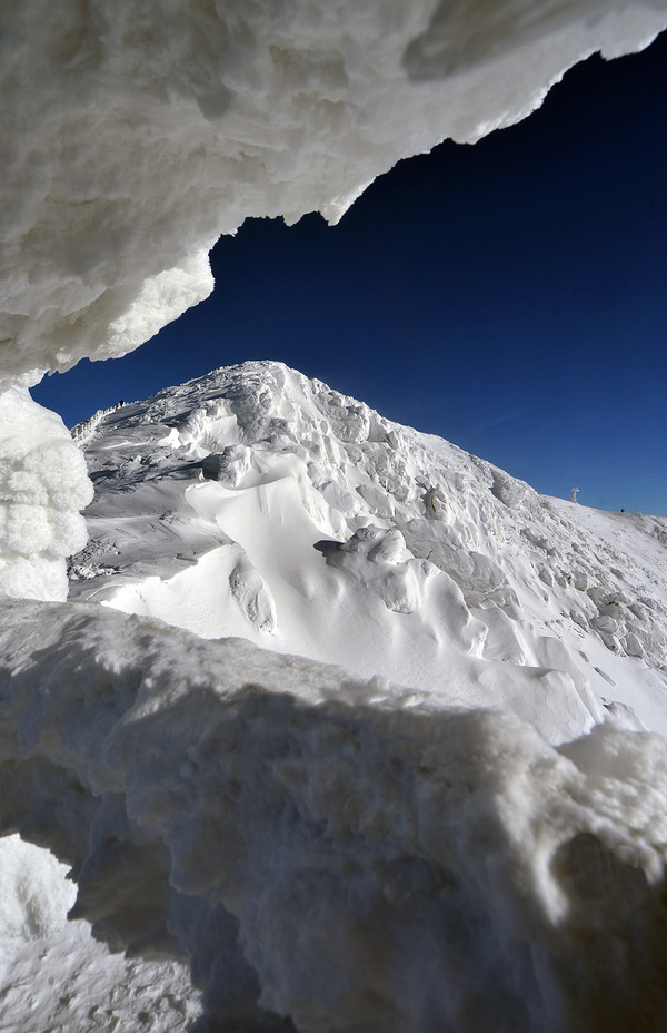
Snieznik Photos
View all
Sudety Mountains photos (22) |
Minor ranges of Europe photos (96) |
photos from mountains in Poland (290) |
all photos
 Upload new photo
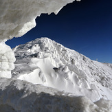
 See 11 more Snieznik photos
Śnieżka
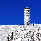
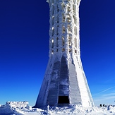
Zima na wieży
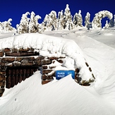
Śnieżnik z Czernicy
Śnieżnik
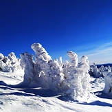
Śnieżnik
Śnieżnik
Śnieżnik