
– Lat/Long: 52.66° N 118.32° W
 Simon Peak (Canada)
Weather Forecast, CanadaIssued: 11 pm Mon 20 Jul Local TimeUpdates in: hr min sUpdate imminent
Issued: 11 pm Mon 20 Jul Local Time
Updates in:
Update imminent hr min s

Issued: 11 pm Mon 20 Jul Local Time
Updates in:
Update imminent hr min s
Days 1–4 Weather SummaryMostly dry. Mild temperatures (max 9°C on Wed afternoon, min 3°C on Mon night). Winds increasing (light winds from the WSW on Mon night, fresh winds from the SW by Thu afternoon). | Days 5–7 Weather SummaryMostly dry. Mild temperatures (max 8°C on Thu night, min 1°C on Sun morning). Winds decreasing (strong winds from the WSW on Fri afternoon, light winds from the SW by Sat night). | ||||||||||||||||||
Tuesday 21 | Wednesday 22 | Thursday 23 | Friday 24 | Saturday 25 | Sunday 26 | ||||||||||||||
night | AM | PM | night | AM | PM | night | AM | PM | night | AM | PM | night | AM | PM | night | AM | PM | night | |
rain shwrs | clear | some clouds | clear | clear | some clouds | clear | some clouds | cloudy | some clouds | clear | clear | some clouds | rain shwrs | rain shwrs | some clouds | cloudy | cloudy | light snow | |
Cloud base (m) | 3450 | 4100 | 4250 | 4250 | 8450 | 4650 | 7900 | 4450 | 4100 | 5700 | 4000 | 4350 | 2900 | 2850 | 2400 | ||||
km/h | |||||||||||||||||||
 |  |  |  |  |  |  | |||||||||||||
— | — | — | — | — | — | — | — | — | — | — | — | — | — | — | — | — | — | 1 | |
mm | 0.1 | — | — | — | — | — | — | — | — | — | — | — | — | 0.5 | 0.1 | — | — | — | — |
max °C | 3 | 3 | 6 | 7 | 6 | 9 | 8 | 8 | 8 | 8 | 6 | 7 | 6 | 4 | 5 | 4 | 1 | 1 | 1 |
min °C | 3 | 3 | 5 | 6 | 5 | 8 | 8 | 8 | 8 | 7 | 5 | 6 | 5 | 4 | 5 | 2 | 1 | 1 | 0 |
chill °C | 0 | 0 | 2 | 3 | 1 | 5 | 5 | 4 | 4 | 2 | -1 | 0 | 0 | -1 | 0 | -3 | -5 | -4 | -6 |
Freezing level m | 3800 | 3800 | 4100 | 4200 | 4100 | 4350 | 4400 | 4400 | 4350 | 4400 | 4150 | 4250 | 4250 | 3950 | 4100 | 4000 | 3550 | 3450 | 3450 |
— | 5:54 | — | — | 5:56 | — | — | 5:58 | — | — | 5:58 | — | — | 6:01 | — | — | 6:01 | — | — | |
— | — | — | 10:02 | — | — | 10:00 | — | — | 10:00 | — | — | 9:58 | — | — | 9:57 | — | — | 9:54 | |
Loading...
Simon Peak (Canada) Weather (Days 0-3):
The weather forecast for Simon Peak (Canada) is: Mostly dry. Mild temperatures (max 9°C on Wed afternoon, min 3°C on Mon night). Winds increasing (light winds from the WSW on Mon night, fresh winds from the SW by Thu afternoon).
Simon Peak (Canada) Weather (Days 3-6):
Mostly dry. Mild temperatures (max 8°C on Thu night, min 1°C on Sun morning). Winds decreasing (strong winds from the WSW on Fri afternoon, light winds from the SW by Sat night).
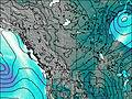
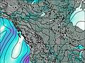
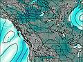
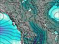
This table gives the weather forecast for Simon Peak (Canada) at the specific elevation of 3322 m. Our advanced weather models allow us to provide distinct weather forecasts for several elevations of Simon Peak (Canada). To see the weather forecasts for the other elevations, use the tab navigation above the table. For a wider overview of the weather, consult the Weather Map of Alberta.
| Weather Station | Temp. | Weather | Wind | Gusts | Cloud / Visibility |
|---|---|---|---|---|---|
Jasper Warden Airport | |||||
Jasper Warden- Alta | |||||
Willow Creek 1- Alta | |||||
Blue River Cs- BC | |||||
Hendrickson Creek- Alta | |||||
Nordegg Cs- Alta | |||||
Edson Climate- Alta | |||||
Clearwater Auto- BC |
* NOTE: not all weather observatories update at the same frequency which is the reason why some locations may show data from stations that are further away than known closer ones.