
– Lat/Long: 45.93° N 60.43° W
 Sgurra Bhreac (Nova Scotia)
Weather Forecast, CanadaIssued: 2 pm Mon 03 Aug Local TimeUpdates in: hr min sUpdate imminent
Issued: 2 pm Mon 03 Aug Local Time
Updates in:
Update imminent hr min s

Issued: 2 pm Mon 03 Aug Local Time
Updates in:
Update imminent hr min s
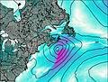
Days 1–4 Weather SummaryLight rain (total 3mm), mostly falling on Tue morning. Warm (max 28°C on Wed afternoon, min 18°C on Tue night). Winds decreasing (fresh winds from the SSW on Tue morning, light winds from the WNW by Thu morning). | Days 5–7 Weather SummaryLight rain (total 3mm), mostly falling on Sat night. Warm (max 28°C on Thu afternoon, min 16°C on Fri night). Wind will be generally light. | ||||||||||||||||
Mon 3 | Tuesday 4 | Wednesday 5 | Thursday 6 | Friday 7 | Saturday 8 | ||||||||||||
PM | night | AM | PM | night | AM | PM | night | AM | PM | night | AM | PM | night | AM | PM | night | |
some clouds | rain shwrs | rain shwrs | clear | clear | clear | clear | clear | clear | some clouds | clear | clear | clear | some clouds | light rain | some clouds | light rain | |
Cloud base (m) | 6450 | 150 | 100 | 1900 | 5200 | 2800 | 900 | 250 | |||||||||
km/h | |||||||||||||||||
 |  |  |  |  |  | ||||||||||||
— | — | — | — | — | — | — | — | — | — | — | — | — | — | — | — | — | |
mm | — | 0.1 | 2 | — | — | — | — | — | — | — | — | — | — | — | 0.5 | — | 3 |
max °C | 23 | 21 | 20 | 24 | 21 | 26 | 28 | 24 | 28 | 28 | 19 | 23 | 24 | 17 | 19 | 22 | 18 |
min °C | 21 | 19 | 20 | 23 | 18 | 21 | 27 | 19 | 23 | 24 | 18 | 20 | 21 | 16 | 17 | 20 | 18 |
chill °C | 21 | 19 | 19 | 23 | 17 | 21 | 27 | 19 | 23 | 24 | 18 | 20 | 21 | 16 | 16 | 20 | 18 |
Freezing level m | 4650 | 4700 | 4550 | 4250 | 4200 | 4400 | 4600 | 4550 | 4600 | 4600 | 4700 | 4650 | 4600 | 4350 | 4100 | 4150 | 4050 |
— | — | 5:47 | — | — | 5:48 | — | — | 5:48 | — | — | 5:50 | — | — | 5:52 | — | — | |
8:28 | — | — | 8:27 | — | — | 8:25 | — | — | 8:23 | — | — | 8:22 | — | — | 8:21 | — | |
Loading...
Sgurra Bhreac (Nova Scotia) Weather (Days 0-3):
The weather forecast for Sgurra Bhreac (Nova Scotia) is: Light rain (total 3mm), mostly falling on Tue morning. Warm (max 28°C on Wed afternoon, min 18°C on Tue night). Winds decreasing (fresh winds from the SSW on Tue morning, light winds from the WNW by Thu morning).
Sgurra Bhreac (Nova Scotia) Weather (Days 3-6):
Light rain (total 3mm), mostly falling on Sat night. Warm (max 28°C on Thu afternoon, min 16°C on Fri night). Wind will be generally light.
This table gives the weather forecast for Sgurra Bhreac (Nova Scotia) at the specific elevation of 222 m. Our advanced weather models allow us to provide distinct weather forecasts for several elevations of Sgurra Bhreac (Nova Scotia). To see the weather forecasts for the other elevations, use the tab navigation above the table. For a wider overview of the weather, consult the Weather Map of Nova-Scotia.