
– Lat/Long: 5.42° N 95.60° E
 Seulawah Agam
Weather Forecast, IndonesiaIssued: 12 am Mon 03 Aug Local TimeUpdates in: hr min sUpdate imminent
Issued: 12 am Mon 03 Aug Local Time
Updates in:
Update imminent hr min s

Issued: 12 am Mon 03 Aug Local Time
Updates in:
Update imminent hr min s
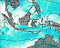
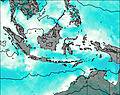
Days 1–4 Weather SummaryHeavy rain (total 53mm), heaviest during Mon night. Warm (max 23°C on Mon morning, min 19°C on Tue night). Winds increasing (calm on Mon morning, fresh winds from the WSW by Tue night). | Days 5–7 Weather SummaryHeavy rain (total 69mm), heaviest during Thu night. Warm (max 21°C on Thu morning, min 19°C on Thu night). Mainly strong winds. | ||||||||||||||||||
Monday 3 | Tuesday 4 | Wednesday 5 | Thursday 6 | Friday 7 | Saturday 8 | ||||||||||||||
night | AM | PM | night | AM | PM | night | AM | PM | night | AM | PM | night | AM | PM | night | AM | PM | night | |
risk tstorm | rain shwrs | risk tstorm | rain shwrs | mod. rain | mod. rain | rain shwrs | risk tstorm | risk tstorm | rain shwrs | risk tstorm | risk tstorm | heavy rain | mod. rain | light rain | light rain | light rain | risk tstorm | some clouds | |
Cloud base (m) | 5500 | 6900 | 1550 | 250 | 150 | 150 | 300 | 450 | 450 | 700 | 250 | 200 | 150 | 150 | 150 | 250 | 3200 | 2350 | 4550 |
km/h | |||||||||||||||||||
 |  |  |  |  |  |  | |||||||||||||
— | — | — | — | — | — | — | — | — | — | — | — | — | — | — | — | — | — | — | |
mm | 1.2 | 0.7 | 7 | 22 | 7 | 5 | 2 | 3 | 4 | 5 | 5 | 10 | 39 | 7 | 1.1 | 1.3 | 0.1 | 0.2 | — |
max °C | 22 | 23 | 22 | 20 | 20 | 20 | 20 | 21 | 20 | 20 | 21 | 20 | 20 | 20 | 20 | 19 | 21 | 21 | 20 |
min °C | 21 | 23 | 21 | 20 | 20 | 20 | 19 | 20 | 20 | 20 | 20 | 20 | 19 | 20 | 20 | 19 | 20 | 21 | 20 |
chill °C | 21 | 23 | 21 | 20 | 20 | 20 | 18 | 20 | 20 | 20 | 20 | 20 | 18 | 20 | 19 | 18 | 20 | 21 | 20 |
Freezing level m | 5050 | 5050 | 5100 | 5000 | 5000 | 5000 | 5050 | 5050 | 5050 | 5100 | 5050 | 5000 | 5000 | 5050 | 5050 | 5050 | 5050 | 5050 | 4950 |
— | 6:33 | — | — | 6:33 | — | — | 6:33 | — | — | 6:33 | — | — | 6:33 | — | — | 6:33 | — | — | |
— | — | 6:53 | — | — | 6:52 | — | — | 6:52 | — | — | 6:52 | — | — | 6:52 | — | — | 6:52 | — | |
Loading...
Seulawah Agam Weather (Days 0-3):
The weather forecast for Seulawah Agam is: Heavy rain (total 53mm), heaviest during Mon night. Warm (max 23°C on Mon morning, min 19°C on Tue night). Winds increasing (calm on Mon morning, fresh winds from the WSW by Tue night).
Seulawah Agam Weather (Days 3-6):
Heavy rain (total 69mm), heaviest during Thu night. Warm (max 21°C on Thu morning, min 19°C on Thu night). Mainly strong winds.
This table gives the weather forecast for Seulawah Agam at the specific elevation of 1000 m. Our advanced weather models allow us to provide distinct weather forecasts for several elevations of Seulawah Agam. To see the weather forecasts for the other elevations, use the tab navigation above the table. For a wider overview of the weather, consult the Weather Map of Indonesia.
| Weather Station | Temp. | Weather | Wind | Gusts | Cloud / Visibility |
|---|---|---|---|---|---|
Banda Ace / lang | |||||
Meda / olonia Airport | |||||
Phuket Airport | |||||
KO Lanta | |||||
Langkawi International Airport | |||||
Krabi Airport | |||||
* NOTE: not all weather observatories update at the same frequency which is the reason why some locations may show data from stations that are further away than known closer ones.