
– Lat/Long: 54.91° N 121.96° W
 Sentinel Peak (British Columbia)
Weather Forecast, CanadaIssued: 4 pm Tue 14 Jul Local TimeUpdates in: hr min sUpdate imminent
Issued: 4 pm Tue 14 Jul Local Time
Updates in:
Update imminent hr min s

Issued: 4 pm Tue 14 Jul Local Time
Updates in:
Update imminent hr min s
Days 1–4 Weather SummaryMostly dry. Very mild (max 16°C on Thu afternoon, min 10°C on Tue afternoon). Winds decreasing (fresh winds from the WSW on Wed afternoon, calm by Thu night). | Days 5–7 Weather SummaryHeavy rain (total 28mm), heaviest during Fri night. Very mild (max 17°C on Fri afternoon, min 7°C on Fri night). Winds decreasing (fresh winds from the WSW on Fri afternoon, calm by Sun afternoon). | ||||||||||||||||
Tue 14 | Wednesday 15 | Thursday 16 | Friday 17 | Saturday 18 | Sunday 19 | ||||||||||||
PM | night | AM | PM | night | AM | PM | night | AM | PM | night | AM | PM | night | AM | PM | night | |
cloudy | clear | clear | clear | clear | clear | clear | clear | some clouds | rain shwrs | rain shwrs | light rain | rain shwrs | clear | clear | clear | clear | |
km/h | |||||||||||||||||
 |  |  |  |  |  | ||||||||||||
— | — | — | — | — | — | — | — | — | — | — | — | — | — | — | — | — | |
mm | — | — | — | — | — | — | — | — | — | 0.3 | 23 | 5 | 0.1 | — | — | — | — |
max °C | 11 | 11 | 11 | 14 | 14 | 14 | 16 | 16 | 15 | 17 | 9 | 7 | 10 | 12 | 12 | 15 | 14 |
min °C | 10 | 10 | 10 | 13 | 12 | 11 | 15 | 15 | 13 | 14 | 7 | 7 | 8 | 11 | 9 | 14 | 12 |
chill °C | 8 | 9 | 8 | 10 | 10 | 8 | 13 | 15 | 12 | 12 | 4 | 4 | 6 | 10 | 9 | 14 | 11 |
Freezing level m | 3250 | 3350 | 3250 | 3600 | 3700 | 3900 | 3950 | 4300 | 4150 | 4000 | 3300 | 3600 | 3950 | 3750 | 3600 | 3800 | 3900 |
Cloud base (m) | 3100 | 8450 | 3200 | 9050 | 4450 | 1700 | 850 | 850 | 9350 | 3400 | |||||||
— | — | 4:50 | — | — | 4:50 | — | — | 4:52 | — | — | 4:54 | — | — | 4:54 | — | — | |
— | 9:37 | — | — | 9:36 | — | — | 9:35 | — | — | 9:34 | — | — | 9:31 | — | — | 9:30 | |
Loading...
Sentinel Peak (British Columbia) Weather (Days 0-3):
The weather forecast for Sentinel Peak (British Columbia) is: Mostly dry. Very mild (max 16°C on Thu afternoon, min 10°C on Tue afternoon). Winds decreasing (fresh winds from the WSW on Wed afternoon, calm by Thu night).
Sentinel Peak (British Columbia) Weather (Days 3-6):
Heavy rain (total 28mm), heaviest during Fri night. Very mild (max 17°C on Fri afternoon, min 7°C on Fri night). Winds decreasing (fresh winds from the WSW on Fri afternoon, calm by Sun afternoon).
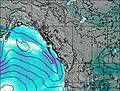
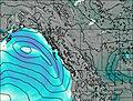
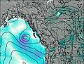
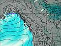
This table gives the weather forecast for Sentinel Peak (British Columbia) at the specific elevation of 2000 m. Our advanced weather models allow us to provide distinct weather forecasts for several elevations of Sentinel Peak (British Columbia). To see the weather forecasts for the other elevations, use the tab navigation above the table. For a wider overview of the weather, consult the Weather Map of British-Columbia.
| Weather Station | Temp. | Weather | Wind | Gusts | Cloud / Visibility |
|---|---|---|---|---|---|
Mackenzie Airport | |||||
Mackenzie- BC | |||||
Chetwynd Airport | |||||
Prince George Airport | |||||
Dawson Creek A- BC | |||||
Dawson Creek Airport | |||||
Fort ST James Auto- BC |
* NOTE: not all weather observatories update at the same frequency which is the reason why some locations may show data from stations that are further away than known closer ones.