
– Lat/Long: 13.62° N 88.85° W
 San Vicente
Weather Forecast, El SalvadorIssued: 5 am Mon 03 Aug Local TimeUpdates in: hr min sUpdate imminent
Issued: 5 am Mon 03 Aug Local Time
Updates in:
Update imminent hr min s

Issued: 5 am Mon 03 Aug Local Time
Updates in:
Update imminent hr min s
Days 1–3 Weather SummaryHeavy rain (total 23mm), heaviest during Tue night. Very mild (max 19°C on Mon morning, min 16°C on Mon night). Winds increasing (light winds from the E on Mon afternoon, fresh winds from the ENE by Wed afternoon). | Days 4–6 Weather SummaryLight rain (total 5mm), mostly falling on Thu night. Very mild (max 19°C on Thu afternoon, min 15°C on Sat afternoon). Mainly strong winds. | |||||||||||||||||
Monday 3 | Tuesday 4 | Wednesday 5 | Thursday 6 | Friday 7 | Saturday 8 | |||||||||||||
AM | PM | night | AM | PM | night | AM | PM | night | AM | PM | night | AM | PM | night | AM | PM | night | |
clear | rain shwrs | risk tstorm | some clouds | rain shwrs | rain shwrs | clear | rain shwrs | rain shwrs | clear | rain shwrs | risk tstorm | cloudy | cloudy | rain shwrs | cloudy | light rain | rain shwrs | |
Cloud base (m) | 4900 | 5300 | 400 | 2850 | 2000 | 5900 | 4050 | 6700 | 2800 | 2150 | 2450 | 2750 | 2300 | |||||
km/h | ||||||||||||||||||
 |  |  |  |  |  | |||||||||||||
— | — | — | — | — | — | — | — | — | — | — | — | — | — | — | — | — | — | |
mm | — | 0.1 | 2 | — | 4 | 8 | — | 5 | 4 | — | 0.1 | 3 | — | — | 0.2 | — | 0.7 | 1.2 |
max °C | 19 | 19 | 19 | 18 | 19 | 18 | 18 | 19 | 18 | 18 | 19 | 17 | 17 | 17 | 17 | 16 | 16 | 17 |
min °C | 17 | 18 | 16 | 17 | 16 | 17 | 17 | 17 | 17 | 17 | 18 | 16 | 16 | 17 | 16 | 16 | 15 | 15 |
chill °C | 16 | 18 | 15 | 16 | 15 | 16 | 16 | 16 | 16 | 16 | 17 | 15 | 14 | 16 | 15 | 15 | 13 | 13 |
Freezing level m | 4900 | 4900 | 4900 | 4950 | 4900 | 4800 | 4850 | 4850 | 4850 | 4900 | 4800 | 4800 | 4850 | 4650 | 4800 | 4850 | 4750 | 4800 |
5:39 | — | — | 5:39 | — | — | 5:39 | — | — | 5:41 | — | — | 5:41 | — | — | 5:41 | — | — | |
— | 6:22 | — | — | 6:22 | — | — | 6:21 | — | — | 6:21 | — | — | 6:20 | — | — | 6:20 | — | |
Loading...
San Vicente Weather (Days 0-3):
The weather forecast for San Vicente is: Heavy rain (total 23mm), heaviest during Tue night. Very mild (max 19°C on Mon morning, min 16°C on Mon night). Winds increasing (light winds from the E on Mon afternoon, fresh winds from the ENE by Wed afternoon).
San Vicente Weather (Days 3-6):
Light rain (total 5mm), mostly falling on Thu night. Very mild (max 19°C on Thu afternoon, min 15°C on Sat afternoon). Mainly strong winds.
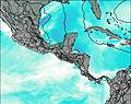
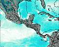
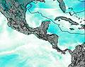
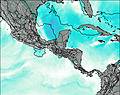
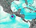
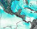
This table gives the weather forecast for San Vicente at the specific elevation of 2000 m. Our advanced weather models allow us to provide distinct weather forecasts for several elevations of San Vicente. To see the weather forecasts for the other elevations, use the tab navigation above the table. For a wider overview of the weather, consult the Weather Map of El Salvador.
| Weather Station | Temp. | Weather | Wind | Gusts | Cloud / Visibility |
|---|---|---|---|---|---|
EL Salvador International Airport | |||||
Ilopang / an Salvador Airport | |||||
San Migue / apal Airport | |||||
Santa An / l Palmer Airport | |||||
Nueva Ocotepeque Airport | |||||
Esquipulas Airport | |||||
La Esperanza Airport | |||||
Santa Rosa de Copán Airport | |||||
Acajutl / onsonate Airport |
* NOTE: not all weather observatories update at the same frequency which is the reason why some locations may show data from stations that are further away than known closer ones.