
– Lat/Long: 12.70° N 87.00° W
 San Cristobal
Weather Forecast, NicaraguaIssued: 11 pm Sun 02 Aug Local TimeUpdates in: hr min sUpdate imminent
Issued: 11 pm Sun 02 Aug Local Time
Updates in:
Update imminent hr min s

Issued: 11 pm Sun 02 Aug Local Time
Updates in:
Update imminent hr min s
Days 1–4 Weather SummaryLight rain (total 5mm), mostly falling on Mon night. Warm (max 28°C on Wed morning, min 21°C on Sun night). Wind will be generally light. | Days 5–7 Weather SummaryLight rain (total 4mm), mostly falling on Fri night. Warm (max 28°C on Thu morning, min 20°C on Thu night). Winds increasing (light winds from the NE on Wed night, fresh winds from the ENE by Thu night). | ||||||||||||||||||
Monday 3 | Tuesday 4 | Wednesday 5 | Thursday 6 | Friday 7 | Saturday 8 | ||||||||||||||
night | AM | PM | night | AM | PM | night | AM | PM | night | AM | PM | night | AM | PM | night | AM | PM | night | |
rain shwrs | some clouds | rain shwrs | risk tstorm | some clouds | some clouds | risk tstorm | some clouds | risk tstorm | rain shwrs | some clouds | risk tstorm | some clouds | some clouds | rain shwrs | rain shwrs | some clouds | rain shwrs | some clouds | |
Cloud base (m) | 2250 | 5650 | 5400 | 2700 | 5050 | 2750 | 4050 | 3000 | 4300 | 6650 | 2150 | 1700 | 2600 | 1950 | 2700 | ||||
km/h | |||||||||||||||||||
 |  |  |  |  |  |  | |||||||||||||
— | — | — | — | — | — | — | — | — | — | — | — | — | — | — | — | — | — | — | |
mm | 1 | — | 0.1 | 3 | — | — | 0.8 | — | 0.3 | 0.1 | — | 0.3 | — | — | 0.6 | 3 | — | 0.1 | — |
max °C | 23 | 25 | 27 | 22 | 27 | 27 | 23 | 28 | 27 | 23 | 28 | 27 | 22 | 25 | 25 | 21 | 24 | 23 | 21 |
min °C | 21 | 24 | 24 | 21 | 23 | 25 | 21 | 23 | 24 | 21 | 22 | 24 | 20 | 21 | 23 | 20 | 22 | 22 | 20 |
chill °C | 21 | 24 | 24 | 21 | 23 | 25 | 21 | 23 | 24 | 21 | 22 | 24 | 20 | 21 | 23 | 20 | 22 | 22 | 20 |
Freezing level m | 4900 | 5000 | 4900 | 4950 | 5100 | 4800 | 4900 | 4900 | 4800 | 4900 | 5000 | 4800 | 4850 | 4900 | 4800 | 4900 | 4900 | 4850 | 4850 |
— | 5:33 | — | — | 5:33 | — | — | 5:33 | — | — | 5:33 | — | — | 5:35 | — | — | 5:35 | — | — | |
— | — | 6:13 | — | — | 6:13 | — | — | 6:13 | — | — | 6:12 | — | — | 6:12 | — | — | 6:10 | — | |
Loading...
San Cristobal Weather (Days 0-3):
The weather forecast for San Cristobal is: Light rain (total 5mm), mostly falling on Mon night. Warm (max 28°C on Wed morning, min 21°C on Sun night). Wind will be generally light.
San Cristobal Weather (Days 3-6):
Light rain (total 4mm), mostly falling on Fri night. Warm (max 28°C on Thu morning, min 20°C on Thu night). Winds increasing (light winds from the NE on Wed night, fresh winds from the ENE by Thu night).
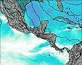
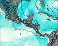
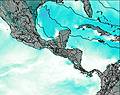
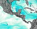
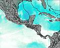
This table gives the weather forecast for San Cristobal at the specific elevation of 1000 m. Our advanced weather models allow us to provide distinct weather forecasts for several elevations of San Cristobal. To see the weather forecasts for the other elevations, use the tab navigation above the table. For a wider overview of the weather, consult the Weather Map of Nicaragua.
| Weather Station | Temp. | Weather | Wind | Gusts | Cloud / Visibility |
|---|---|---|---|---|---|
EL Salvador International Airport | |||||
lightning 47km ESE of Punuare | |||||
Liberi / omas Guardia Airport | |||||
La Ceib / oloson International Airport | |||||
lightning 9km SW of Jutiapa | |||||
lightning 30km NNE of El Triunfo de la Cruz |
* NOTE: not all weather observatories update at the same frequency which is the reason why some locations may show data from stations that are further away than known closer ones.