
– Lat/Long: 35.32° N 80.54° W
 Rocky River Bike Park
Weather Forecast, United StatesIssued: 7 pm Sun 24 May Local TimeUpdates in: hr min sUpdate imminent
Issued: 7 pm Sun 24 May Local Time
Updates in:
Update imminent hr min s

Issued: 7 pm Sun 24 May Local Time
Updates in:
Update imminent hr min s
Days 1–4 Weather SummaryHeavy rain (total 41mm), heaviest during Sun night. Warm (max 28°C on Wed afternoon, min 20°C on Sun night). Wind will be generally light. | Days 5–7 Weather SummaryHeavy rain (total 23mm), heaviest during Sat afternoon. Warm (max 29°C on Thu afternoon, min 14°C on Sat afternoon). Wind will be generally light. | ||||||||||||||||||
Monday 25 | Tuesday 26 | Wednesday 27 | Thursday 28 | Friday 29 | Saturday 30 | ||||||||||||||
night | AM | PM | night | AM | PM | night | AM | PM | night | AM | PM | night | AM | PM | night | AM | PM | night | |
rain shwrs | some clouds | risk tstorm | risk tstorm | some clouds | risk tstorm | risk tstorm | some clouds | cloudy | risk tstorm | rain shwrs | clear | clear | clear | some clouds | rain shwrs | light rain | mod. rain | mod. rain | |
km/h | |||||||||||||||||||
 |  |  |  |  |  |  | |||||||||||||
— | — | — | — | — | — | — | — | — | — | — | — | — | — | — | — | — | — | — | |
16 | — | 0.8 | 20 | — | 0.6 | 3 | — | — | 8 | 0.2 | — | — | — | — | 3 | 1.8 | 10 | 6 | |
max °C | 25 | 24 | 27 | 23 | 24 | 27 | 24 | 26 | 28 | 23 | 26 | 29 | 27 | 26 | 29 | 27 | 19 | 16 | 14 |
min °C | 20 | 20 | 27 | 20 | 21 | 27 | 21 | 22 | 28 | 20 | 21 | 28 | 21 | 21 | 29 | 20 | 17 | 14 | 12 |
20 | 20 | 27 | 20 | 21 | 27 | 21 | 22 | 28 | 20 | 21 | 28 | 21 | 21 | 29 | 20 | 16 | 13 | 11 | |
4300 | 4350 | 4450 | 4400 | 4500 | 4500 | 4500 | 4350 | 4350 | 4250 | 4200 | 4300 | 4300 | 4250 | 4350 | 4350 | 4250 | 4150 | 4100 | |
Cloud base (m) | 750 | 300 | 850 | 550 | 400 | 1550 | 1600 | 5300 | 3100 | 1850 | 2250 | 550 | 150 | 200 | |||||
— | 6:11 | — | — | 6:09 | — | — | 6:09 | — | — | 6:09 | — | — | 6:09 | — | — | 6:09 | — | — | |
— | — | — | 8:27 | — | — | 8:28 | — | — | 8:28 | — | — | 8:29 | — | — | 8:30 | — | — | 8:30 | |
Loading...
Rocky River Weather (Days 0-3):
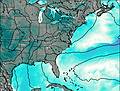
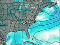
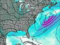
The weather forecast for Rocky River is: Heavy rain (total 41mm), heaviest during Sun night. Warm (max 28°C on Wed afternoon, min 20°C on Sun night). Wind will be generally light.
Rocky River Weather (Days 3-6):
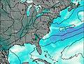
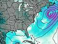
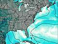
Heavy rain (total 23mm), heaviest during Sat afternoon. Warm (max 29°C on Thu afternoon, min 14°C on Sat afternoon). Wind will be generally light.
This table gives the weather forecast for Rocky River at the specific elevation of 214 m. Our advanced weather models allow us to provide distinct weather forecasts for several elevations of Rocky River. To see the weather forecasts for the other elevations, use the tab navigation above the table. For a wider overview of the weather, consult the Weather Map of South-Carolina.
| Weather Station | Temp. | Weather | Wind | Gusts | Cloud / Visibility |
|---|---|---|---|---|---|
Concord Regional Airport | |||||
Monroe Airport | |||||
Albemarle Stanly Airport | |||||
Salisbury Rowan Airport | |||||
Charlotte Airport | |||||
Wadesboro- Anson County Airport (NC) | |||||
Davidson County Airport | |||||
Gastonia Airport | |||||
Rock Hill Airport |
* NOTE: not all weather observatories update at the same frequency which is the reason why some locations may show data from stations that are further away than known closer ones.