
– Lat/Long: 45.93° N 7.78° E
 Roccia Nera
Weather Forecast, ItalyIssued: 7 am Mon 03 Aug Local TimeUpdates in: hr min sUpdate imminent
Issued: 7 am Mon 03 Aug Local Time
Updates in:
Update imminent hr min s

Issued: 7 am Mon 03 Aug Local Time
Updates in:
Update imminent hr min s
Days 1–3 Weather SummaryA dusting of snow. Milder later with heavy rain (total 27mm) on Wed night. Temperatures will be slightly above freezing (max 3°C on Mon afternoon, min 2°C on Mon morning). Wind will be generally light. | Days 4–6 Weather SummaryMild at first with light rain (total 5mm) on Thu afternoon followed by colder weather and light fall of snow, heaviest on Thu night. Freeze-thaw conditions (max 3°C on Thu morning, min 0°C on Sat morning). Wind will be generally light. | |||||||||||||||||
Monday 3 | Tuesday 4 | Wednesday 5 | Thursday 6 | Friday 7 | Saturday 8 | |||||||||||||
AM | PM | night | AM | PM | night | AM | PM | night | AM | PM | night | AM | PM | night | AM | PM | night | |
rain shwrs | risk tstorm | snow shwrs | clear | risk tstorm | risk tstorm | clear | light rain | risk tstorm | rain shwrs | risk tstorm | snow shwrs | clear | snow shwrs | snow shwrs | clear | snow shwrs | snow shwrs | |
Cloud base (m) | 4900 | 4200 | 4200 | 3200 | 4250 | 3350 | 3600 | |||||||||||
km/h | ||||||||||||||||||
 |  |  |  |  |  | |||||||||||||
— | — | 2 | — | — | — | — | — | — | — | — | 6 | — | 2 | 1 | — | 2 | 1 | |
mm | 1.9 | 5 | 1.6 | — | 4 | 4 | — | 5 | 5 | 0.2 | 5 | — | — | — | — | — | — | — |
max °C | 2 | 3 | 2 | 2 | 2 | 2 | 3 | 3 | 3 | 3 | 3 | 1 | 1 | 2 | 1 | 1 | 2 | 2 |
min °C | 2 | 3 | 2 | 2 | 2 | 2 | 2 | 3 | 2 | 2 | 2 | 1 | 1 | 2 | 1 | 0 | 2 | 1 |
chill °C | -1 | 0 | -2 | -2 | -3 | -1 | 1 | 1 | 0 | -1 | -2 | -2 | -1 | -1 | -3 | -4 | -2 | -3 |
Freezing level m | 4450 | 4500 | 4350 | 4350 | 4450 | 4450 | 4500 | 4550 | 4450 | 4450 | 4400 | 4300 | 4200 | 4350 | 4250 | 4300 | 4350 | 4250 |
6:13 | — | — | 6:13 | — | — | 6:15 | — | — | 6:16 | — | — | 6:16 | — | — | 6:18 | — | — | |
— | — | 8:55 | — | — | 8:54 | — | — | 8:52 | — | — | 8:52 | — | — | 8:50 | — | — | 8:49 | |
Loading...
Roccia Nera Weather (Days 0-3):
The weather forecast for Roccia Nera is: A dusting of snow. Milder later with heavy rain (total 27mm) on Wed night. Temperatures will be slightly above freezing (max 3°C on Mon afternoon, min 2°C on Mon morning). Wind will be generally light.
Roccia Nera Weather (Days 3-6):
Mild at first with light rain (total 5mm) on Thu afternoon followed by colder weather and light fall of snow, heaviest on Thu night. Freeze-thaw conditions (max 3°C on Thu morning, min 0°C on Sat morning). Wind will be generally light.
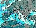
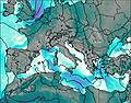
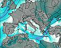
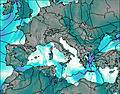
This table gives the weather forecast for Roccia Nera at the specific elevation of 4075 m. Our advanced weather models allow us to provide distinct weather forecasts for several elevations of Roccia Nera. To see the weather forecasts for the other elevations, use the tab navigation above the table. For a wider overview of the weather, consult the Weather Map of Italy.