
– Lat/Long: 34.91° N 99.32° W
 Quartz Mountain
Weather Forecast, United StatesIssued: 6 am Mon 03 Aug Local TimeUpdates in: hr min sUpdate imminent
Issued: 6 am Mon 03 Aug Local Time
Updates in:
Update imminent hr min s

Issued: 6 am Mon 03 Aug Local Time
Updates in:
Update imminent hr min s
Days 1–3 Weather SummaryMostly dry. Warm (max 37°C on Tue afternoon, min 27°C on Mon night). Winds decreasing (fresh winds from the S on Mon night, light winds from the SSW by Wed night). | Days 4–6 Weather SummarySome drizzle, heaviest during Thu night. Warm (max 37°C on Thu afternoon, min 25°C on Thu night). Mainly strong winds. | |||||||||||||||||
Monday 3 | Tuesday 4 | Wednesday 5 | Thursday 6 | Friday 7 | Saturday 8 | |||||||||||||
AM | PM | night | AM | PM | night | AM | PM | night | AM | PM | night | AM | PM | night | AM | PM | night | |
clear | clear | clear | cloudy | clear | rain shwrs | some clouds | clear | rain shwrs | clear | clear | rain shwrs | clear | clear | clear | clear | clear | clear | |
Cloud base (m) | 4800 | 4800 | 4900 | 6500 | 5600 | 4550 | 8850 | 6350 | ||||||||||
km/h | ||||||||||||||||||
 |  |  |  |  |  | |||||||||||||
— | — | — | — | — | — | — | — | — | — | — | — | — | — | — | — | — | — | |
mm | — | — | — | — | — | 0.1 | — | — | 0.1 | — | — | 1.9 | — | — | — | — | — | — |
max °C | 32 | 36 | 32 | 34 | 37 | 35 | 35 | 37 | 34 | 35 | 37 | 34 | 34 | 36 | 32 | 33 | 36 | 32 |
min °C | 28 | 35 | 27 | 31 | 37 | 28 | 32 | 37 | 29 | 32 | 37 | 25 | 30 | 34 | 27 | 30 | 36 | 27 |
chill °C | 28 | 35 | 27 | 31 | 37 | 28 | 32 | 37 | 29 | 32 | 37 | 25 | 30 | 34 | 27 | 30 | 36 | 27 |
Freezing level m | 5000 | 5150 | 5250 | 5200 | 5150 | 5200 | 5100 | 5150 | 5100 | 5000 | 5000 | 5050 | 5050 | 4950 | 5050 | 4900 | 4900 | 5150 |
6:48 | — | — | 6:48 | — | — | 6:48 | — | — | 6:50 | — | — | 6:50 | — | — | 6:50 | — | — | |
— | 8:37 | — | — | 8:37 | — | — | 8:36 | — | — | 8:35 | — | — | 8:34 | — | — | 8:32 | — | |
Loading...
Quartz Mountain Weather (Days 0-3):
The weather forecast for Quartz Mountain is: Mostly dry. Warm (max 37°C on Tue afternoon, min 27°C on Mon night). Winds decreasing (fresh winds from the S on Mon night, light winds from the SSW by Wed night).
Quartz Mountain Weather (Days 3-6):
Some drizzle, heaviest during Thu night. Warm (max 37°C on Thu afternoon, min 25°C on Thu night). Mainly strong winds.
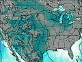
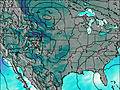
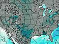
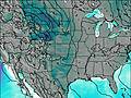
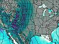
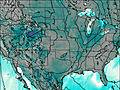
This table gives the weather forecast for Quartz Mountain at the specific elevation of 622 m. Our advanced weather models allow us to provide distinct weather forecasts for several elevations of Quartz Mountain. To see the weather forecasts for the other elevations, use the tab navigation above the table. For a wider overview of the weather, consult the Weather Map of Oklahoma.
| Weather Station | Temp. | Weather | Wind | Gusts | Cloud / Visibility |
|---|---|---|---|---|---|
Elk City Regional Business Airport (Oklahoma) | |||||
Frederic / ltus Air Force Base Airport | |||||
Vernon Wilbarger | |||||
Clinton Airport | |||||
Fort Sill Airport | |||||
* NOTE: not all weather observatories update at the same frequency which is the reason why some locations may show data from stations that are further away than known closer ones.