– Lat/Long: 41.65° S 146.70° E
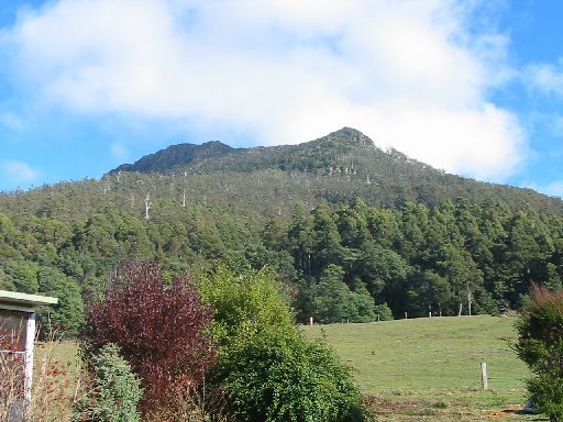
 Quamby Bluff
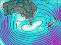
Weather Forecast, AustraliaIssued: 3 pm Mon 03 Aug Local TimeUpdates in: hr min sUpdate imminent
Issued: 3 pm Mon 03 Aug Local Time
Updates in:
Update imminent hr min s

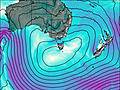
Issued: 3 pm Mon 03 Aug Local Time
Updates in:
Update imminent hr min s
Days 1–4 Weather SummaryA dusting of new snow. Freeze-thaw conditions (max 4°C on Wed morning, min 0°C on Mon night). Wind will be generally light. | Days 5–7 Weather SummaryA moderate fall of snow, heaviest on Sun morning. Turning milder with moderate rain (total 10mm), heaviest on Sun morning. Freeze-thaw conditions (max 4°C on Fri morning, min 0°C on Fri night). Winds increasing (calm on Fri afternoon, near gales from the N by Sat night). | ||||||||||||||||
Mon 3 | Tuesday 4 | Wednesday 5 | Thursday 6 | Friday 7 | Saturday 8 | ||||||||||||
PM | night | AM | PM | night | AM | PM | night | AM | PM | night | AM | PM | night | AM | PM | night | |
light snow | some clouds | some clouds | rain shwrs | some clouds | cloudy | some clouds | some clouds | cloudy | snow shwrs | clear | clear | clear | some clouds | cloudy | cloudy | mod. snow | |
Cloud base (m) | 600 | 750 | 800 | 1600 | 900 | 6500 | 1900 | 1950 | 800 | 800 | 700 | 7950 | 1700 | 900 | 700 | 600 | 600 |
km/h | |||||||||||||||||
 |  |  |  |  |  | ||||||||||||
1 | — | — | — | — | — | — | — | — | 1 | — | — | — | — | — | — | 6 | |
mm | — | — | — | 0.2 | — | — | — | — | — | — | — | — | — | — | — | — | — |
max °C | 1 | 1 | 3 | 2 | 1 | 4 | 4 | 2 | 3 | 2 | 1 | 4 | 3 | 1 | 1 | 1 | 2 |
min °C | 1 | 0 | 1 | 1 | 1 | 2 | 3 | 1 | 2 | 2 | 1 | 3 | 2 | 0 | 1 | 1 | 1 |
chill °C | -3 | -2 | -1 | -2 | 1 | 0 | -1 | -3 | -1 | -2 | -5 | 0 | 1 | -6 | -5 | -5 | -7 |
Freezing level m | 1350 | 1300 | 1400 | 1550 | 1400 | 1600 | 1850 | 1700 | 1450 | 1550 | 1450 | 1850 | 1850 | 1300 | 1400 | 1400 | 1450 |
— | — | 7:18 | — | — | 7:18 | — | — | 7:16 | — | — | 7:16 | — | — | 7:13 | — | — | |
5:17 | — | — | 5:19 | — | — | 5:20 | — | — | 5:21 | — | — | 5:22 | — | — | 5:22 | — | |
Loading...
Quamby Bluff Weather (Days 0-3):
The weather forecast for Quamby Bluff is: A dusting of new snow. Freeze-thaw conditions (max 4°C on Wed morning, min 0°C on Mon night). Wind will be generally light.
Quamby Bluff Weather (Days 3-6):
A moderate fall of snow, heaviest on Sun morning. Turning milder with moderate rain (total 10mm), heaviest on Sun morning. Freeze-thaw conditions (max 4°C on Fri morning, min 0°C on Fri night). Winds increasing (calm on Fri afternoon, near gales from the N by Sat night).
This table gives the weather forecast for Quamby Bluff at the specific elevation of 1228 m. Our advanced weather models allow us to provide distinct weather forecasts for several elevations of Quamby Bluff. To see the weather forecasts for the other elevations, use the tab navigation above the table. For a wider overview of the weather, consult the Weather Map of Tasmania.
| Weather Station | Temp. | Weather | Wind | Gusts | Cloud / Visibility |
|---|---|---|---|---|---|
Sheffield School Farm | |||||
Launceston Airport | |||||
Launceston (TI Tree Bend) | |||||
SHIP1396 | |||||
SHIP8529 | |||||
SHIP8759 | |||||
SHIP3028 | |||||
SHIP2280 |
* NOTE: not all weather observatories update at the same frequency which is the reason why some locations may show data from stations that are further away than known closer ones.
Quamby Bluff Photos
View all
Other ranges of Australia photos (85) |
photos from mountains in Australia (242) |
all photos
 Upload new photo
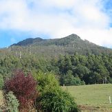
Quamby Bluff