– Lat/Long: 38.84° N 105.04° W
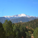
 Pikes Peak
Weather Forecast, United StatesIssued: 11 pm Sun 02 Aug Local TimeUpdates in: hr min sUpdate imminent
Issued: 11 pm Sun 02 Aug Local Time
Updates in:
Update imminent hr min s

Issued: 11 pm Sun 02 Aug Local Time
Updates in:
Update imminent hr min s
Days 1–4 Weather SummaryMostly dry. Very mild (max 12°C on Mon morning, min 4°C on Mon night). Winds increasing (light winds from the WNW on Mon afternoon, strong winds from the WNW by Wed morning). | Days 5–7 Weather SummaryMostly dry. Very mild (max 12°C on Fri afternoon, min 4°C on Wed night). Wind will be generally light. | ||||||||||||||||||
Monday 3 | Tuesday 4 | Wednesday 5 | Thursday 6 | Friday 7 | Saturday 8 | ||||||||||||||
night | AM | PM | night | AM | PM | night | AM | PM | night | AM | PM | night | AM | PM | night | AM | PM | night | |
clear | clear | some clouds | some clouds | clear | rain shwrs | rain shwrs | clear | cloudy | clear | clear | some clouds | clear | clear | some clouds | clear | some clouds | some clouds | some clouds | |
Cloud base (m) | 5800 | 6100 | 6250 | 5950 | 6150 | 7750 | 8600 | 6850 | 7100 | 6550 | 6350 | ||||||||
km/h | |||||||||||||||||||
 |  |  |  |  |  |  | |||||||||||||
— | — | — | — | — | — | — | — | — | — | — | — | — | — | — | — | — | — | — | |
mm | — | — | — | — | — | 0.5 | 0.1 | — | — | — | — | — | — | — | — | — | — | — | — |
max °C | 11 | 12 | 12 | 8 | 7 | 8 | 7 | 9 | 10 | 7 | 9 | 11 | 9 | 10 | 12 | 10 | 11 | 12 | 11 |
min °C | 10 | 10 | 12 | 4 | 4 | 6 | 5 | 7 | 9 | 4 | 8 | 10 | 8 | 9 | 11 | 10 | 10 | 12 | 10 |
chill °C | 8 | 7 | 9 | 0 | 0 | 2 | 1 | 2 | 7 | 1 | 5 | 10 | 6 | 6 | 10 | 8 | 8 | 10 | 8 |
Freezing level m | 5700 | 5600 | 5650 | 5150 | 4900 | 5300 | 5200 | 5250 | 5400 | 4950 | 5250 | 5400 | 5350 | 5350 | 5500 | 5550 | 5400 | 5600 | 5600 |
— | 6:01 | — | — | 6:03 | — | — | 6:03 | — | — | 6:05 | — | — | 6:05 | — | — | 6:07 | — | — | |
— | — | 8:08 | — | — | 8:07 | — | — | 8:07 | — | — | 8:06 | — | — | 8:05 | — | — | 8:02 | — | |
Loading...
Pikes Peak Weather (Days 0-3):
The weather forecast for Pikes Peak is: Mostly dry. Very mild (max 12°C on Mon morning, min 4°C on Mon night). Winds increasing (light winds from the WNW on Mon afternoon, strong winds from the WNW by Wed morning).
Pikes Peak Weather (Days 3-6):
Mostly dry. Very mild (max 12°C on Fri afternoon, min 4°C on Wed night). Wind will be generally light.
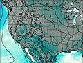
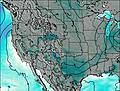
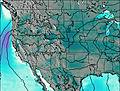
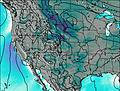
This table gives the weather forecast for Pikes Peak at the specific elevation of 4300 m. Our advanced weather models allow us to provide distinct weather forecasts for several elevations of Pikes Peak. To see the weather forecasts for the other elevations, use the tab navigation above the table. For a wider overview of the weather, consult the Weather Map of Colorado.
| Weather Station | Temp. | Weather | Wind | Gusts | Cloud / Visibility |
|---|---|---|---|---|---|
Cheyenne Mtn Airport | |||||
Colorado Springs Airport | |||||
Fort Carson Airport | |||||
Wilkerson Pass | |||||
Canon City Airport | |||||
Schriever AFB | |||||
* NOTE: not all weather observatories update at the same frequency which is the reason why some locations may show data from stations that are further away than known closer ones.
Pikes Peak Photos
View all
Front Range photos (101) |
Rocky Mountains (USA) photos (298) |
photos from mountains in United States (3056) |
all photos
 Upload new photo
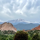

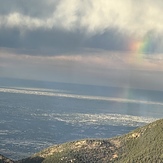 See 31 more Pikes Peak photos
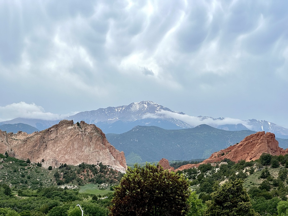
Pikes Peak From Garden Of The Gods Park
Hairpin Turns on the Upper Slopes of Pikes Peak
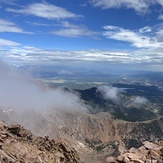
Pikes Peak at 10am
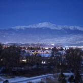
Pikes Peak Over Colorado Springs by Night
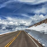
Snow-Cleared Road on Pikes Peak Highway in Late Spring
Pikes Peak
Gods promise