
– Lat/Long: 17.15° N 120.98° E
 Patoc
Patoc
Weather Forecast, PhilippinesIssued: 7 pm Mon 03 Aug Local TimeUpdates in: hr min sUpdate imminent
Issued: 7 pm Mon 03 Aug Local Time
Updates in:
Update imminent hr min s

Issued: 7 pm Mon 03 Aug Local Time
Updates in:
Update imminent hr min s
Days 1–4 Weather SummaryHeavy rain (total 119mm), heaviest during Wed night. Warm (max 20°C on Thu morning, min 16°C on Mon night). Wind will be generally light. | Days 5–7 Weather SummaryHeavy rain (total 40mm), heaviest during Sun morning. Very mild (max 18°C on Fri morning, min 16°C on Thu night). Winds increasing (light winds from the W on Thu night, fresh winds from the W by Sun afternoon). | |||||||||||||||
Tuesday 4 | Wednesday 5 | Thursday 6 | Friday 7 | Saturday 8 | ||||||||||||
night | AM | PM | night | AM | PM | night | AM | PM | night | AM | PM | night | AM | PM | night | |
rain shwrs | risk tstorm | risk tstorm | risk tstorm | rain shwrs | risk tstorm | heavy rain | rain shwrs | rain shwrs | rain shwrs | rain shwrs | risk tstorm | light rain | light rain | light rain | mod. rain | |
Cloud base (m) | 1900 | 2150 | 1750 | 1850 | 2050 | 1550 | 1550 | 1550 | 1750 | 1800 | 1550 | 1600 | 1600 | 1550 | ||
km/h | ||||||||||||||||
 |  |  |  |  |  | |||||||||||
— | — | — | — | — | — | — | — | — | — | — | — | — | — | — | — | |
mm | 6 | 1.9 | 8 | 8 | 4 | 30 | 62 | 0.1 | 0.2 | 0.2 | 1 | 3 | 1.6 | 4 | 4 | 10 |
max °C | 17 | 19 | 19 | 17 | 19 | 18 | 16 | 20 | 20 | 16 | 18 | 18 | 17 | 17 | 17 | 17 |
min °C | 16 | 17 | 18 | 16 | 18 | 17 | 16 | 16 | 19 | 16 | 17 | 17 | 16 | 17 | 17 | 17 |
chill °C | 16 | 17 | 18 | 16 | 18 | 17 | 16 | 16 | 19 | 15 | 16 | 16 | 15 | 16 | 16 | 16 |
Freezing level m | 5200 | 5250 | 5200 | 5300 | 5150 | 5350 | 5150 | 5200 | 5300 | 5350 | 5150 | 5200 | 5400 | 5200 | 5200 | 5250 |
— | 5:35 | — | — | 5:35 | — | — | 5:37 | — | — | 5:37 | — | — | 5:37 | — | — | |
— | — | 6:27 | — | — | 6:27 | — | — | 6:25 | — | — | 6:25 | — | — | 6:24 | — | |
Loading...
Patoc Weather (Days 0-3):
The weather forecast for Patoc is: Heavy rain (total 119mm), heaviest during Wed night. Warm (max 20°C on Thu morning, min 16°C on Mon night). Wind will be generally light.
Patoc Weather (Days 3-6):
Heavy rain (total 40mm), heaviest during Sun morning. Very mild (max 18°C on Fri morning, min 16°C on Thu night). Winds increasing (light winds from the W on Thu night, fresh winds from the W by Sun afternoon).
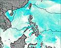
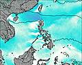
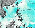
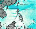
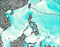
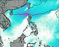
This table gives the weather forecast for Patoc at the specific elevation of 1865 m. Our advanced weather models allow us to provide distinct weather forecasts for several elevations of Patoc. To see the weather forecasts for the other elevations, use the tab navigation above the table. For a wider overview of the weather, consult the Weather Map of Philippines.
| Weather Station | Temp. | Weather | Wind | Gusts | Cloud / Visibility |
|---|---|---|---|---|---|
lightning 4km WNW of Angad | |||||
lightning 8km NNE of Agbannawag | |||||
lightning 24km W of Conner | |||||
lightning 6km N of Bantay | |||||
lightning 5km NW of Calinauan | |||||
Baguio | |||||
Tuguegarao | |||||
lightning 20km W of Kabugao | |||||
Sinait Synoptic Station |
* NOTE: not all weather observatories update at the same frequency which is the reason why some locations may show data from stations that are further away than known closer ones.