– Lat/Long: 42.86° N 71.88° W
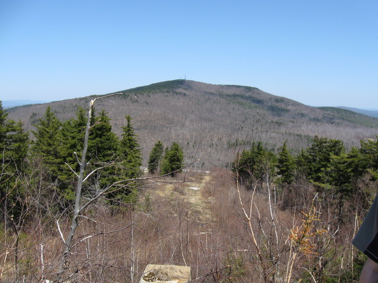
 Pack Monadnock
Weather Forecast, United StatesIssued: 7 pm Mon 13 Jul Local TimeUpdates in: hr min sUpdate imminent
Issued: 7 pm Mon 13 Jul Local Time
Updates in:
Update imminent hr min s

Issued: 7 pm Mon 13 Jul Local Time
Updates in:
Update imminent hr min s
Days 1–4 Weather SummaryMostly dry. Warm (max 29°C on Tue afternoon, min 17°C on Wed night). Mainly fresh winds. | Days 5–7 Weather SummaryLight rain (total 4mm), mostly falling on Sat afternoon. Warm (max 21°C on Fri afternoon, min 13°C on Thu night). Winds increasing (calm on Fri night, strong winds from the W by Sat night). | ||||||||||||||||||
Tuesday 14 | Wednesday 15 | Thursday 16 | Friday 17 | Saturday 18 | Sunday 19 | ||||||||||||||
night | AM | PM | night | AM | PM | night | AM | PM | night | AM | PM | night | AM | PM | night | AM | PM | night | |
rain shwrs | some clouds | clear | clear | risk tstorm | some clouds | clear | clear | some clouds | rain shwrs | clear | clear | some clouds | cloudy | rain shwrs | rain shwrs | rain shwrs | rain shwrs | clear | |
km/h | |||||||||||||||||||
 |  |  |  |  |  |  | |||||||||||||
— | — | — | — | — | — | — | — | — | — | — | — | — | — | — | — | — | — | — | |
mm | 0.3 | — | — | — | 0.4 | — | — | — | — | 0.5 | — | — | — | — | 1.6 | 1.4 | 0.2 | 0.1 | — |
max °C | 21 | 25 | 29 | 26 | 23 | 26 | 21 | 21 | 23 | 20 | 17 | 21 | 18 | 18 | 19 | 20 | 20 | 21 | 16 |
min °C | 19 | 22 | 27 | 24 | 22 | 26 | 17 | 19 | 23 | 13 | 15 | 20 | 14 | 17 | 18 | 18 | 18 | 20 | 11 |
chill °C | 19 | 22 | 27 | 24 | 22 | 26 | 16 | 18 | 23 | 11 | 13 | 20 | 13 | 17 | 17 | 17 | 17 | 19 | 9 |
Freezing level m | 4200 | 4700 | 5000 | 4800 | 4350 | 3800 | 3400 | 3200 | 3500 | 3300 | 3700 | 3950 | 4050 | 4100 | 4400 | 4500 | 4250 | 4050 | 3550 |
Cloud base (m) | 8100 | 8650 | 5700 | 3050 | 2950 | 8900 | 3050 | 2650 | 6750 | 2600 | 700 | 200 | 400 | 8800 | 7050 | ||||
— | 5:20 | — | — | 5:22 | — | — | 5:22 | — | — | 5:22 | — | — | 5:24 | — | — | 5:24 | — | — | |
— | — | — | 8:24 | — | — | 8:23 | — | — | 8:22 | — | — | 8:22 | — | — | 8:22 | — | — | 8:21 | |
Loading...
Pack Monadnock Weather (Days 0-3):
The weather forecast for Pack Monadnock is: Mostly dry. Warm (max 29°C on Tue afternoon, min 17°C on Wed night). Mainly fresh winds.
Pack Monadnock Weather (Days 3-6):
Light rain (total 4mm), mostly falling on Sat afternoon. Warm (max 21°C on Fri afternoon, min 13°C on Thu night). Winds increasing (calm on Fri night, strong winds from the W by Sat night).
This table gives the weather forecast for Pack Monadnock at the specific elevation of 698 m. Our advanced weather models allow us to provide distinct weather forecasts for several elevations of Pack Monadnock. To see the weather forecasts for the other elevations, use the tab navigation above the table. For a wider overview of the weather, consult the Weather Map of New-Hampshire.
| Weather Station | Temp. | Weather | Wind | Gusts | Cloud / Visibility |
|---|---|---|---|---|---|
Jaffrey Airport | |||||
* NOTE: not all weather observatories update at the same frequency which is the reason why some locations may show data from stations that are further away than known closer ones.
Pack Monadnock Photos
View all
Wapack Range photos (3) |
Appalachians photos (910) |
photos from mountains in United States (3055) |
all photos
 Upload new photo
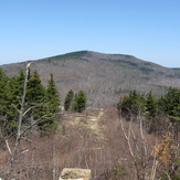
Pack Monadnock