• Get Premium
    • Countries
    • Mountain Ranges
    • Weather Maps
    • Forecast Anywhere
  • Photos
  • Log in or sign up to save your favourites

    Create a free account

    Already a Member? Log In

  • Log In
  • Sign Up
  • Log In
    • Countries
    • Mountain Ranges
    • Weather Maps
    • Forecast Anywhere
  • Photos
  • Log in or sign up to save your favourites

    Create a free account

    Already a Member? Log In

    • Height / Distance

    • Speed

    • Temperature

  • Continue in app

Forecast Anywhere

Click any point on the map, from summit to valley floor, to get its forecast.Tap any point on the map, from summit to valley floor, to get its forecast.

    • Central American Ranges
    • Sierra Madre
    – Lat/Long: 14.38° N 90.60° W

    Pacaya Photos

    Sierra Madre · Guatemala
    • Forecasts
    • Weather Map
    • Mountain Info
    • Climbing Notes
    • Photos (4)
    • More
      • Mountain Info
      • Climbing Notes
    Go Ad-Free with Mountain Pro

    Pacaya Mountain Photos

    View photos from Sierra Madre (28) | photos from Central American Ranges (86) | photos from Guatemala (42) | all photos
    Sort icon Upload new photo
    Sort iconSort by:
    Latest uploads
    RatingLatest takenMost viewed
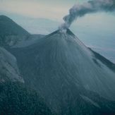
    Pacaya
    Pacaya

    Pacaya

    Atardeciendo en el Pacaya

    Atardeciendo en el Pacaya

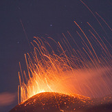
    Erupción, Pacaya

    Erupción

    Mountain Forecast
    app storeplay store

    Explore

    • Countries
    • Mountain Ranges
    • Weather Maps
    • Whiteroom News
    • Photos

    Social

    • Facebook
    • Instagram

    Forecasts For Every Adventure

    • Snow Forecast
    • Surf Forecast
    • Tide Forecast
    • Weather Forecast
    • Meteo365
    • Terms of Use
    • Privacy Policy
    • Cookie Policy
    • Contact Us
    • Privacy Settings
    • Do Not Sell My Personal Information

    © 2026 Meteo365 Ltd. All rights reserved