
– Lat/Long: 45.53° S 168.37° E
 Mt Bee Bunkrooms
Weather Forecast, New ZealandIssued: 5 am Mon 08 Sep Local TimeUpdates in: hr min sUpdate imminent
Issued: 5 am Mon 08 Sep Local Time
Updates in:
Update imminent hr min s

Issued: 5 am Mon 08 Sep Local Time
Updates in:
Update imminent hr min s
Days 1–3 Weather SummaryDrizzle at first, then turning colder with dusting of snow on Wed morning. Freeze-thaw conditions (max 7°C on Tue afternoon, min -3°C on Wed night). Winds increasing (light winds from the NNW on Mon morning, near gales from the NNW by Tue afternoon). | Days 4–6 Weather SummaryModerate rain (total 13mm) heaviest on Sat night, then becoming colder with a dusting of snow on Sat night. Freeze-thaw conditions (max 4°C on Fri morning, min -2°C on Sat night). Winds increasing (light winds from the NW on Fri afternoon, stormy winds from the WNW by Sat night). | |||||||||||||||||
Monday 8 | Tuesday 9 | Wednesday 10 | Thursday 11 | Friday 12 | Saturday 13 | |||||||||||||
AM | PM | night | AM | PM | night | AM | PM | night | AM | PM | night | AM | PM | night | AM | PM | night | |
clear | clear | some clouds | some clouds | rain shwrs | rain shwrs | light snow | snow shwrs | snow shwrs | some clouds | some clouds | some clouds | some clouds | rain shwrs | light rain | some clouds | some clouds | light snow | |
km/h | ||||||||||||||||||
 |  |  |  |  |  | |||||||||||||
— | — | — | — | — | — | 1 | 2 | 1 | — | — | — | — | — | — | — | — | 3 | |
— | — | — | — | 0.2 | 1 | — | — | — | — | — | — | — | 1.2 | 0.3 | — | — | 12 | |
max°C | 6 | 6 | 4 | 6 | 7 | 4 | 1 | 0 | -2 | 1 | 2 | 2 | 4 | 4 | 3 | 1 | 2 | 3 |
min°C | 2 | 4 | 3 | 4 | 5 | 1 | 1 | -1 | -3 | -1 | 2 | 1 | 3 | 4 | 0 | -1 | 2 | -2 |
-1 | 0 | -2 | -2 | -1 | -6 | -6 | -7 | -10 | -7 | -4 | -5 | -3 | 0 | -8 | -9 | -6 | -13 | |
1800 | 2150 | 2350 | 1900 | 2250 | 1400 | 1100 | 900 | 350 | 800 | 1200 | 1250 | 1450 | 1500 | 1500 | 800 | 1150 | 1400 | |
Cloud base (m) | 500 | 550 | 600 | 650 | 400 | 400 | 500 | 750 | 650 | 1400 | 800 | 800 | 750 | 700 | 700 | 1750 | 400 | |
7:03 | — | — | 7:01 | — | — | 6:58 | — | — | 6:56 | — | — | 6:54 | — | — | 6:52 | — | — | |
— | 6:25 | — | — | 6:27 | — | — | 6:28 | — | — | 6:29 | — | — | 6:30 | — | — | 6:31 | — | |
Loading...
Mt Bee Bunkrooms Weather (Days 0-3):
The weather forecast for Mt Bee Bunkrooms is: Drizzle at first, then turning colder with dusting of snow on Wed morning. Freeze-thaw conditions (max 7°C on Tue afternoon, min -3°C on Wed night). Winds increasing (light winds from the NNW on Mon morning, near gales from the NNW by Tue afternoon).
Mt Bee Bunkrooms Weather (Days 3-6):
Moderate rain (total 13mm) heaviest on Sat night, then becoming colder with a dusting of snow on Sat night. Freeze-thaw conditions (max 4°C on Fri morning, min -2°C on Sat night). Winds increasing (light winds from the NW on Fri afternoon, stormy winds from the WNW by Sat night).
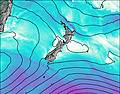
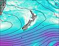
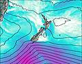
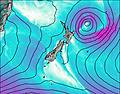
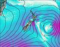
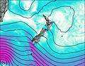
This table gives the weather forecast for Mt Bee Bunkrooms at the specific elevation of 939 m. Our advanced weather models allow us to provide distinct weather forecasts for several elevations of Mt Bee Bunkrooms. To see the weather forecasts for the other elevations, use the tab navigation above the table. For a wider overview of the weather, consult the Weather Map of New Zealand.
| Weather Station | Temp. | Weather | Wind | Gusts | Cloud / Visibility |
|---|---|---|---|---|---|
Kingston SPHGC | |||||
Skyline Gondola | |||||
QueenstownAeroAws | |||||
Coronet Peak Tandems | |||||
Flightpark | |||||
Terrace SouthernClub | |||||
Rocky Gully | |||||
Glenorchy | |||||
InvercargillAeroAws | |||||
* NOTE: not all weather observatories update at the same frequency which is the reason why some locations may show data from stations that are further away than known closer ones.