
– Lat/Long: 42.62° S 147.30° E
 Mount Wellington
Weather Forecast, AustraliaIssued: 9 pm Sun 02 Aug Local TimeUpdates in: hr min sUpdate imminent
Issued: 9 pm Sun 02 Aug Local Time
Updates in:
Update imminent hr min s

Issued: 9 pm Sun 02 Aug Local Time
Updates in:
Update imminent hr min s
Days 1–4 Weather SummaryMostly dry. Mild temperatures (max 9°C on Wed morning, min 2°C on Mon night). Wind will be generally light. | Days 5–7 Weather SummaryMostly dry. Very mild (max 12°C on Sat morning, min 2°C on Wed night). Wind will be generally light. | ||||||||||||||||||
Monday 3 | Tuesday 4 | Wednesday 5 | Thursday 6 | Friday 7 | Saturday 8 | ||||||||||||||
night | AM | PM | night | AM | PM | night | AM | PM | night | AM | PM | night | AM | PM | night | AM | PM | night | |
some clouds | light rain | light rain | some clouds | clear | some clouds | some clouds | clear | clear | some clouds | some clouds | clear | some clouds | clear | some clouds | clear | some clouds | some clouds | cloudy | |
Cloud base (m) | 950 | 600 | 550 | 1450 | 900 | 900 | 650 | 750 | 850 | 850 | 1700 | 1850 | 1550 | 1750 | 2500 | ||||
km/h | |||||||||||||||||||
 |  |  |  |  |  |  | |||||||||||||
— | — | — | — | — | — | — | — | — | — | — | — | — | — | — | — | — | — | — | |
mm | — | 0.8 | 0.1 | — | — | — | — | — | — | — | — | — | — | — | — | — | — | — | — |
max °C | 5 | 6 | 7 | 4 | 8 | 7 | 4 | 9 | 9 | 4 | 9 | 9 | 6 | 10 | 10 | 5 | 12 | 10 | 7 |
min °C | 4 | 6 | 5 | 2 | 5 | 4 | 2 | 6 | 5 | 2 | 6 | 6 | 4 | 7 | 6 | 3 | 8 | 7 | 7 |
chill °C | 0 | 3 | 3 | 2 | 5 | 3 | 2 | 5 | 3 | 0 | 4 | 3 | 1 | 5 | 6 | 0 | 6 | 3 | 3 |
Freezing level m | 1600 | 1400 | 1350 | 1350 | 1350 | 1400 | 1550 | 1700 | 1750 | 1750 | 1500 | 1650 | 1500 | 2050 | 2050 | 2000 | 1950 | 1850 | 1750 |
— | 7:20 | — | — | 7:18 | — | — | 7:18 | — | — | 7:16 | — | — | 7:15 | — | — | 7:13 | — | — | |
— | — | 5:14 | — | — | 5:15 | — | — | 5:15 | — | — | 5:16 | — | — | 5:17 | — | — | 5:19 | — | |
Loading...
Mount Wellington Weather (Days 0-3):
The weather forecast for Mount Wellington is: Mostly dry. Mild temperatures (max 9°C on Wed morning, min 2°C on Mon night). Wind will be generally light.
Mount Wellington Weather (Days 3-6):
Mostly dry. Very mild (max 12°C on Sat morning, min 2°C on Wed night). Wind will be generally light.
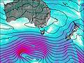
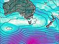
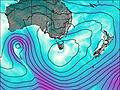
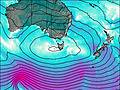
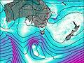
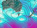
This table gives the weather forecast for Mount Wellington at the specific elevation of 500 m. Our advanced weather models allow us to provide distinct weather forecasts for several elevations of Mount Wellington. To see the weather forecasts for the other elevations, use the tab navigation above the table. For a wider overview of the weather, consult the Weather Map of Tasmania.
| Weather Station | Temp. | Weather | Wind | Gusts | Cloud / Visibility |
|---|---|---|---|---|---|
Winton | |||||
Campania (Kinkora) | |||||
Tunnak Fire Station | |||||
Hobart Airport | |||||
Hobart (Ellerslie Road) | |||||
Mount Wellington | |||||
Woodspring | |||||
Bushy Park (Bushy Park Estates) | |||||
Lemon Hill | |||||
Mary Ann Bay |
* NOTE: not all weather observatories update at the same frequency which is the reason why some locations may show data from stations that are further away than known closer ones.