
– Lat/Long: 61.41° N 152.41° W
 Mount Torbert
Weather Forecast, United StatesIssued: 3 am Sun 12 Jul Local TimeUpdates in: hr min sUpdate imminent
Issued: 3 am Sun 12 Jul Local Time
Updates in:
Update imminent hr min s

Issued: 3 am Sun 12 Jul Local Time
Updates in:
Update imminent hr min s
Days 1–3 Weather SummaryA heavy fall of snow, heaviest during Tue night. Temperatures will be below freezing (max -2°C on Mon night, min -6°C on Sun morning). Wind will be generally light. | Days 4–6 Weather SummaryA heavy fall of snow, heaviest during Thu morning. Temperatures will be well below freezing (max -6°C on Wed morning, min -8°C on Thu morning). Wind will be generally light. | |||||||||||||||||
Sunday 12 | Monday 13 | Tuesday 14 | Wednesday 15 | Thursday 16 | Friday 17 | |||||||||||||
AM | PM | night | AM | PM | night | AM | PM | night | AM | PM | night | AM | PM | night | AM | PM | night | |
light snow | light snow | light snow | light snow | light snow | mod. snow | snow shwrs | light snow | heavy snow | cloudy | light snow | mod. snow | mod. snow | light snow | light snow | light snow | light snow | light snow | |
km/h | ||||||||||||||||||
 |  |  |  |  |  | |||||||||||||
3 | 4 | 2 | 2 | 1 | 7 | 3 | 2 | 11 | — | 1 | 6 | 6 | 3 | 4 | 1 | 1 | 3 | |
mm | — | — | — | — | — | — | — | — | — | — | — | — | — | — | — | — | — | — |
max °C | -5 | -5 | -6 | -6 | -4 | -2 | -2 | -3 | -4 | -6 | -7 | -7 | -8 | -8 | -8 | -8 | -8 | -7 |
min °C | -6 | -5 | -6 | -6 | -5 | -4 | -2 | -3 | -6 | -7 | -7 | -7 | -8 | -8 | -8 | -8 | -8 | -8 |
chill °C | -11 | -11 | -12 | -14 | -12 | -11 | -8 | -10 | -9 | -11 | -12 | -12 | -14 | -12 | -11 | -8 | -11 | -11 |
Freezing level m | 2000 | 2000 | 1900 | 1900 | 2050 | 2000 | 2100 | 2150 | 1700 | 1800 | 1900 | 1800 | 1650 | 1700 | 1600 | 1600 | 1850 | 1700 |
Cloud base (m) | 1850 | 1850 | 1850 | 1850 | 1850 | 1850 | 1850 | 1850 | 1850 | 1850 | 1850 | 1850 | 1850 | 1850 | 1850 | 1850 | 1850 | 1850 |
4:52 | — | — | 4:54 | — | — | 4:56 | — | — | 4:58 | — | — | 5:00 | — | — | 5:03 | — | — | |
— | — | 11:36 | — | — | 11:34 | — | — | 11:31 | — | — | 11:30 | — | — | 11:28 | — | — | 11:25 | |
Loading...
Mount Torbert Weather (Days 0-3):
The weather forecast for Mount Torbert is: A heavy fall of snow, heaviest during Tue night. Temperatures will be below freezing (max -2°C on Mon night, min -6°C on Sun morning). Wind will be generally light.
Mount Torbert Weather (Days 3-6):
A heavy fall of snow, heaviest during Thu morning. Temperatures will be well below freezing (max -6°C on Wed morning, min -8°C on Thu morning). Wind will be generally light.
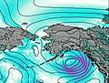
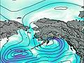
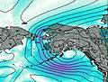
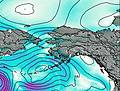
This table gives the weather forecast for Mount Torbert at the specific elevation of 3000 m. Our advanced weather models allow us to provide distinct weather forecasts for several elevations of Mount Torbert. To see the weather forecasts for the other elevations, use the tab navigation above the table. For a wider overview of the weather, consult the Weather Map of Alaska United States.