
– Lat/Long: 35.54° N 114.19° W
 Mount Tipton
Weather Forecast, United StatesIssued: 4 am Sat 01 Aug Local TimeUpdates in: hr min sUpdate imminent
Issued: 4 am Sat 01 Aug Local Time
Updates in:
Update imminent hr min s

Issued: 4 am Sat 01 Aug Local Time
Updates in:
Update imminent hr min s
Days 1–3 Weather SummaryMostly dry. Warm (max 28°C on Sat afternoon, min 23°C on Mon night). Winds increasing (light winds from the SSW on Sat morning, fresh winds from the SW by Sun afternoon). | Days 4–6 Weather SummaryMostly dry. Warm (max 27°C on Tue afternoon, min 22°C on Wed morning). Mainly fresh winds. | |||||||||||||||||
Saturday 1 | Sunday 2 | Monday 3 | Tuesday 4 | Wednesday 5 | Thursday 6 | |||||||||||||
AM | PM | night | AM | PM | night | AM | PM | night | AM | PM | night | AM | PM | night | AM | PM | night | |
clear | clear | clear | clear | clear | clear | clear | clear | clear | clear | clear | clear | clear | clear | clear | clear | clear | clear | |
Cloud base (m) | ||||||||||||||||||
km/h | ||||||||||||||||||
 |  |  |  |  |  | |||||||||||||
— | — | — | — | — | — | — | — | — | — | — | — | — | — | — | — | — | — | |
mm | — | — | — | — | — | — | — | — | — | — | — | — | — | — | — | — | — | — |
max °C | 26 | 28 | 28 | 26 | 27 | 27 | 25 | 27 | 27 | 25 | 27 | 27 | 24 | 27 | 26 | 24 | 27 | 26 |
min °C | 26 | 28 | 26 | 25 | 27 | 25 | 24 | 26 | 23 | 23 | 26 | 23 | 22 | 26 | 24 | 22 | 26 | 22 |
chill °C | 26 | 28 | 26 | 25 | 27 | 25 | 24 | 26 | 23 | 23 | 26 | 23 | 22 | 26 | 24 | 22 | 26 | 22 |
Freezing level m | 5700 | 5800 | 5750 | 5650 | 5650 | 5700 | 5550 | 5600 | 5600 | 5500 | 5600 | 5450 | 5500 | 5600 | 5500 | 5450 | 5550 | 5450 |
5:45 | — | — | 5:45 | — | — | 5:46 | — | — | 5:47 | — | — | 5:48 | — | — | 5:48 | — | — | |
— | 7:39 | — | — | 7:38 | — | — | 7:37 | — | — | 7:37 | — | — | 7:36 | — | — | 7:35 | — | |
Loading...
Mount Tipton Weather (Days 0-3):
The weather forecast for Mount Tipton is: Mostly dry. Warm (max 28°C on Sat afternoon, min 23°C on Mon night). Winds increasing (light winds from the SSW on Sat morning, fresh winds from the SW by Sun afternoon).
Mount Tipton Weather (Days 3-6):
Mostly dry. Warm (max 27°C on Tue afternoon, min 22°C on Wed morning). Mainly fresh winds.
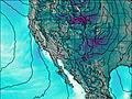
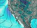
This table gives the weather forecast for Mount Tipton at the specific elevation of 2179 m. Our advanced weather models allow us to provide distinct weather forecasts for several elevations of Mount Tipton. To see the weather forecasts for the other elevations, use the tab navigation above the table. For a wider overview of the weather, consult the Weather Map of Arizona.
| Weather Station | Temp. | Weather | Wind | Gusts | Cloud / Visibility |
|---|---|---|---|---|---|
Kingman Airport | |||||
Bullhead City Airport | |||||
Boulder City Municipal Airport | |||||
Las Vegas Airport | |||||
* NOTE: not all weather observatories update at the same frequency which is the reason why some locations may show data from stations that are further away than known closer ones.