
– Lat/Long: 58.33° N 154.68° W
 Mount Snowy
Weather Forecast, United StatesIssued: 9 am Sun 12 Jul Local TimeUpdates in: hr min sUpdate imminent
Issued: 9 am Sun 12 Jul Local Time
Updates in:
Update imminent hr min s

Issued: 9 am Sun 12 Jul Local Time
Updates in:
Update imminent hr min s
Days 1–3 Weather SummaryLight rain (total 6mm) at first, then becoming colder with a dusting of snow on Tue morning. Freeze-thaw conditions (max 4°C on Mon night, min -2°C on Sun morning). Winds increasing (light winds from the WNW on Sun night, near gales from the SSW by Mon night). | Days 4–6 Weather SummaryA moderate fall of snow, heaviest on Fri night. Temperatures will be below freezing (max -2°C on Wed morning, min -5°C on Fri night). Wind will be generally light. | |||||||||||||||||
Sunday 12 | Monday 13 | Tuesday 14 | Wednesday 15 | Thursday 16 | Friday 17 | |||||||||||||
AM | PM | night | AM | PM | night | AM | PM | night | AM | PM | night | AM | PM | night | AM | PM | night | |
cloudy | some clouds | some clouds | cloudy | light rain | light rain | light snow | light snow | some clouds | some clouds | some clouds | light snow | light snow | light snow | some clouds | cloudy | light snow | mod. snow | |
km/h | ||||||||||||||||||
 |  |  |  |  |  | |||||||||||||
— | — | — | — | — | — | 1 | 2 | — | — | — | 4 | 3 | 1 | — | — | 1 | 9 | |
mm | — | — | — | — | 4 | 1.7 | 0.3 | — | — | — | — | — | — | — | — | — | — | — |
max °C | -2 | -2 | -1 | 0 | 2 | 4 | 2 | 0 | -1 | -2 | -2 | -3 | -3 | -3 | -3 | -4 | -4 | -4 |
min °C | -2 | -2 | -2 | -1 | 1 | 3 | 1 | -1 | -2 | -2 | -2 | -3 | -3 | -4 | -4 | -4 | -4 | -5 |
chill °C | -7 | -6 | -5 | -7 | -5 | -3 | -6 | -8 | -8 | -8 | -7 | -7 | -6 | -9 | -9 | -8 | -7 | -9 |
Freezing level m | 1800 | 1700 | 1750 | 1900 | 2650 | 3250 | 2900 | 2200 | 1750 | 1500 | 1700 | 1400 | 1450 | 1450 | 1550 | 1400 | 1500 | 1400 |
Cloud base (m) | 550 | 600 | 950 | 650 | 750 | 550 | 550 | 550 | 700 | 800 | 750 | 550 | 500 | 550 | 650 | 650 | 600 | 550 |
5:31 | — | — | 5:33 | — | — | 5:33 | — | — | 5:35 | — | — | 5:37 | — | — | 5:39 | — | — | |
— | — | 11:15 | — | — | 11:14 | — | — | 11:13 | — | — | 11:10 | — | — | 11:09 | — | — | 11:07 | |
Loading...
Mount Snowy Weather (Days 0-3):
The weather forecast for Mount Snowy is: Light rain (total 6mm) at first, then becoming colder with a dusting of snow on Tue morning. Freeze-thaw conditions (max 4°C on Mon night, min -2°C on Sun morning). Winds increasing (light winds from the WNW on Sun night, near gales from the SSW by Mon night).
Mount Snowy Weather (Days 3-6):
A moderate fall of snow, heaviest on Fri night. Temperatures will be below freezing (max -2°C on Wed morning, min -5°C on Fri night). Wind will be generally light.
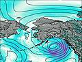
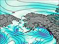
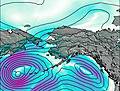
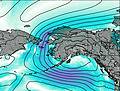
This table gives the weather forecast for Mount Snowy at the specific elevation of 2161 m. Our advanced weather models allow us to provide distinct weather forecasts for several elevations of Mount Snowy. To see the weather forecasts for the other elevations, use the tab navigation above the table. For a wider overview of the weather, consult the Weather Map of Alaska United States.
| Weather Station | Temp. | Weather | Wind | Gusts | Cloud / Visibility |
|---|---|---|---|---|---|
BUOY-DCXA2 | |||||
Shelikof Strait- AK | |||||
King Salmon Airport | |||||
Igiugig Airport | |||||
BUOY-AUGA2 | |||||
South Naknek (AK) | |||||
Kodiak Airport | |||||
BUOY-WBXA2 | |||||
BUOY-WFXA2 | |||||
BUOY-KGXA2 |
* NOTE: not all weather observatories update at the same frequency which is the reason why some locations may show data from stations that are further away than known closer ones.