– Lat/Long: 41.04° S 172.60° E
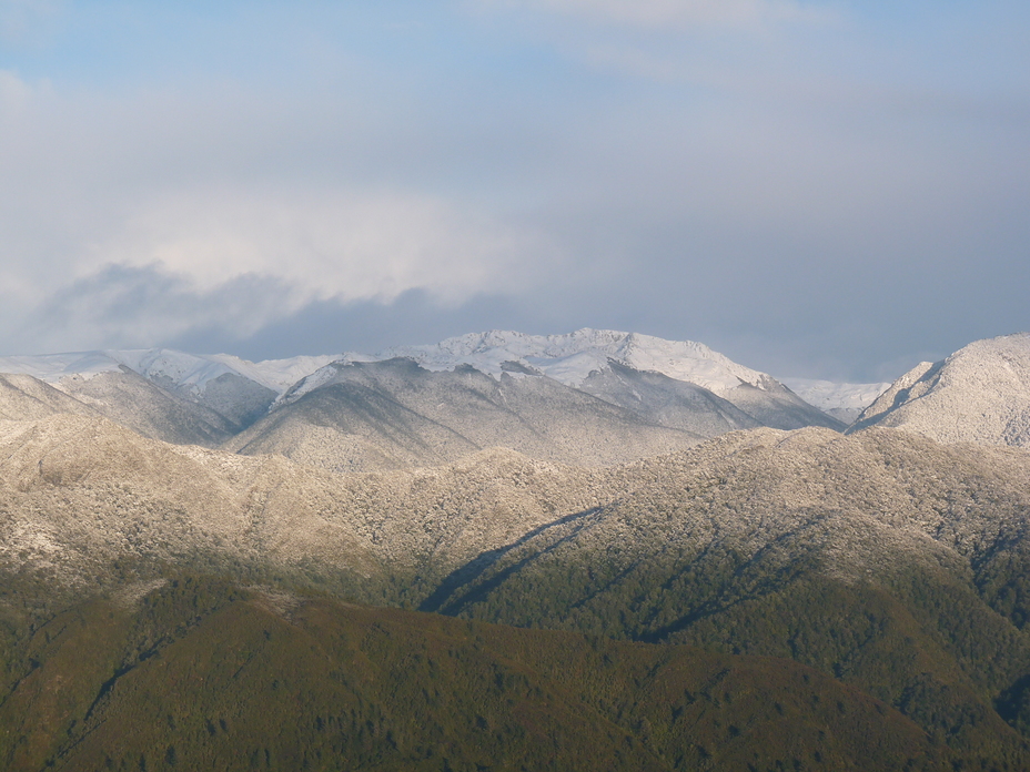
 Mount Snowdon
Weather Forecast, New ZealandIssued: 11 pm Mon 03 Aug Local TimeUpdates in: hr min sUpdate imminent
Issued: 11 pm Mon 03 Aug Local Time
Updates in:
Update imminent hr min s

Issued: 11 pm Mon 03 Aug Local Time
Updates in:
Update imminent hr min s
Days 1–4 Weather SummaryMostly dry. Temperatures will be below freezing (max -1°C on Mon night, min -5°C on Tue afternoon). Winds decreasing (gales from the SW on Mon night, light winds from the SW by Thu afternoon). | Days 5–7 Weather SummaryA moderate fall of snow, heaviest on Fri afternoon. Freeze-thaw conditions (max 1°C on Fri night, min -2°C on Thu night). Wind will be generally light. | |||||||||||||||
Tuesday 4 | Wednesday 5 | Thursday 6 | Friday 7 | Saturday 8 | ||||||||||||
night | AM | PM | night | AM | PM | night | AM | PM | night | AM | PM | night | AM | PM | night | |
cloudy | some clouds | clear | clear | clear | clear | clear | clear | clear | some clouds | cloudy | light snow | light snow | light snow | snow shwrs | some clouds | |
Cloud base (m) | 750 | 700 | 700 | 750 | 1650 | 800 | 750 | 700 | 750 | 1800 | 700 | 850 | ||||
km/h | ||||||||||||||||
 |  |  |  |  |  | |||||||||||
— | — | — | — | — | — | — | — | — | — | — | 5 | 1 | 1 | 2 | — | |
mm | — | — | — | — | — | — | — | — | — | — | — | — | — | — | — | — |
max °C | -1 | -4 | -4 | -4 | -4 | -3 | -3 | -3 | -2 | -1 | -1 | 0 | 1 | -1 | -1 | -1 |
min °C | -3 | -4 | -5 | -4 | -5 | -3 | -3 | -3 | -2 | -2 | -1 | -1 | 0 | -1 | -2 | -2 |
chill °C | -12 | -11 | -12 | -10 | -10 | -8 | -7 | -7 | -6 | -6 | -6 | -8 | -5 | -1 | -4 | -6 |
Freezing level m | 1350 | 1150 | 1350 | 750 | 1000 | 1400 | 950 | 1300 | 1550 | 1600 | 1600 | 1650 | 1950 | 1650 | 1500 | 1600 |
— | 7:33 | — | — | 7:33 | — | — | 7:31 | — | — | 7:31 | — | — | 7:30 | — | — | |
— | — | 5:37 | — | — | 5:37 | — | — | 5:38 | — | — | 5:39 | — | — | 5:40 | — | |
Loading...
Mount Snowdon Weather (Days 0-3):
The weather forecast for Mount Snowdon is: Mostly dry. Temperatures will be below freezing (max -1°C on Mon night, min -5°C on Tue afternoon). Winds decreasing (gales from the SW on Mon night, light winds from the SW by Thu afternoon).
Mount Snowdon Weather (Days 3-6):
A moderate fall of snow, heaviest on Fri afternoon. Freeze-thaw conditions (max 1°C on Fri night, min -2°C on Thu night). Wind will be generally light.
This table gives the weather forecast for Mount Snowdon at the specific elevation of 1859 m. Our advanced weather models allow us to provide distinct weather forecasts for several elevations of Mount Snowdon. To see the weather forecasts for the other elevations, use the tab navigation above the table. For a wider overview of the weather, consult the Weather Map of New Zealand.
| Weather Station | Temp. | Weather | Wind | Gusts | Cloud / Visibility |
|---|---|---|---|---|---|
Big Pokororo 2 | |||||
Takaka Aero | |||||
* NOTE: not all weather observatories update at the same frequency which is the reason why some locations may show data from stations that are further away than known closer ones.
Mount Snowdon Photos
View all
Nelson Ranges photos (35) |
New Zealand photos (156) |
photos from mountains in New Zealand (160) |
all photos
 Upload new photo
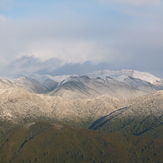
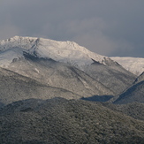
Kahurangi Snowfall
Kahurangi Snowfall
Mount Snowdon
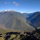
Tasman Mountains