– Lat/Long: 69.18° N 104.72° W
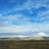
 Mount Pelly
Weather Forecast, CanadaIssued: 11 pm Sun 02 Aug Local TimeUpdates in: hr min sUpdate imminent
Issued: 11 pm Sun 02 Aug Local Time
Updates in:
Update imminent hr min s

Issued: 11 pm Sun 02 Aug Local Time
Updates in:
Update imminent hr min s
Days 1–4 Weather SummaryLight rain (total 6mm), mostly falling on Tue night. Very mild (max 14°C on Wed afternoon, min 7°C on Mon night). Winds increasing (light winds from the NW on Mon morning, strong winds from the ENE by Tue night). | Days 5–7 Weather SummaryMostly dry. Very mild (max 18°C on Sat afternoon, min 7°C on Wed night). Winds decreasing (strong winds from the NE on Wed night, light winds from the NNW by Sat afternoon). | ||||||||||||||||||
Monday 3 | Tuesday 4 | Wednesday 5 | Thursday 6 | Friday 7 | Saturday 8 | ||||||||||||||
night | AM | PM | night | AM | PM | night | AM | PM | night | AM | PM | night | AM | PM | night | AM | PM | night | |
rain shwrs | cloudy | clear | some clouds | some clouds | light rain | mod. rain | cloudy | cloudy | some clouds | clear | clear | clear | clear | clear | clear | clear | clear | clear | |
Cloud base (m) | 500 | 600 | 1650 | 1650 | 1800 | 3800 | 100 | 6000 | 5700 | 5900 | 8750 | 9350 | 8500 | 9350 | 9350 | 9000 | 6300 | ||
km/h | |||||||||||||||||||
 |  |  |  |  |  |  | |||||||||||||
— | — | — | — | — | — | — | — | — | — | — | — | — | — | — | — | — | — | — | |
mm | 0.1 | — | — | — | — | 0.1 | 5 | — | — | — | — | — | — | — | — | — | — | — | — |
max °C | 10 | 11 | 13 | 12 | 11 | 11 | 8 | 13 | 14 | 12 | 12 | 13 | 11 | 13 | 15 | 14 | 15 | 18 | 15 |
min °C | 8 | 9 | 12 | 7 | 10 | 8 | 7 | 10 | 14 | 7 | 10 | 13 | 7 | 10 | 15 | 10 | 12 | 18 | 14 |
chill °C | 5 | 7 | 10 | 4 | 7 | 3 | 2 | 6 | 11 | 2 | 6 | 10 | 2 | 7 | 14 | 8 | 10 | 18 | 12 |
Freezing level m | 1350 | 1700 | 1900 | 2000 | 1900 | 1850 | 2500 | 2950 | 3200 | 3300 | 3450 | 3500 | 3350 | 3350 | 3350 | 3250 | 3250 | 3350 | 3200 |
— | 3:00 | — | — | 3:05 | — | — | 3:12 | — | — | 3:16 | — | — | 3:23 | — | — | 3:28 | — | — | |
— | — | — | 11:04 | — | — | 10:58 | — | — | 10:52 | — | — | 10:46 | — | — | 10:40 | — | — | 10:35 | |
Loading...
Mount Pelly Weather (Days 0-3):
The weather forecast for Mount Pelly is: Light rain (total 6mm), mostly falling on Tue night. Very mild (max 14°C on Wed afternoon, min 7°C on Mon night). Winds increasing (light winds from the NW on Mon morning, strong winds from the ENE by Tue night).
Mount Pelly Weather (Days 3-6):
Mostly dry. Very mild (max 18°C on Sat afternoon, min 7°C on Wed night). Winds decreasing (strong winds from the NE on Wed night, light winds from the NNW by Sat afternoon).
This table gives the weather forecast for Mount Pelly at the specific elevation of 200 m. Our advanced weather models allow us to provide distinct weather forecasts for several elevations of Mount Pelly. To see the weather forecasts for the other elevations, use the tab navigation above the table. For a wider overview of the weather, consult the Weather Map of Nunavut.
| Weather Station | Temp. | Weather | Wind | Gusts | Cloud / Visibility |
|---|---|---|---|---|---|
Cambridge Bay Gsn- NU | |||||
Cambridge Bay Airport | |||||
Bathurst Inlet- NU | |||||
Gjoa Haven Airport | |||||
Kugluktuk Climate- NU | |||||
Coppermine Airport | |||||
Robertson Lake (Aut)- NU | |||||
Lupin Airport | |||||
* NOTE: not all weather observatories update at the same frequency which is the reason why some locations may show data from stations that are further away than known closer ones.