
– Lat/Long: 43.42° N 143.03° E
 Mount Maru (Kamishihoro-Shintoku)
Weather Forecast, JapanIssued: 8 pm Sat 01 Aug Local TimeUpdates in: hr min sUpdate imminent
Issued: 8 pm Sat 01 Aug Local Time
Updates in:
Update imminent hr min s

Issued: 8 pm Sat 01 Aug Local Time
Updates in:
Update imminent hr min s
Days 1–4 Weather SummaryLight rain (total 5mm), mostly falling on Sat night. Very mild (max 16°C on Tue morning, min 11°C on Sat night). Wind will be generally light. | Days 5–7 Weather SummaryMostly dry. Warm (max 20°C on Thu morning, min 16°C on Tue night). Wind will be generally light. | ||||||||||||||||||
Sunday 2 | Monday 3 | Tuesday 4 | Wednesday 5 | Thursday 6 | Friday 7 | ||||||||||||||
night | AM | PM | night | AM | PM | night | AM | PM | night | AM | PM | night | AM | PM | night | AM | PM | night | |
rain shwrs | light rain | rain shwrs | rain shwrs | clear | clear | some clouds | some clouds | clear | clear | clear | clear | clear | clear | clear | clear | clear | risk tstorm | rain shwrs | |
Cloud base (m) | 700 | 800 | 900 | 800 | 750 | 6800 | 5750 | 700 | 700 | ||||||||||
km/h | |||||||||||||||||||
 |  |  |  |  |  |  | |||||||||||||
— | — | — | — | — | — | — | — | — | — | — | — | — | — | — | — | — | — | — | |
mm | 3 | 0.6 | 1.1 | 0.1 | — | — | — | — | — | — | — | — | — | — | — | — | — | 0.3 | 0.1 |
max °C | 11 | 11 | 13 | 13 | 15 | 15 | 15 | 16 | 16 | 18 | 18 | 18 | 19 | 20 | 19 | 18 | 18 | 18 | 17 |
min °C | 11 | 11 | 12 | 12 | 13 | 14 | 14 | 15 | 15 | 16 | 17 | 18 | 19 | 19 | 18 | 18 | 18 | 17 | 16 |
chill °C | 11 | 11 | 12 | 12 | 13 | 14 | 14 | 15 | 15 | 16 | 17 | 18 | 19 | 19 | 18 | 18 | 18 | 17 | 16 |
Freezing level m | 3950 | 3850 | 4000 | 4300 | 4450 | 4700 | 4950 | 5000 | 5200 | 5250 | 5300 | 5400 | 5400 | 5300 | 5300 | 5300 | 5200 | 5200 | 5050 |
— | 4:18 | — | — | 4:18 | — | — | 4:20 | — | — | 4:20 | — | — | 4:22 | — | — | 4:22 | — | — | |
— | — | 6:49 | — | — | 6:47 | — | — | 6:46 | — | — | 6:45 | — | — | 6:44 | — | — | 6:43 | — | |
Loading...
Mount Maru (Kamishihoro-Shintoku) Weather (Days 0-3):
The weather forecast for Mount Maru (Kamishihoro-Shintoku) is: Light rain (total 5mm), mostly falling on Sat night. Very mild (max 16°C on Tue morning, min 11°C on Sat night). Wind will be generally light.
Mount Maru (Kamishihoro-Shintoku) Weather (Days 3-6):
Mostly dry. Warm (max 20°C on Thu morning, min 16°C on Tue night). Wind will be generally light.
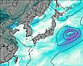
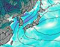
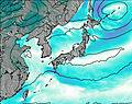
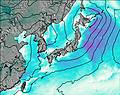
This table gives the weather forecast for Mount Maru (Kamishihoro-Shintoku) at the specific elevation of 1692 m. Our advanced weather models allow us to provide distinct weather forecasts for several elevations of Mount Maru (Kamishihoro-Shintoku). To see the weather forecasts for the other elevations, use the tab navigation above the table. For a wider overview of the weather, consult the Weather Map of Japan.
| Weather Station | Temp. | Weather | Wind | Gusts | Cloud / Visibility |
|---|---|---|---|---|---|
Asahikawa Airport | |||||
Kushiro Airport | |||||
Chitose Airport | |||||
SHIP8672 | |||||
Juzhno -Kuril sk | |||||
SHIP1477 | |||||
SHIP8557 | |||||
SHIP5878 | |||||
SHIP9406 | |||||
SHIP5205 |
* NOTE: not all weather observatories update at the same frequency which is the reason why some locations may show data from stations that are further away than known closer ones.