
– Lat/Long: 51.60° S 59.59° W
 Mount Maria
Weather Forecast, Falkland IslandsIssued: 8 am Mon 03 Aug Local TimeUpdates in: hr min sUpdate imminent
Issued: 8 am Mon 03 Aug Local Time
Updates in:
Update imminent hr min s

Issued: 8 am Mon 03 Aug Local Time
Updates in:
Update imminent hr min s
Days 1–3 Weather SummaryA dusting of new snow. Temperatures will be below freezing (max 0°C on Mon night, min -2°C on Wed morning). Winds decreasing (strong winds from the ENE on Mon night, calm by Wed night). | Days 4–6 Weather SummaryA dusting of new snow. Temperatures will be below freezing (max -1°C on Thu morning, min -4°C on Sat night). Winds increasing (calm on Fri morning, strong winds from the S by Sat night). | |||||||||||||||||
Monday 3 | Tuesday 4 | Wednesday 5 | Thursday 6 | Friday 7 | Saturday 8 | |||||||||||||
AM | PM | night | AM | PM | night | AM | PM | night | AM | PM | night | AM | PM | night | AM | PM | night | |
cloudy | cloudy | light snow | cloudy | cloudy | cloudy | cloudy | cloudy | cloudy | cloudy | some clouds | some clouds | cloudy | some clouds | some clouds | some clouds | cloudy | light snow | |
Cloud base (m) | 350 | 200 | 100 | 100 | 50 | 150 | 100 | 100 | 50 | 50 | 50 | 150 | 250 | 400 | 200 | 150 | 50 | 50 |
km/h | ||||||||||||||||||
 |  |  |  |  |  | |||||||||||||
— | — | 2 | — | — | — | — | — | — | — | — | — | — | — | — | — | — | 2 | |
mm | — | — | — | — | — | — | — | — | — | — | — | — | — | — | — | — | — | — |
max °C | -1 | -1 | 0 | 0 | 0 | 0 | -2 | -2 | -2 | -1 | -1 | -1 | -1 | -1 | -2 | -2 | -2 | -3 |
min °C | -1 | -1 | -1 | 0 | 0 | -1 | -2 | -2 | -2 | -2 | -1 | -2 | -2 | -2 | -3 | -3 | -2 | -4 |
chill °C | -9 | -9 | -9 | -6 | -4 | -6 | -8 | -7 | -6 | -4 | -5 | -6 | -4 | -8 | -10 | -11 | -10 | -14 |
Freezing level m | 400 | 550 | 600 | 600 | 650 | 550 | 400 | 400 | 250 | 350 | 500 | 450 | 450 | 500 | 250 | 200 | 350 | 250 |
8:30 | — | — | 8:30 | — | — | 8:27 | — | — | 8:26 | — | — | 8:25 | — | — | 8:22 | — | — | |
— | 5:37 | — | — | 5:38 | — | — | 5:39 | — | — | 5:42 | — | — | 5:43 | — | — | 5:45 | — | |
Loading...
Mount Maria Weather (Days 0-3):
The weather forecast for Mount Maria is: A dusting of new snow. Temperatures will be below freezing (max 0°C on Mon night, min -2°C on Wed morning). Winds decreasing (strong winds from the ENE on Mon night, calm by Wed night).
Mount Maria Weather (Days 3-6):
A dusting of new snow. Temperatures will be below freezing (max -1°C on Thu morning, min -4°C on Sat night). Winds increasing (calm on Fri morning, strong winds from the S by Sat night).
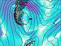
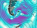
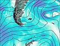
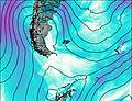
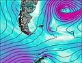
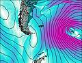
This table gives the weather forecast for Mount Maria at the specific elevation of 658 m. Our advanced weather models allow us to provide distinct weather forecasts for several elevations of Mount Maria. To see the weather forecasts for the other elevations, use the tab navigation above the table. For a wider overview of the weather, consult the Weather Map of Falkland Islands.
| Weather Station | Temp. | Weather | Wind | Gusts | Cloud / Visibility |
|---|---|---|---|---|---|
Pebble Island | |||||
Mount Byron | |||||
Mount Pleasant Airport | |||||
Mount Alice | |||||
Weddell Island | |||||
Mount Kent | |||||
ASCATB302E51S | |||||
Stanley Airport | |||||
ASCATB302E52S | |||||
ASCATB302E50S |
* NOTE: not all weather observatories update at the same frequency which is the reason why some locations may show data from stations that are further away than known closer ones.