– Lat/Long: 57.20° N 156.74° W
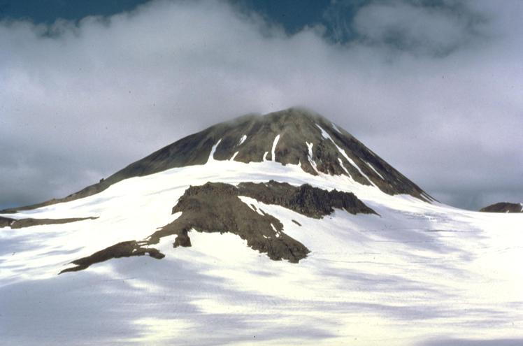
 Mount Kialagvik
Weather Forecast, United StatesIssued: 3 am Mon 03 Aug Local TimeUpdates in: hr min sUpdate imminent
Issued: 3 am Mon 03 Aug Local Time
Updates in:
Update imminent hr min s

Issued: 3 am Mon 03 Aug Local Time
Updates in:
Update imminent hr min s
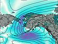
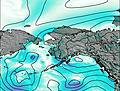
Days 1–3 Weather SummaryHeavy rain (total 35mm), heaviest during Mon night. Very mild (max 12°C on Mon morning, min 6°C on Mon night). Winds decreasing (near gales from the S on Mon afternoon, calm by Tue afternoon). | Days 4–6 Weather SummaryMostly dry. Very mild (max 10°C on Fri morning, min 7°C on Sat night). Wind will be generally light. | |||||||||||||||||
Monday 3 | Tuesday 4 | Wednesday 5 | Thursday 6 | Friday 7 | Saturday 8 | |||||||||||||
AM | PM | night | AM | PM | night | AM | PM | night | AM | PM | night | AM | PM | night | AM | PM | night | |
light rain | heavy rain | heavy rain | rain shwrs | rain shwrs | cloudy | light rain | rain shwrs | light rain | some clouds | rain shwrs | some clouds | clear | clear | clear | clear | rain shwrs | cloudy | |
Cloud base (m) | 500 | 350 | 300 | 400 | 400 | 700 | 800 | 500 | 400 | 400 | 650 | 650 | 550 | 450 | 400 | 350 | 550 | 400 |
km/h | ||||||||||||||||||
 |  |  |  |  |  | |||||||||||||
— | — | — | — | — | — | — | — | — | — | — | — | — | — | — | — | — | — | |
mm | 0.1 | 14 | 19 | 0.1 | 0.1 | — | 0.1 | 0.3 | 0.7 | — | 0.4 | — | — | — | — | — | 0.1 | — |
max °C | 12 | 11 | 9 | 7 | 7 | 7 | 7 | 8 | 8 | 8 | 9 | 8 | 10 | 10 | 10 | 10 | 10 | 9 |
min °C | 11 | 11 | 6 | 7 | 7 | 6 | 7 | 8 | 7 | 8 | 9 | 8 | 9 | 10 | 8 | 8 | 10 | 7 |
chill °C | 7 | 7 | 4 | 6 | 7 | 6 | 6 | 6 | 5 | 6 | 8 | 8 | 9 | 10 | 7 | 7 | 9 | 4 |
Freezing level m | 4100 | 4000 | 3200 | 2950 | 2600 | 2600 | 2600 | 2850 | 2900 | 3000 | 3200 | 3150 | 3150 | 3300 | 3400 | 3400 | 3550 | 3600 |
6:28 | — | — | 6:30 | — | — | 6:31 | — | — | 6:33 | — | — | 6:35 | — | — | 6:37 | — | — | |
— | — | 10:36 | — | — | 10:34 | — | — | 10:31 | — | — | 10:29 | — | — | 10:27 | — | — | 10:24 | |
Loading...
Mount Kialagvik Weather (Days 0-3):
The weather forecast for Mount Kialagvik is: Heavy rain (total 35mm), heaviest during Mon night. Very mild (max 12°C on Mon morning, min 6°C on Mon night). Winds decreasing (near gales from the S on Mon afternoon, calm by Tue afternoon).
Mount Kialagvik Weather (Days 3-6):
Mostly dry. Very mild (max 10°C on Fri morning, min 7°C on Sat night). Wind will be generally light.
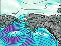
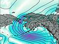
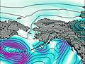
This table gives the weather forecast for Mount Kialagvik at the specific elevation of 1000 m. Our advanced weather models allow us to provide distinct weather forecasts for several elevations of Mount Kialagvik. To see the weather forecasts for the other elevations, use the tab navigation above the table. For a wider overview of the weather, consult the Weather Map of Alaska United States.
| Weather Station | Temp. | Weather | Wind | Gusts | Cloud / Visibility |
|---|---|---|---|---|---|
Pilot Point | |||||
Port Heiden Airport | |||||
Chignik Bay Airport | |||||
BUOY-ALIA2 | |||||
Akhiok | |||||
King Salmon Airport | |||||
South Naknek (AK) | |||||
Shelikof Strait- AK | |||||
BUOY-DCXA2 |
* NOTE: not all weather observatories update at the same frequency which is the reason why some locations may show data from stations that are further away than known closer ones.
Mount Kialagvik Photos
View all
Aleutian Range photos (5) |
Alaska/Yukon Ranges photos (65) |
photos from mountains in United States (3056) |
all photos
 Upload new photo
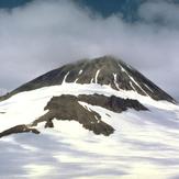
Mount Kialagvik