
– Lat/Long: 49.68° N 125.90° W
 Mount Kent-Urquhart
Weather Forecast, CanadaIssued: 4 am Mon 03 Aug Local TimeUpdates in: hr min sUpdate imminent
Issued: 4 am Mon 03 Aug Local Time
Updates in:
Update imminent hr min s

Issued: 4 am Mon 03 Aug Local Time
Updates in:
Update imminent hr min s
Days 1–3 Weather SummaryMostly dry. Warm (max 23°C on Wed afternoon, min 11°C on Mon morning). Wind will be generally light. | Days 4–6 Weather SummaryMostly dry. Warm (max 22°C on Thu afternoon, min 13°C on Fri night). Wind will be generally light. | |||||||||||||||||
Monday 3 | Tuesday 4 | Wednesday 5 | Thursday 6 | Friday 7 | Saturday 8 | |||||||||||||
AM | PM | night | AM | PM | night | AM | PM | night | AM | PM | night | AM | PM | night | AM | PM | night | |
clear | clear | clear | clear | clear | clear | clear | clear | clear | some clouds | some clouds | some clouds | clear | clear | clear | clear | clear | clear | |
Cloud base (m) | 9300 | 9350 | 7150 | 6750 | 4600 | 9550 | 9450 | 8700 | ||||||||||
km/h | ||||||||||||||||||
 |  |  |  |  |  | |||||||||||||
— | — | — | — | — | — | — | — | — | — | — | — | — | — | — | — | — | — | |
mm | — | — | — | — | — | — | — | — | — | — | — | — | — | — | — | — | — | — |
max °C | 14 | 18 | 16 | 18 | 21 | 19 | 20 | 23 | 20 | 20 | 22 | 18 | 16 | 18 | 16 | 16 | 18 | 16 |
min °C | 11 | 17 | 15 | 16 | 21 | 17 | 18 | 22 | 18 | 19 | 21 | 15 | 15 | 18 | 13 | 14 | 18 | 13 |
chill °C | 11 | 17 | 15 | 16 | 21 | 17 | 18 | 22 | 18 | 19 | 21 | 15 | 15 | 18 | 13 | 14 | 18 | 13 |
Freezing level m | 3600 | 3700 | 3850 | 4000 | 4150 | 4450 | 4550 | 4550 | 4450 | 4250 | 4050 | 3850 | 3600 | 3450 | 3500 | 3650 | 3500 | 3750 |
5:56 | — | — | 5:56 | — | — | 5:58 | — | — | 6:00 | — | — | 6:01 | — | — | 6:03 | — | — | |
— | — | 9:01 | — | — | 9:00 | — | — | 8:59 | — | — | 8:57 | — | — | 8:54 | — | — | 8:53 | |
Loading...
Mount Kent-Urquhart Weather (Days 0-3):
The weather forecast for Mount Kent-Urquhart is: Mostly dry. Warm (max 23°C on Wed afternoon, min 11°C on Mon morning). Wind will be generally light.
Mount Kent-Urquhart Weather (Days 3-6):
Mostly dry. Warm (max 22°C on Thu afternoon, min 13°C on Fri night). Wind will be generally light.
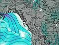
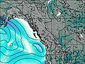
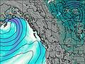
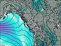
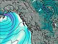
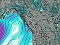
This table gives the weather forecast for Mount Kent-Urquhart at the specific elevation of 1000 m. Our advanced weather models allow us to provide distinct weather forecasts for several elevations of Mount Kent-Urquhart. To see the weather forecasts for the other elevations, use the tab navigation above the table. For a wider overview of the weather, consult the Weather Map of British-Columbia.
| Weather Station | Temp. | Weather | Wind | Gusts | Cloud / Visibility |
|---|---|---|---|---|---|
Campbell River Airport | |||||
Estevan Point Cs- BC | |||||
Tofino | |||||
Tofino Airport | |||||
SHIP6468 | |||||
SHIP7139 | |||||
SHIP3274 | |||||
Sentry Shoal Buoy | |||||
Comox Millitary Base Airport | |||||
Cfb - Comox- BC |
* NOTE: not all weather observatories update at the same frequency which is the reason why some locations may show data from stations that are further away than known closer ones.