
– Lat/Long: 52.22° N 117.29° W
 Mount K2
Weather Forecast, CanadaIssued: 11 pm Sat 01 Aug Local TimeUpdates in: hr min sUpdate imminent
Issued: 11 pm Sat 01 Aug Local Time
Updates in:
Update imminent hr min s

Issued: 11 pm Sat 01 Aug Local Time
Updates in:
Update imminent hr min s
Days 1–4 Weather SummaryLight rain (total 3mm) at first, then becoming colder with a dusting of snow on Sun night. Freeze-thaw conditions (max 9°C on Tue afternoon, min -1°C on Sat night). Wind will be generally light. | Days 5–7 Weather SummaryMostly dry. Very mild (max 16°C on Fri afternoon, min 8°C on Tue night). Wind will be generally light. | ||||||||||||||||||
Sunday 2 | Monday 3 | Tuesday 4 | Wednesday 5 | Thursday 6 | Friday 7 | ||||||||||||||
night | AM | PM | night | AM | PM | night | AM | PM | night | AM | PM | night | AM | PM | night | AM | PM | night | |
rain shwrs | some clouds | light rain | light snow | some clouds | cloudy | some clouds | clear | clear | some clouds | some clouds | clear | clear | clear | some clouds | clear | clear | some clouds | rain shwrs | |
Cloud base (m) | 2400 | 2700 | 2550 | 2500 | 3100 | 3350 | 5350 | 5300 | 4300 | 4600 | 5700 | 5350 | 4550 | ||||||
km/h | |||||||||||||||||||
 |  |  |  |  |  |  | |||||||||||||
— | — | — | 1 | — | — | — | — | — | — | — | — | — | — | — | — | — | — | — | |
mm | 3 | — | 0.3 | — | — | — | — | — | — | — | — | — | — | — | — | — | — | — | 0.8 |
max °C | 7 | 0 | 2 | 1 | 2 | 6 | 6 | 6 | 9 | 9 | 10 | 13 | 12 | 12 | 15 | 14 | 14 | 16 | 16 |
min °C | -1 | -1 | 1 | 0 | 0 | 5 | 4 | 5 | 8 | 8 | 8 | 12 | 11 | 11 | 14 | 12 | 13 | 16 | 11 |
chill °C | -6 | -6 | -2 | -5 | -4 | 3 | 4 | 4 | 7 | 7 | 8 | 11 | 11 | 11 | 14 | 12 | 12 | 16 | 11 |
Freezing level m | 3000 | 2400 | 2600 | 2500 | 2500 | 3100 | 3150 | 3100 | 3600 | 3800 | 3800 | 4150 | 4250 | 4150 | 4350 | 4400 | 4400 | 4450 | 4500 |
— | 6:11 | — | — | 6:11 | — | — | 6:13 | — | — | 6:15 | — | — | 6:16 | — | — | 6:18 | — | — | |
— | — | — | 9:37 | — | — | 9:36 | — | — | 9:35 | — | — | 9:32 | — | — | 9:30 | — | — | 9:29 | |
Loading...
Mount K2 Weather (Days 0-3):
The weather forecast for Mount K2 is: Light rain (total 3mm) at first, then becoming colder with a dusting of snow on Sun night. Freeze-thaw conditions (max 9°C on Tue afternoon, min -1°C on Sat night). Wind will be generally light.
Mount K2 Weather (Days 3-6):
Mostly dry. Very mild (max 16°C on Fri afternoon, min 8°C on Tue night). Wind will be generally light.
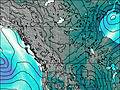
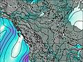
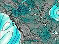
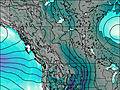
This table gives the weather forecast for Mount K2 at the specific elevation of 2500 m. Our advanced weather models allow us to provide distinct weather forecasts for several elevations of Mount K2. To see the weather forecasts for the other elevations, use the tab navigation above the table. For a wider overview of the weather, consult the Weather Map of Alberta.
| Weather Station | Temp. | Weather | Wind | Gusts | Cloud / Visibility |
|---|---|---|---|---|---|
Nordegg Cs- Alta | |||||
Jasper Warden- Alta | |||||
Jasper Warden Airport | |||||
Mount 7 | |||||
lightning 46km NNE of Lake Louise | |||||
Yoho Park- BC | |||||
lightning 41km WNW of Rocky Mountain House | |||||
Blue River Cs- BC | |||||
lightning 48km WSW of Drayton Valley |
* NOTE: not all weather observatories update at the same frequency which is the reason why some locations may show data from stations that are further away than known closer ones.