
– Lat/Long: 50.26° N 126.17° W
 Mount Juliet (British Columbia)
Weather Forecast, CanadaIssued: 10 pm Sat 25 Jul Local TimeUpdates in: hr min sUpdate imminent
Issued: 10 pm Sat 25 Jul Local Time
Updates in:
Update imminent hr min s

Issued: 10 pm Sat 25 Jul Local Time
Updates in:
Update imminent hr min s
Days 1–4 Weather SummaryHeavy rain (total 50mm), heaviest during Sat night. Mild temperatures (max 7°C on Sat night, min 5°C on Sun night). Wind will be generally light. | Days 5–7 Weather SummaryModerate rain (total 17mm), heaviest on Fri afternoon. Very mild (max 10°C on Thu afternoon, min 5°C on Tue night). Wind will be generally light. | ||||||||||||||||||
Sunday 26 | Monday 27 | Tuesday 28 | Wednesday 29 | Thursday 30 | Friday 31 | ||||||||||||||
night | AM | PM | night | AM | PM | night | AM | PM | night | AM | PM | night | AM | PM | night | AM | PM | night | |
heavy rain | light rain | light rain | rain shwrs | light rain | mod. rain | mod. rain | rain shwrs | rain shwrs | rain shwrs | clear | some clouds | some clouds | cloudy | some clouds | light rain | light rain | heavy rain | rain shwrs | |
Cloud base (m) | 550 | 550 | 550 | 2100 | 650 | 650 | 550 | 550 | 1950 | 1850 | 2500 | 6200 | 1550 | 2050 | 2400 | 750 | 550 | 1600 | |
km/h | |||||||||||||||||||
 |  |  |  |  |  |  | |||||||||||||
— | — | — | — | — | — | — | — | — | — | — | — | — | — | — | — | — | — | — | |
mm | 17 | 2 | 4 | 1.5 | 3 | 5 | 8 | 8 | 2 | 0.4 | — | — | — | — | — | 0.2 | 4 | 12 | 1.5 |
max °C | 7 | 6 | 6 | 6 | 6 | 6 | 7 | 6 | 6 | 6 | 6 | 9 | 9 | 7 | 10 | 9 | 7 | 6 | 5 |
min °C | 6 | 6 | 6 | 5 | 6 | 6 | 6 | 6 | 6 | 5 | 6 | 9 | 8 | 7 | 9 | 8 | 6 | 6 | 4 |
chill °C | 2 | 3 | 3 | 2 | 3 | 2 | 2 | 2 | 3 | 5 | 6 | 9 | 8 | 5 | 7 | 6 | 3 | 3 | 0 |
Freezing level m | 2750 | 2600 | 2650 | 2500 | 2500 | 2650 | 2750 | 2500 | 2600 | 2650 | 3100 | 3150 | 3350 | 3200 | 3100 | 3200 | 3050 | 2800 | 2300 |
— | 5:43 | — | — | 5:45 | — | — | 5:47 | — | — | 5:48 | — | — | 5:48 | — | — | 5:50 | — | — | |
— | — | — | 9:16 | — | — | 9:15 | — | — | 9:14 | — | — | 9:12 | — | — | 9:10 | — | — | 9:08 | |
Loading...
Mount Juliet (British Columbia) Weather (Days 0-3):
The weather forecast for Mount Juliet (British Columbia) is: Heavy rain (total 50mm), heaviest during Sat night. Mild temperatures (max 7°C on Sat night, min 5°C on Sun night). Wind will be generally light.
Mount Juliet (British Columbia) Weather (Days 3-6):
Moderate rain (total 17mm), heaviest on Fri afternoon. Very mild (max 10°C on Thu afternoon, min 5°C on Tue night). Wind will be generally light.
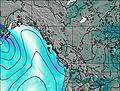
This table gives the weather forecast for Mount Juliet (British Columbia) at the specific elevation of 1626 m. Our advanced weather models allow us to provide distinct weather forecasts for several elevations of Mount Juliet (British Columbia). To see the weather forecasts for the other elevations, use the tab navigation above the table. For a wider overview of the weather, consult the Weather Map of British-Columbia.