– Lat/Long: 44.69° N 121.80° W
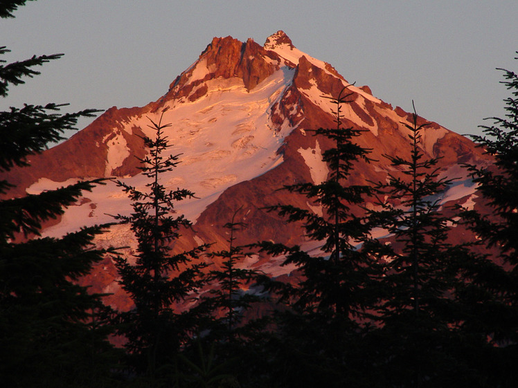
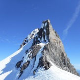
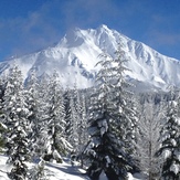
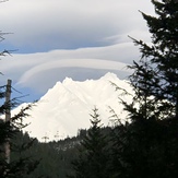
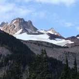
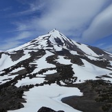
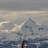
 Mount Jefferson (Oregon)
Weather Forecast, United StatesIssued: 4 am Mon 03 Aug Local TimeUpdates in: hr min sUpdate imminent
Issued: 4 am Mon 03 Aug Local Time
Updates in:
Update imminent hr min s

Issued: 4 am Mon 03 Aug Local Time
Updates in:
Update imminent hr min s
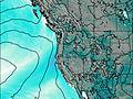
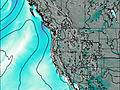
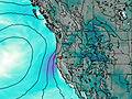
Days 1–3 Weather SummaryMostly dry. Very mild (max 14°C on Wed night, min 6°C on Mon morning). Winds increasing (light winds from the NNW on Mon morning, fresh winds from the WSW by Wed night). | Days 4–6 Weather SummaryMostly dry. Very mild (max 14°C on Thu night, min 9°C on Fri morning). Winds decreasing (near gales from the WSW on Thu night, light winds from the WSW by Sat afternoon). | |||||||||||||||||
Monday 3 | Tuesday 4 | Wednesday 5 | Thursday 6 | Friday 7 | Saturday 8 | |||||||||||||
AM | PM | night | AM | PM | night | AM | PM | night | AM | PM | night | AM | PM | night | AM | PM | night | |
clear | clear | clear | clear | clear | clear | clear | clear | clear | clear | clear | clear | clear | clear | clear | clear | clear | clear | |
Cloud base (m) | ||||||||||||||||||
km/h | ||||||||||||||||||
 |  |  |  |  |  | |||||||||||||
— | — | — | — | — | — | — | — | — | — | — | — | — | — | — | — | — | — | |
mm | — | — | — | — | — | — | — | — | — | — | — | — | — | — | — | — | — | — |
max °C | 7 | 9 | 10 | 10 | 10 | 12 | 12 | 13 | 14 | 13 | 13 | 14 | 10 | 10 | 11 | 10 | 10 | 10 |
min °C | 6 | 8 | 9 | 10 | 9 | 11 | 12 | 12 | 13 | 12 | 12 | 11 | 9 | 9 | 10 | 10 | 10 | 9 |
chill °C | 3 | 6 | 7 | 8 | 7 | 8 | 11 | 11 | 10 | 8 | 9 | 8 | 5 | 5 | 7 | 8 | 8 | 6 |
Freezing level m | 4300 | 4500 | 4600 | 4750 | 4700 | 4950 | 4950 | 5000 | 5100 | 4950 | 5000 | 4900 | 4650 | 4800 | 4850 | 4700 | 4700 | 4700 |
5:54 | — | — | 5:56 | — | — | 5:56 | — | — | 5:58 | — | — | 5:58 | — | — | 6:01 | — | — | |
— | — | 8:30 | — | — | 8:29 | — | — | 8:28 | — | — | 8:25 | — | — | 8:24 | — | — | 8:22 | |
Loading...
Mount Jefferson (Oregon) Weather (Days 0-3):
The weather forecast for Mount Jefferson (Oregon) is: Mostly dry. Very mild (max 14°C on Wed night, min 6°C on Mon morning). Winds increasing (light winds from the NNW on Mon morning, fresh winds from the WSW by Wed night).
Mount Jefferson (Oregon) Weather (Days 3-6):
Mostly dry. Very mild (max 14°C on Thu night, min 9°C on Fri morning). Winds decreasing (near gales from the WSW on Thu night, light winds from the WSW by Sat afternoon).
This table gives the weather forecast for Mount Jefferson (Oregon) at the specific elevation of 3199 m. Our advanced weather models allow us to provide distinct weather forecasts for several elevations of Mount Jefferson (Oregon). To see the weather forecasts for the other elevations, use the tab navigation above the table. For a wider overview of the weather, consult the Weather Map of Oregon.
| Weather Station | Temp. | Weather | Wind | Gusts | Cloud / Visibility |
|---|---|---|---|---|---|
Madras Municipal Airport (Oregon) | |||||
* NOTE: not all weather observatories update at the same frequency which is the reason why some locations may show data from stations that are further away than known closer ones.
Mount Jefferson (Oregon) Photos
View all
Cascade Range photos (451) |
Pacific Coast Ranges photos (1060) |
photos from mountains in United States (3056) |
all photos
 Upload new photo
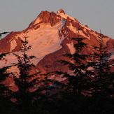
 See 10 more Mount Jefferson (Oregon) photos
Evening Alpinglow
Mount Jefferson summit
Fresh snow at Mt Jefferson
West side of Mt Jefferson
Mount Jefferson south ridge
Mt. Jefferson from Black Butte