
– Lat/Long: 42.48° S 172.85° E
 Mount Isobel
Weather Forecast, New ZealandIssued: 5 pm Mon 29 Jun Local TimeUpdates in: hr min sUpdate imminent
Issued: 5 pm Mon 29 Jun Local Time
Updates in:
Update imminent hr min s

Issued: 5 pm Mon 29 Jun Local Time
Updates in:
Update imminent hr min s
Days 1–4 Weather SummaryMostly dry. Freeze-thaw conditions (max 5°C on Tue morning, min 0°C on Mon night). Wind will be generally light. | Days 5–7 Weather SummaryLight rain (total 3mm), mostly falling on Sun morning. Mild temperatures (max 6°C on Sat morning, min 2°C on Sun morning). Winds increasing (light winds from the NW on Thu afternoon, severe gales from the NW by Sat night). | ||||||||||||||||
Mon 29 | Tuesday 30 | Wednesday 1 | Thursday 2 | Friday 3 | Saturday 4 | ||||||||||||
PM | night | AM | PM | night | AM | PM | night | AM | PM | night | AM | PM | night | AM | PM | night | |
some clouds | clear | clear | clear | clear | clear | clear | clear | clear | clear | clear | clear | some clouds | some clouds | rain shwrs | some clouds | rain shwrs | |
km/h | |||||||||||||||||
 |  |  |  |  |  | ||||||||||||
— | — | — | — | — | — | — | — | — | — | — | — | — | — | — | — | — | |
mm | — | — | — | — | — | — | — | — | — | — | — | — | — | — | 0.9 | — | 1.2 |
max °C | 1 | 3 | 5 | 5 | 4 | 3 | 4 | 3 | 4 | 4 | 4 | 5 | 5 | 4 | 6 | 6 | 5 |
min °C | 1 | 0 | 4 | 4 | 3 | 3 | 3 | 3 | 3 | 3 | 3 | 4 | 4 | 4 | 5 | 6 | 4 |
chill °C | 1 | 0 | 2 | 2 | 1 | 1 | 1 | 1 | 1 | 0 | 0 | -1 | -2 | -3 | -2 | -1 | -4 |
Freezing level m | 1450 | 1750 | 2350 | 2300 | 2150 | 2000 | 2100 | 2100 | 2100 | 2250 | 2350 | 2550 | 2800 | 3200 | 2900 | 2700 | 2150 |
Cloud base (m) | 950 | 1000 | 1000 | 1750 | 1700 | 1600 | 1600 | 9300 | 650 | 650 | 2000 | ||||||
— | — | 7:58 | — | — | 7:58 | — | — | 7:58 | — | — | 7:58 | — | — | 7:58 | — | — | |
5:04 | — | — | 5:05 | — | — | 5:05 | — | — | 5:06 | — | — | 5:06 | — | — | 5:07 | — | |
Loading...
Mount Isobel Weather (Days 0-3):
The weather forecast for Mount Isobel is: Mostly dry. Freeze-thaw conditions (max 5°C on Tue morning, min 0°C on Mon night). Wind will be generally light.
Mount Isobel Weather (Days 3-6):
Light rain (total 3mm), mostly falling on Sun morning. Mild temperatures (max 6°C on Sat morning, min 2°C on Sun morning). Winds increasing (light winds from the NW on Thu afternoon, severe gales from the NW by Sat night).
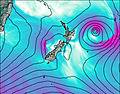
This table gives the weather forecast for Mount Isobel at the specific elevation of 1319 m. Our advanced weather models allow us to provide distinct weather forecasts for several elevations of Mount Isobel. To see the weather forecasts for the other elevations, use the tab navigation above the table. For a wider overview of the weather, consult the Weather Map of New Zealand.
| Weather Station | Temp. | Weather | Wind | Gusts | Cloud / Visibility |
|---|---|---|---|---|---|
Christchurch International Airport | |||||
Taylor's Mistake | |||||
Springfield | |||||
CHGPC Allandale | |||||
Lincoln Broadfield | |||||
Baring Head |
* NOTE: not all weather observatories update at the same frequency which is the reason why some locations may show data from stations that are further away than known closer ones.