
– Lat/Long: 42.20° S 145.95° E
 Mount Gould (Tasmania)
Weather Forecast, AustraliaIssued: 9 am Tue 28 Jul Local TimeUpdates in: hr min sUpdate imminent
Issued: 9 am Tue 28 Jul Local Time
Updates in:
Update imminent hr min s

Issued: 9 am Tue 28 Jul Local Time
Updates in:
Update imminent hr min s
Days 1–3 Weather SummaryA heavy fall of snow, heaviest during Tue afternoon. Freeze-thaw conditions (max 1°C on Tue morning, min -5°C on Wed morning). Winds decreasing (gales from the NNW on Tue morning, moderate winds from the W by Tue night). | Days 4–6 Weather SummaryA light covering of new snow mostly falling on Sun morning. Temperatures will be below freezing (max 0°C on Fri afternoon, min -5°C on Sun afternoon). Winds decreasing (gales from the NW on Sat night, calm by Sun night). | |||||||||||||||||
Tuesday 28 | Wednesday 29 | Thursday 30 | Friday 31 | Saturday 1 | Sunday 2 | |||||||||||||
AM | PM | night | AM | PM | night | AM | PM | night | AM | PM | night | AM | PM | night | AM | PM | night | |
light snow | mod. snow | light snow | light snow | light snow | light snow | light snow | light snow | some clouds | some clouds | some clouds | some clouds | some clouds | some clouds | some clouds | mod. snow | clear | clear | |
Cloud base (m) | 400 | 350 | 400 | 400 | 450 | 450 | 450 | 450 | 450 | 600 | 800 | 850 | 900 | 850 | 800 | 550 | 550 | 700 |
km/h | ||||||||||||||||||
 |  |  |  |  |  | |||||||||||||
5 | 7 | 2 | 4 | 2 | 3 | 4 | 1 | — | — | — | — | — | — | — | 7 | — | — | |
mm | — | — | — | — | — | — | — | — | — | — | — | — | — | — | — | — | — | — |
max °C | 1 | -1 | -4 | -3 | -5 | -2 | -2 | -2 | -1 | -1 | 0 | 0 | 0 | 0 | 0 | -2 | -4 | -3 |
min °C | 1 | -3 | -4 | -5 | -5 | -4 | -2 | -2 | -1 | -1 | -1 | -1 | 0 | -1 | -1 | -3 | -5 | -5 |
chill °C | -8 | -12 | -13 | -16 | -16 | -14 | -11 | -10 | -8 | -8 | -8 | -8 | -8 | -9 | -10 | -10 | -12 | -11 |
Freezing level m | 1700 | 1400 | 800 | 1000 | 800 | 900 | 1200 | 1250 | 1300 | 1350 | 1450 | 1400 | 1550 | 1500 | 1350 | 1150 | 950 | 350 |
7:31 | — | — | 7:30 | — | — | 7:28 | — | — | 7:28 | — | — | 7:26 | — | — | 7:26 | — | — | |
— | 5:14 | — | — | 5:15 | — | — | 5:15 | — | — | 5:16 | — | — | 5:17 | — | — | 5:19 | — | |
Loading...
Mount Gould (Tasmania) Weather (Days 0-3):
The weather forecast for Mount Gould (Tasmania) is: A heavy fall of snow, heaviest during Tue afternoon. Freeze-thaw conditions (max 1°C on Tue morning, min -5°C on Wed morning). Winds decreasing (gales from the NNW on Tue morning, moderate winds from the W by Tue night).
Mount Gould (Tasmania) Weather (Days 3-6):
A light covering of new snow mostly falling on Sun morning. Temperatures will be below freezing (max 0°C on Fri afternoon, min -5°C on Sun afternoon). Winds decreasing (gales from the NW on Sat night, calm by Sun night).
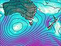
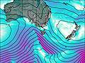
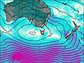
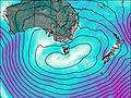
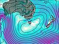
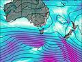
This table gives the weather forecast for Mount Gould (Tasmania) at the specific elevation of 1491 m. Our advanced weather models allow us to provide distinct weather forecasts for several elevations of Mount Gould (Tasmania). To see the weather forecasts for the other elevations, use the tab navigation above the table. For a wider overview of the weather, consult the Weather Map of Tasmania.