– Lat/Long: 41.93° S 146.06° E
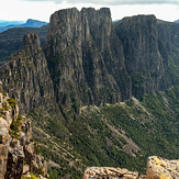
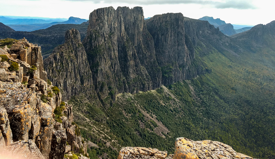
 Mount Geryon
Weather Forecast, AustraliaIssued: 3 am Tue 04 Aug Local TimeUpdates in: hr min sUpdate imminent
Issued: 3 am Tue 04 Aug Local Time
Updates in:
Update imminent hr min s

Issued: 3 am Tue 04 Aug Local Time
Updates in:
Update imminent hr min s
Days 1–3 Weather SummaryLight rain (total 5mm), mostly falling on Thu afternoon. Mild temperatures (max 5°C on Wed morning, min 1°C on Wed night). Wind will be generally light. | Days 4–6 Weather SummaryLight rain (total 9mm), mostly falling on Sun afternoon. Mild temperatures (max 5°C on Sun night, min 1°C on Fri night). Winds increasing (calm on Fri morning, fresh winds from the NNE by Sat night). | |||||||||||||||||
Tuesday 4 | Wednesday 5 | Thursday 6 | Friday 7 | Saturday 8 | Sunday 9 | |||||||||||||
AM | PM | night | AM | PM | night | AM | PM | night | AM | PM | night | AM | PM | night | AM | PM | night | |
rain shwrs | light rain | some clouds | clear | clear | some clouds | cloudy | light rain | light rain | clear | clear | clear | cloudy | some clouds | light rain | light rain | light rain | rain shwrs | |
Cloud base (m) | 700 | 700 | 650 | 700 | 1600 | 800 | 700 | 600 | 650 | 850 | 650 | 900 | 550 | 500 | 500 | 550 | ||
km/h | ||||||||||||||||||
 |  |  |  |  |  | |||||||||||||
— | — | — | — | — | — | — | — | — | — | — | — | — | — | — | — | — | — | |
mm | 0.1 | 0.4 | — | — | — | — | — | 4 | 0.6 | — | — | — | — | — | 3 | 3 | 3 | 0.4 |
max °C | 3 | 2 | 2 | 5 | 5 | 3 | 4 | 3 | 2 | 4 | 4 | 2 | 4 | 4 | 3 | 4 | 4 | 5 |
min °C | 2 | 2 | 2 | 4 | 3 | 1 | 2 | 2 | 1 | 2 | 3 | 1 | 2 | 3 | 3 | 3 | 4 | 4 |
chill °C | 0 | 0 | 0 | 3 | 1 | -1 | 0 | 1 | -1 | 2 | 1 | -3 | -2 | -2 | -2 | -2 | 0 | 2 |
Freezing level m | 1300 | 1350 | 1300 | 1600 | 1750 | 1700 | 1300 | 1450 | 1300 | 1300 | 1500 | 1700 | 1350 | 1500 | 1550 | 1600 | 1600 | 1850 |
7:22 | — | — | 7:20 | — | — | 7:20 | — | — | 7:18 | — | — | 7:16 | — | — | 7:16 | — | — | |
— | 5:21 | — | — | 5:22 | — | — | 5:22 | — | — | 5:23 | — | — | 5:24 | — | — | 5:25 | — | |
Loading...
Mount Geryon Weather (Days 0-3):
The weather forecast for Mount Geryon is: Light rain (total 5mm), mostly falling on Thu afternoon. Mild temperatures (max 5°C on Wed morning, min 1°C on Wed night). Wind will be generally light.
Mount Geryon Weather (Days 3-6):
Light rain (total 9mm), mostly falling on Sun afternoon. Mild temperatures (max 5°C on Sun night, min 1°C on Fri night). Winds increasing (calm on Fri morning, fresh winds from the NNE by Sat night).
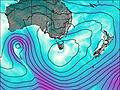
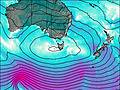
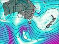
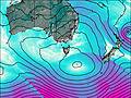
This table gives the weather forecast for Mount Geryon at the specific elevation of 1000 m. Our advanced weather models allow us to provide distinct weather forecasts for several elevations of Mount Geryon. To see the weather forecasts for the other elevations, use the tab navigation above the table. For a wider overview of the weather, consult the Weather Map of Tasmania.