
– Lat/Long: 58.87° N 153.55° W
 Mount Douglas
Weather Forecast, United StatesIssued: 3 pm Sat 18 Jul Local TimeUpdates in: hr min sUpdate imminent
Issued: 3 pm Sat 18 Jul Local Time
Updates in:
Update imminent hr min s

Issued: 3 pm Sat 18 Jul Local Time
Updates in:
Update imminent hr min s
Days 1–4 Weather SummaryA light covering of new snow mostly falling on Sat night will be washed away by heavy rain (total 31mm) on Sat night. Freeze-thaw conditions (max 4°C on Sat night, min 0°C on Sat afternoon). Winds decreasing (strong winds from the SE on Sat afternoon, light winds from the SW by Mon night). | Days 5–7 Weather SummaryA dusting of snow. Milder later with heavy rain (total 30mm) on Tue night. Very mild (max 13°C on Thu night, min 1°C on Tue afternoon). Winds increasing (light winds from the SW on Wed morning, near gales from the WNW by Thu night). | ||||||||||||||||
Sat 18 | Sunday 19 | Monday 20 | Tuesday 21 | Wednesday 22 | Thursday 23 | ||||||||||||
PM | night | AM | PM | night | AM | PM | night | AM | PM | night | AM | PM | night | AM | PM | night | |
light snow | light snow | heavy rain | light rain | light rain | clear | clear | some clouds | light snow | light snow | heavy rain | light rain | light rain | light rain | rain shwrs | some clouds | rain shwrs | |
Cloud base (m) | 400 | 400 | 400 | 400 | 400 | 500 | 450 | 550 | 450 | 400 | 400 | 550 | 450 | 400 | 450 | 400 | 450 |
km/h | |||||||||||||||||
 |  |  |  |  |  | ||||||||||||
3 | 4 | — | — | — | — | — | — | 1 | 1 | — | — | — | — | — | — | — | |
mm | — | 16 | 11 | 4 | 0.5 | — | — | — | — | 6 | 14 | 2 | 2 | 5 | 0.2 | — | 0.3 |
max °C | 1 | 4 | 4 | 4 | 3 | 1 | 2 | 2 | 1 | 2 | 5 | 5 | 6 | 8 | 9 | 12 | 13 |
min °C | 0 | 1 | 4 | 3 | 2 | 1 | 2 | 2 | 0 | 1 | 4 | 4 | 5 | 7 | 8 | 10 | 9 |
chill °C | -8 | -6 | -1 | -2 | -2 | -3 | -1 | 0 | -7 | -5 | 1 | 2 | 2 | 4 | 5 | 7 | 4 |
Freezing level m | 1700 | 2200 | 2250 | 2250 | 2050 | 1750 | 1800 | 1950 | 1650 | 2000 | 2900 | 2900 | 2850 | 3900 | 4000 | 4300 | 4000 |
— | — | 5:33 | — | — | 5:35 | — | — | 5:37 | — | — | 5:39 | — | — | 5:41 | — | — | |
— | 11:06 | — | — | 11:04 | — | — | 11:01 | — | — | 11:00 | — | — | 10:59 | — | — | 10:57 | |
Loading...
Mount Douglas Weather (Days 0-3):
The weather forecast for Mount Douglas is: A light covering of new snow mostly falling on Sat night will be washed away by heavy rain (total 31mm) on Sat night. Freeze-thaw conditions (max 4°C on Sat night, min 0°C on Sat afternoon). Winds decreasing (strong winds from the SE on Sat afternoon, light winds from the SW by Mon night).
Mount Douglas Weather (Days 3-6):
A dusting of snow. Milder later with heavy rain (total 30mm) on Tue night. Very mild (max 13°C on Thu night, min 1°C on Tue afternoon). Winds increasing (light winds from the SW on Wed morning, near gales from the WNW by Thu night).
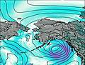
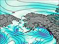
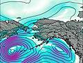
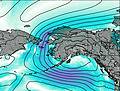
This table gives the weather forecast for Mount Douglas at the specific elevation of 1500 m. Our advanced weather models allow us to provide distinct weather forecasts for several elevations of Mount Douglas. To see the weather forecasts for the other elevations, use the tab navigation above the table. For a wider overview of the weather, consult the Weather Map of Alaska United States.