
– Lat/Long: 47.95° N 89.02° W
 Mount Desor
Weather Forecast, United StatesIssued: 1 am Wed 24 Jun Local TimeUpdates in: hr min sUpdate imminent
Issued: 1 am Wed 24 Jun Local Time
Updates in:
Update imminent hr min s

Issued: 1 am Wed 24 Jun Local Time
Updates in:
Update imminent hr min s
Days 1–3 Weather SummaryMostly dry. Very mild (max 15°C on Fri afternoon, min 7°C on Wed night). Wind will be generally light. | Days 4–6 Weather SummaryMostly dry. Warm (max 20°C on Mon afternoon, min 11°C on Sat morning). Mainly fresh winds. | |||||||||||||||||
Wednesday 24 | Thursday 25 | Friday 26 | Saturday 27 | Sunday 28 | Monday 29 | |||||||||||||
AM | PM | night | AM | PM | night | AM | PM | night | AM | PM | night | AM | PM | night | AM | PM | night | |
light rain | rain shwrs | some clouds | clear | clear | clear | clear | some clouds | some clouds | clear | clear | some clouds | some clouds | cloudy | rain shwrs | rain shwrs | rain shwrs | clear | |
km/h | ||||||||||||||||||
 |  |  |  |  |  | |||||||||||||
— | — | — | — | — | — | — | — | — | — | — | — | — | — | — | — | — | — | |
mm | 0.5 | 0.2 | — | — | — | — | — | — | — | — | — | — | — | — | 0.3 | 0.1 | 0.2 | — |
max °C | 10 | 10 | 10 | 10 | 14 | 13 | 13 | 15 | 15 | 13 | 15 | 14 | 15 | 16 | 18 | 19 | 20 | 19 |
min °C | 9 | 10 | 7 | 8 | 12 | 11 | 12 | 14 | 12 | 11 | 14 | 12 | 12 | 16 | 18 | 16 | 20 | 16 |
chill °C | 7 | 8 | 4 | 6 | 11 | 11 | 12 | 14 | 11 | 10 | 13 | 10 | 11 | 16 | 18 | 16 | 20 | 15 |
Freezing level m | 2750 | 2850 | 2800 | 2650 | 2850 | 2850 | 2900 | 3050 | 3250 | 3450 | 3850 | 4350 | 4750 | 5000 | 5300 | 5150 | 5250 | 5150 |
Cloud base (m) | 2450 | 2500 | 950 | 350 | 8650 | 6550 | 5550 | 5750 | 1550 | 650 | 550 | 200 | 150 | 150 | ||||
5:56 | — | — | 5:56 | — | — | 5:58 | — | — | 5:58 | — | — | 5:58 | — | — | 5:58 | — | — | |
— | — | 9:59 | — | — | 9:59 | — | — | 9:59 | — | — | 9:59 | — | — | 9:59 | — | — | 9:59 | |
Loading...
Mount Desor Weather (Days 0-3):
The weather forecast for Mount Desor is: Mostly dry. Very mild (max 15°C on Fri afternoon, min 7°C on Wed night). Wind will be generally light.
Mount Desor Weather (Days 3-6):
Mostly dry. Warm (max 20°C on Mon afternoon, min 11°C on Sat morning). Mainly fresh winds.
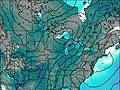
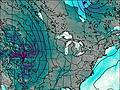
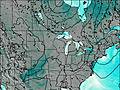
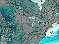
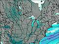
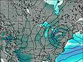
This table gives the weather forecast for Mount Desor at the specific elevation of 425 m. Our advanced weather models allow us to provide distinct weather forecasts for several elevations of Mount Desor. To see the weather forecasts for the other elevations, use the tab navigation above the table. For a wider overview of the weather, consult the Weather Map of Michigan.
| Weather Station | Temp. | Weather | Wind | Gusts | Cloud / Visibility |
|---|---|---|---|---|---|
BUOY-ROAM4 | |||||
Welcome Island (Aut)- Ont | |||||
Thunder Bay Cs- Ont | |||||
BUOY-PILM4 | |||||
North Entry Buoy- North Keweenaw Peninsula | |||||
West Superior Buoy- 30NM NE of Outer Island | |||||
Mid Superior Buoy- 60NM NNE of Hancock |
* NOTE: not all weather observatories update at the same frequency which is the reason why some locations may show data from stations that are further away than known closer ones.