– Lat/Long: 39.79° N 79.18° W
 Mount Davis
Weather Forecast, United StatesIssued: 7 am Mon 03 Aug Local TimeUpdates in: hr min sUpdate imminent
Issued: 7 am Mon 03 Aug Local Time
Updates in:
Update imminent hr min s

Issued: 7 am Mon 03 Aug Local Time
Updates in:
Update imminent hr min s
Days 1–3 Weather SummaryLight rain (total 7mm), mostly falling on Wed night. Warm (max 27°C on Tue afternoon, min 18°C on Mon night). Wind will be generally light. | Days 4–6 Weather SummaryHeavy rain (total 22mm), heaviest during Fri afternoon. Warm (max 29°C on Sat afternoon, min 22°C on Thu night). Wind will be generally light. | |||||||||||||||||
Monday 3 | Tuesday 4 | Wednesday 5 | Thursday 6 | Friday 7 | Saturday 8 | |||||||||||||
AM | PM | night | AM | PM | night | AM | PM | night | AM | PM | night | AM | PM | night | AM | PM | night | |
rain shwrs | clear | clear | clear | some clouds | some clouds | some clouds | rain shwrs | risk tstorm | rain shwrs | risk tstorm | risk tstorm | rain shwrs | mod. rain | risk tstorm | rain shwrs | risk tstorm | rain shwrs | |
Cloud base (m) | 500 | 2200 | 4650 | 2100 | 6400 | 8900 | 3000 | 8200 | 4950 | 3000 | 6150 | 6000 | 5050 | |||||
km/h | ||||||||||||||||||
 |  |  |  |  |  | |||||||||||||
— | — | — | — | — | — | — | — | — | — | — | — | — | — | — | — | — | — | |
mm | 0.5 | — | — | — | — | — | — | 1.4 | 5 | 1.6 | 5 | 3 | 2 | 6 | 4 | 0.1 | 0.6 | 0.3 |
max °C | 20 | 25 | 22 | 24 | 27 | 23 | 26 | 27 | 24 | 25 | 27 | 25 | 26 | 26 | 25 | 27 | 29 | 26 |
min °C | 20 | 24 | 18 | 20 | 27 | 21 | 22 | 26 | 22 | 23 | 26 | 22 | 23 | 26 | 22 | 22 | 27 | 23 |
chill °C | 20 | 24 | 18 | 20 | 27 | 21 | 22 | 26 | 22 | 23 | 26 | 22 | 23 | 26 | 22 | 22 | 27 | 23 |
Freezing level m | 4400 | 4500 | 4750 | 4750 | 4750 | 4650 | 4700 | 4750 | 4800 | 4700 | 4650 | 4650 | 4600 | 4650 | 4700 | 4600 | 4700 | 4700 |
6:16 | — | — | 6:16 | — | — | 6:18 | — | — | 6:18 | — | — | 6:20 | — | — | 6:20 | — | — | |
— | — | 8:28 | — | — | 8:27 | — | — | 8:24 | — | — | 8:23 | — | — | 8:22 | — | — | 8:22 | |
Loading...
Mount Davis Weather (Days 0-3):
The weather forecast for Mount Davis is: Light rain (total 7mm), mostly falling on Wed night. Warm (max 27°C on Tue afternoon, min 18°C on Mon night). Wind will be generally light.
Mount Davis Weather (Days 3-6):
Heavy rain (total 22mm), heaviest during Fri afternoon. Warm (max 29°C on Sat afternoon, min 22°C on Thu night). Wind will be generally light.
This table gives the weather forecast for Mount Davis at the specific elevation of 400 m. Our advanced weather models allow us to provide distinct weather forecasts for several elevations of Mount Davis. To see the weather forecasts for the other elevations, use the tab navigation above the table. For a wider overview of the weather, consult the Weather Map of Pennsylvania.
| Weather Station | Temp. | Weather | Wind | Gusts | Cloud / Visibility |
|---|---|---|---|---|---|
Garrett Colorado Airport | |||||
Joseph A Hardy Connellsville Airport (Pennsylvania) | |||||
Latrob / rnold Palmer Regional Airport | |||||
Morgantown Airport | |||||
* NOTE: not all weather observatories update at the same frequency which is the reason why some locations may show data from stations that are further away than known closer ones.
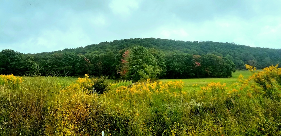
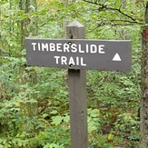
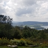
Mount Davis Photos
View all
Allegheny Mountains photos (28) |
Appalachians photos (910) |
photos from mountains in United States (3056) |
all photos
 Upload new photo
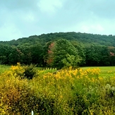


 See 8 more Mount Davis photos
Mt davis
Mt davis
Mt davis
Mt davis
Mt davis
Mt davis
Mt davis