
– Lat/Long: 46.70° N 88.24° W
 Mount Curwood
Weather Forecast, United StatesIssued: 7 am Mon 03 Aug Local TimeUpdates in: hr min sUpdate imminent
Issued: 7 am Mon 03 Aug Local Time
Updates in:
Update imminent hr min s

Issued: 7 am Mon 03 Aug Local Time
Updates in:
Update imminent hr min s
Days 1–3 Weather SummarySome drizzle, heaviest during Tue afternoon. Warm (max 27°C on Mon afternoon, min 14°C on Tue night). Winds decreasing (strong winds from the SSW on Mon night, calm by Wed night). | Days 4–6 Weather SummaryHeavy rain (total 21mm), heaviest during Sat night. Warm (max 26°C on Thu afternoon, min 16°C on Sat night). Winds decreasing (fresh winds from the W on Thu night, light winds from the NNE by Sat night). | |||||||||||||||||
Monday 3 | Tuesday 4 | Wednesday 5 | Thursday 6 | Friday 7 | Saturday 8 | |||||||||||||
AM | PM | night | AM | PM | night | AM | PM | night | AM | PM | night | AM | PM | night | AM | PM | night | |
clear | clear | clear | cloudy | rain shwrs | clear | clear | clear | some clouds | clear | clear | clear | clear | rain shwrs | risk tstorm | rain shwrs | light rain | rain shwrs | |
Cloud base (m) | 5200 | 8350 | 5950 | 6650 | 3350 | 9150 | 3600 | 4200 | 4300 | 4500 | 500 | 400 | ||||||
km/h | ||||||||||||||||||
 |  |  |  |  |  | |||||||||||||
— | — | — | — | — | — | — | — | — | — | — | — | — | — | — | — | — | — | |
mm | — | — | — | — | 1 | — | — | — | — | — | — | — | — | 0.2 | 2 | 3 | 1.3 | 15 |
max °C | 21 | 27 | 25 | 20 | 18 | 18 | 18 | 22 | 21 | 23 | 26 | 24 | 20 | 24 | 21 | 21 | 24 | 18 |
min °C | 16 | 24 | 22 | 20 | 16 | 14 | 14 | 20 | 18 | 18 | 25 | 19 | 18 | 23 | 18 | 19 | 20 | 16 |
chill °C | 16 | 24 | 22 | 19 | 15 | 14 | 14 | 20 | 18 | 18 | 25 | 18 | 18 | 23 | 18 | 19 | 20 | 15 |
Freezing level m | 4400 | 4550 | 4700 | 4500 | 4350 | 3950 | 3600 | 3200 | 3450 | 3350 | 3550 | 4000 | 4000 | 4050 | 4100 | 4150 | 4450 | 4500 |
6:35 | — | — | 6:35 | — | — | 6:37 | — | — | 6:37 | — | — | 6:39 | — | — | 6:41 | — | — | |
— | — | 9:22 | — | — | 9:20 | — | — | 9:19 | — | — | 9:17 | — | — | 9:15 | — | — | 9:15 | |
Loading...
Mount Curwood Weather (Days 0-3):
The weather forecast for Mount Curwood is: Some drizzle, heaviest during Tue afternoon. Warm (max 27°C on Mon afternoon, min 14°C on Tue night). Winds decreasing (strong winds from the SSW on Mon night, calm by Wed night).
Mount Curwood Weather (Days 3-6):
Heavy rain (total 21mm), heaviest during Sat night. Warm (max 26°C on Thu afternoon, min 16°C on Sat night). Winds decreasing (fresh winds from the W on Thu night, light winds from the NNE by Sat night).
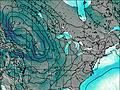
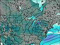
This table gives the weather forecast for Mount Curwood at the specific elevation of 603 m. Our advanced weather models allow us to provide distinct weather forecasts for several elevations of Mount Curwood. To see the weather forecasts for the other elevations, use the tab navigation above the table. For a wider overview of the weather, consult the Weather Map of Michigan.