
– Lat/Long: 57.13° N 157.00° W
 Mount Chiginagak
Weather Forecast, United StatesIssued: 9 pm Sat 18 Jul Local TimeUpdates in: hr min sUpdate imminent
Issued: 9 pm Sat 18 Jul Local Time
Updates in:
Update imminent hr min s

Issued: 9 pm Sat 18 Jul Local Time
Updates in:
Update imminent hr min s
Days 1–4 Weather SummaryA light fall of snow, heaviest on Sat night. Turning milder with light rain (total 6mm) on Tue morning. Freeze-thaw conditions (max 6°C on Tue afternoon, min -3°C on Sun morning). Winds increasing (light winds from the SW on Mon morning, near gales from the WSW by Tue afternoon). | Days 5–7 Weather SummaryHeavy rain (total 23mm), heaviest during Wed night. Very mild (max 11°C on Thu night, min 3°C on Tue night). Winds increasing (strong winds from the W on Tue night, stormy winds from the WNW by Thu night). | ||||||||||||||||||
Sunday 19 | Monday 20 | Tuesday 21 | Wednesday 22 | Thursday 23 | Friday 24 | ||||||||||||||
night | AM | PM | night | AM | PM | night | AM | PM | night | AM | PM | night | AM | PM | night | AM | PM | night | |
snow shwrs | snow shwrs | snow shwrs | snow shwrs | cloudy | some clouds | light snow | light rain | light rain | light rain | light rain | light rain | heavy rain | light rain | light rain | light rain | rain shwrs | rain shwrs | clear | |
Cloud base (m) | 250 | 200 | 350 | 850 | 500 | 400 | 2000 | 200 | 200 | 200 | 500 | 750 | 200 | 200 | 200 | 200 | 200 | 200 | 350 |
km/h | |||||||||||||||||||
 |  |  |  |  |  |  | |||||||||||||
2 | 2 | 2 | 2 | — | — | 2 | — | — | — | — | — | — | — | — | — | — | — | — | |
mm | — | — | — | — | — | — | — | 4 | 1.9 | 0.5 | 0.2 | 0.1 | 17 | 0.8 | 0.4 | 3 | 0.9 | 0.1 | — |
max °C | -1 | -3 | -3 | -3 | -3 | -2 | 2 | 5 | 6 | 6 | 3 | 6 | 7 | 10 | 10 | 11 | 9 | 7 | 5 |
min °C | -2 | -3 | -3 | -3 | -3 | -3 | -1 | 3 | 5 | 3 | 3 | 4 | 6 | 9 | 10 | 9 | 8 | 6 | 4 |
chill °C | -11 | -12 | -11 | -11 | -7 | -7 | -8 | -4 | -1 | -3 | -4 | -3 | -1 | 4 | 5 | 3 | 2 | -1 | -4 |
Freezing level m | 1350 | 1400 | 1400 | 1550 | 1500 | 1550 | 1750 | 3050 | 3300 | 3500 | 3150 | 3450 | 4000 | 4450 | 4450 | 4400 | 4500 | 4250 | 3850 |
— | 6:01 | — | — | 6:03 | — | — | 6:03 | — | — | 6:05 | — | — | 6:07 | — | — | 6:09 | — | — | |
— | — | — | 11:05 | — | — | 11:04 | — | — | 11:01 | — | — | 11:00 | — | — | 10:59 | — | — | 10:57 | |
Loading...
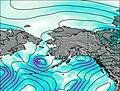
Mount Chiginagak Weather (Days 0-3):
The weather forecast for Mount Chiginagak is: A light fall of snow, heaviest on Sat night. Turning milder with light rain (total 6mm) on Tue morning. Freeze-thaw conditions (max 6°C on Tue afternoon, min -3°C on Sun morning). Winds increasing (light winds from the SW on Mon morning, near gales from the WSW by Tue afternoon).
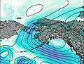
Mount Chiginagak Weather (Days 3-6):
Heavy rain (total 23mm), heaviest during Wed night. Very mild (max 11°C on Thu night, min 3°C on Tue night). Winds increasing (strong winds from the W on Tue night, stormy winds from the WNW by Thu night).
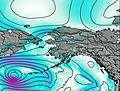
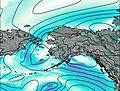
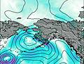
This table gives the weather forecast for Mount Chiginagak at the specific elevation of 2075 m. Our advanced weather models allow us to provide distinct weather forecasts for several elevations of Mount Chiginagak. To see the weather forecasts for the other elevations, use the tab navigation above the table. For a wider overview of the weather, consult the Weather Map of Alaska United States.
| Weather Station | Temp. | Weather | Wind | Gusts | Cloud / Visibility |
|---|---|---|---|---|---|
Pilot Point | |||||
SHIP5147 | |||||
Port Heiden Airport | |||||
Chignik Bay Airport | |||||
SHIP7980 | |||||
SHIP2288 | |||||
SHIP6673 | |||||
SHIP6521 | |||||
SHIP2133 |
* NOTE: not all weather observatories update at the same frequency which is the reason why some locations may show data from stations that are further away than known closer ones.
Mount Chiginagak Photos
View all
Aleutian Range photos (5) |
Alaska/Yukon Ranges photos (65) |
photos from mountains in United States (3055) |
all photos
 Upload new photo
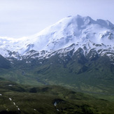
Mount Chiginagak