
– Lat/Long: 52.03° N 117.32° W
 Mount Bryce
Weather Forecast, CanadaIssued: 5 pm Sat 18 Jul Local TimeUpdates in: hr min sUpdate imminent
Issued: 5 pm Sat 18 Jul Local Time
Updates in:
Update imminent hr min s

Issued: 5 pm Sat 18 Jul Local Time
Updates in:
Update imminent hr min s
Days 1–4 Weather SummaryA dusting of new snow. Freeze-thaw conditions (max 5°C on Sat afternoon, min -1°C on Sat night). Wind will be generally light. | Days 5–7 Weather SummaryLight rain (total 9mm), mostly falling on Thu night. Mild temperatures (max 7°C on Tue afternoon, min 2°C on Fri morning). Wind will be generally light. | ||||||||||||||||
Sat 18 | Sunday 19 | Monday 20 | Tuesday 21 | Wednesday 22 | Thursday 23 | ||||||||||||
PM | night | AM | PM | night | AM | PM | night | AM | PM | night | AM | PM | night | AM | PM | night | |
rain shwrs | snow shwrs | clear | some clouds | rain shwrs | some clouds | rain shwrs | clear | clear | some clouds | clear | some clouds | some clouds | rain shwrs | rain shwrs | rain shwrs | rain shwrs | |
Cloud base (m) | 4450 | 2750 | 3100 | 3200 | 3450 | 3350 | 8850 | 3950 | 4350 | 5250 | 4400 | 4250 | 2200 | ||||
km/h | |||||||||||||||||
 |  |  |  |  |  | ||||||||||||
— | 2 | — | — | — | — | — | — | — | — | — | — | — | — | — | — | — | |
mm | 0.2 | — | — | — | 0.1 | — | 0.2 | — | — | — | — | — | — | 0.1 | 0.1 | 0.2 | 7 |
max °C | 5 | 0 | -1 | 2 | 2 | 1 | 3 | 4 | 4 | 7 | 7 | 7 | 7 | 7 | 6 | 7 | 4 |
min °C | 4 | -1 | -1 | 1 | 1 | 1 | 2 | 4 | 4 | 6 | 7 | 6 | 6 | 7 | 6 | 7 | 3 |
chill °C | 0 | -5 | -5 | -2 | 0 | -2 | 2 | 3 | 2 | 4 | 5 | 4 | 4 | 4 | 3 | 5 | -2 |
Freezing level m | 4200 | 3350 | 3300 | 3650 | 3850 | 3600 | 3850 | 4150 | 4100 | 4300 | 4500 | 4450 | 4450 | 4550 | 4400 | 4550 | 4100 |
— | — | 5:50 | — | — | 5:52 | — | — | 5:54 | — | — | 5:54 | — | — | 5:56 | — | — | |
— | 9:59 | — | — | 9:58 | — | — | 9:57 | — | — | 9:55 | — | — | 9:53 | — | — | 9:52 | |
Loading...
Mount Bryce Weather (Days 0-3):
The weather forecast for Mount Bryce is: A dusting of new snow. Freeze-thaw conditions (max 5°C on Sat afternoon, min -1°C on Sat night). Wind will be generally light.
Mount Bryce Weather (Days 3-6):
Light rain (total 9mm), mostly falling on Thu night. Mild temperatures (max 7°C on Tue afternoon, min 2°C on Fri morning). Wind will be generally light.
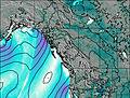
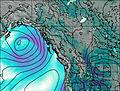
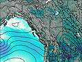
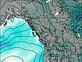
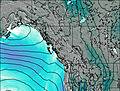
This table gives the weather forecast for Mount Bryce at the specific elevation of 3507 m. Our advanced weather models allow us to provide distinct weather forecasts for several elevations of Mount Bryce. To see the weather forecasts for the other elevations, use the tab navigation above the table. For a wider overview of the weather, consult the Weather Map of British-Columbia.
| Weather Station | Temp. | Weather | Wind | Gusts | Cloud / Visibility |
|---|---|---|---|---|---|
lightning 70km N of Golden | |||||
lightning 106km N of Lake Louise | |||||
Golden Airport | |||||
Mount 7 | |||||
lightning 77km SSW of Jasper Park Lodge | |||||
Yoho Park- BC | |||||
Nordegg Cs- Alta | |||||
Jasper Warden- Alta | |||||
lightning 45km ENE of Revelstoke |
* NOTE: not all weather observatories update at the same frequency which is the reason why some locations may show data from stations that are further away than known closer ones.