
– Lat/Long: 49.58° S 69.50° E
 Mont Ross
Weather Forecast, French Southern and Antarctic LandsIssued: 4 pm Mon 03 Aug Local TimeUpdates in: hr min sUpdate imminent
Issued: 4 pm Mon 03 Aug Local Time
Updates in:
Update imminent hr min s

Issued: 4 pm Mon 03 Aug Local Time
Updates in:
Update imminent hr min s
Days 1–4 Weather SummaryLight rain (total 9mm), mostly falling on Mon night. Mild temperatures (max 5°C on Mon night, min 1°C on Mon afternoon). Winds decreasing (severe gales from the W on Mon night, moderate winds from the SW by Tue night). | Days 5–7 Weather SummaryLight rain (total 4mm), mostly falling on Fri afternoon. Mild temperatures (max 9°C on Thu night, min 2°C on Fri night). Winds increasing (light winds from the SW on Fri night, gales from the W by Sat night). | ||||||||||||||||
Mon 3 | Tuesday 4 | Wednesday 5 | Thursday 6 | Friday 7 | Saturday 8 | ||||||||||||
PM | night | AM | PM | night | AM | PM | night | AM | PM | night | AM | PM | night | AM | PM | night | |
light rain | light rain | rain shwrs | rain shwrs | clear | some clouds | some clouds | rain shwrs | some clouds | some clouds | rain shwrs | rain shwrs | light rain | light rain | some clouds | rain shwrs | clear | |
Cloud base (m) | 350 | 200 | 200 | 300 | 550 | 350 | 400 | 300 | 450 | 450 | 400 | 300 | 300 | 250 | 300 | 300 | |
km/h | |||||||||||||||||
 |  |  |  |  |  | ||||||||||||
— | — | — | — | — | — | — | — | — | — | — | — | — | — | — | — | — | |
mm | 0.6 | 5 | 1 | 1.2 | — | — | — | 1.6 | — | — | 0.1 | 0.3 | 3 | 0.7 | — | 0.1 | — |
max °C | 2 | 5 | 2 | 2 | 1 | 2 | 3 | 4 | 4 | 6 | 9 | 9 | 6 | 2 | 2 | 2 | 4 |
min °C | 1 | 4 | 2 | 1 | 1 | 2 | 2 | 1 | 1 | 5 | 6 | 9 | 4 | 2 | 2 | 2 | 3 |
chill °C | -7 | -4 | -7 | -7 | -6 | -6 | -6 | -5 | -5 | -2 | -1 | 3 | -2 | -3 | -6 | -6 | -5 |
Freezing level m | 400 | 1100 | 200 | 100 | 0 | 1200 | 1500 | 900 | 1500 | 2400 | 2350 | 2300 | 1400 | 450 | 500 | 1500 | 1250 |
— | — | 7:48 | — | — | 7:46 | — | — | 7:43 | — | — | 7:43 | — | — | 7:41 | — | — | |
5:07 | — | — | 5:07 | — | — | 5:09 | — | — | 5:10 | — | — | 5:12 | — | — | 5:14 | — | |
Loading...
Mont Ross Weather (Days 0-3):
The weather forecast for Mont Ross is: Light rain (total 9mm), mostly falling on Mon night. Mild temperatures (max 5°C on Mon night, min 1°C on Mon afternoon). Winds decreasing (severe gales from the W on Mon night, moderate winds from the SW by Tue night).
Mont Ross Weather (Days 3-6):
Light rain (total 4mm), mostly falling on Fri afternoon. Mild temperatures (max 9°C on Thu night, min 2°C on Fri night). Winds increasing (light winds from the SW on Fri night, gales from the W by Sat night).
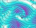
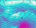
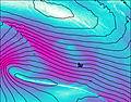
This table gives the weather forecast for Mont Ross at the specific elevation of 0 m. Our advanced weather models allow us to provide distinct weather forecasts for several elevations of Mont Ross. To see the weather forecasts for the other elevations, use the tab navigation above the table. For a wider overview of the weather, consult the Weather Map of French Southern and Antarctic Lands.
| Weather Station | Temp. | Weather | Wind | Gusts | Cloud / Visibility |
|---|---|---|---|---|---|
SHIP5445 | |||||
Alfred Faure (Iles Crozet) | |||||
Martin DE Vivies (Ile Amsterdam) | |||||
Termas de Río Hondo international Airport | |||||
Termas de Río Hondo international Airport | |||||
SHIP7161 | |||||
SHIP5345 | |||||
SHIP1722 | |||||
SHIP4810 |
* NOTE: not all weather observatories update at the same frequency which is the reason why some locations may show data from stations that are further away than known closer ones.