 Moelfre Isaf – Climbing, Hiking & Mountaineering information

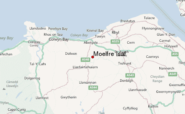
Moelfre Isaf Guide
- Elevation: 317
- Difficulty: -
- Best months to climb: April, May, June, July, August, September
- Convenient center: Rhyl
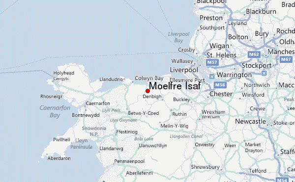
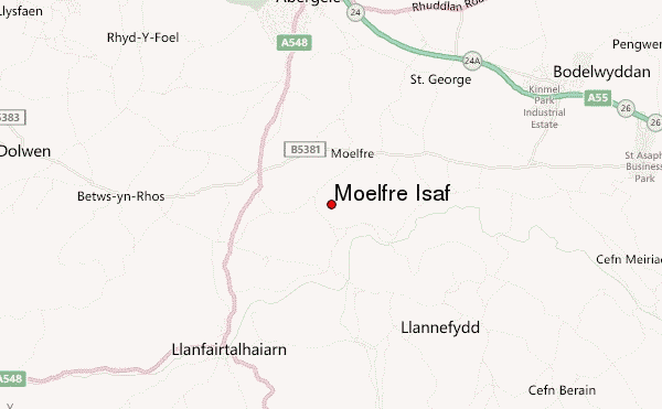
Moelfre Isaf looms below the town of Abergele, North Wales. It is 317m (1040ft) high.Its appearance is green round and pleasant. Its a long trek from Abergele to the summit. The walk takes in Tower Hill woods and the River Gele. It can be quite boggy near the top. The views from the top are outstanding,taking in Snowdonia,The Clwydians, you can also see the Lake District on some days. Warning-you cant go down the south side of the mountain.
Moelfre Isaf climbers NotesBe the first to submit your climbers note! Please submit any useful information about climbing Moelfre Isaf that may be useful to other climbers. Consider things such as access and accommodation at the base of Moelfre Isaf, as well as the logistics of climbing to the summit. |
| Select a
mountain summit from the menu |
||
|
Select a Mountain Summit
|
||
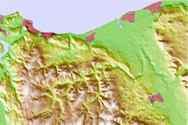
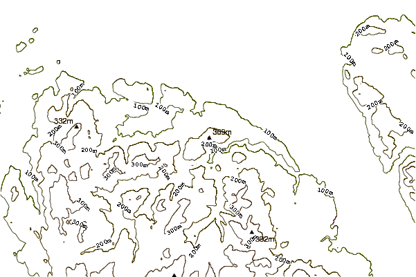
Use this relief map to navigate to mountain peaks in the area of Moelfre Isaf.
10 other mountain peaks closest to Moelfre Isaf:
| 1. | Cefn-yr-Ogof (204 m) | 3.8 km |
| 2. | Moelfre Uchaf (396 m) | 5.5 km |
| 3. | Penycloddiau (440 m) | 18.4 km |
| 4. | Mwdwl-eithin (532 m) | 19.5 km |
| 5. | Mynydd y Dref (244 m) | 19.6 km |
| 6. | Great Orme (207 m) | 21.1 km |
| 7. | Tal y Fan (610 m) | 22.1 km |
| 8. | Moel Famau (555 m) | 23.5 km |
| 9. | Creigiau Gleision North Top (634 m) | 24.3 km |
| 10. | Carnedd y Ddelw (688 m) | 24.5 km |