
– Lat/Long: 42.22° S 173.62° E
 Manakau (Seaward Kaikoura (Manakau (Seaward Kaikoura))
Weather Forecast, New ZealandIssued: 11 pm Mon 03 Aug Local TimeUpdates in: hr min sUpdate imminent
Issued: 11 pm Mon 03 Aug Local Time
Updates in:
Update imminent hr min s

Issued: 11 pm Mon 03 Aug Local Time
Updates in:
Update imminent hr min s
Days 1–4 Weather SummaryA moderate fall of snow, heaviest on Mon night. Freeze-thaw conditions (max 2°C on Mon night, min -8°C on Tue morning). Winds decreasing (near gales from the SW on Tue morning, calm by Thu afternoon). | Days 5–7 Weather SummaryA dusting of new snow. Freeze-thaw conditions (max 5°C on Fri morning, min -1°C on Sat night). Wind will be generally light. | ||||||||||||||||||
Tuesday 4 | Wednesday 5 | Thursday 6 | Friday 7 | Saturday 8 | Sunday 9 | ||||||||||||||
night | AM | PM | night | AM | PM | night | AM | PM | night | AM | PM | night | AM | PM | night | AM | PM | night | |
snow shwrs | light snow | light snow | snow shwrs | clear | clear | clear | clear | clear | clear | some clouds | cloudy | cloudy | cloudy | light snow | cloudy | cloudy | cloudy | some clouds | |
Cloud base (m) | 1550 | 700 | 700 | 700 | 750 | 750 | 750 | 2850 | 4550 | 900 | 650 | 700 | 700 | 700 | |||||
km/h | |||||||||||||||||||
 |  |  |  |  |  |  | |||||||||||||
6 | 1 | 5 | 2 | — | — | — | — | — | — | — | — | — | — | 1 | — | — | — | — | |
mm | — | — | — | — | — | — | — | — | — | — | — | — | — | — | — | — | — | — | — |
max °C | 2 | -8 | -7 | -6 | -4 | -2 | -2 | 0 | 1 | 4 | 5 | 5 | 4 | 2 | 0 | 0 | -1 | -1 | -2 |
min °C | -7 | -8 | -8 | -7 | -5 | -3 | -3 | -1 | 0 | 1 | 5 | 4 | 3 | 1 | 0 | -1 | -1 | -1 | -2 |
chill °C | -17 | -20 | -19 | -18 | -12 | -7 | -7 | -4 | -2 | 1 | 3 | 2 | 3 | -2 | -2 | -6 | -4 | -1 | -2 |
Freezing level m | 1200 | 500 | 450 | 400 | 450 | 1100 | 350 | 1150 | 1550 | 1850 | 2300 | 2250 | 2100 | 1800 | 1550 | 1450 | 1350 | 1350 | 1250 |
— | 7:33 | — | — | 7:31 | — | — | 7:30 | — | — | 7:28 | — | — | 7:28 | — | — | 7:26 | — | — | |
— | — | 5:30 | — | — | 5:30 | — | — | 5:31 | — | — | 5:32 | — | — | 5:34 | — | — | 5:35 | — | |
Loading...
Manakau (Seaward Kaikoura Weather (Days 0-3):
The weather forecast for Manakau (Seaward Kaikoura is: A moderate fall of snow, heaviest on Mon night. Freeze-thaw conditions (max 2°C on Mon night, min -8°C on Tue morning). Winds decreasing (near gales from the SW on Tue morning, calm by Thu afternoon).
Manakau (Seaward Kaikoura Weather (Days 3-6):
A dusting of new snow. Freeze-thaw conditions (max 5°C on Fri morning, min -1°C on Sat night). Wind will be generally light.
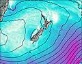
This table gives the weather forecast for Manakau (Seaward Kaikoura at the specific elevation of 1500 m. Our advanced weather models allow us to provide distinct weather forecasts for several elevations of Manakau (Seaward Kaikoura. To see the weather forecasts for the other elevations, use the tab navigation above the table. For a wider overview of the weather, consult the Weather Map of New Zealand.