
– Lat/Long: 52.46° N 118.31° W
 Mallard Peak
Weather Forecast, CanadaIssued: 5 pm Sat 25 Jul Local TimeUpdates in: hr min sUpdate imminent
Issued: 5 pm Sat 25 Jul Local Time
Updates in:
Update imminent hr min s

Issued: 5 pm Sat 25 Jul Local Time
Updates in:
Update imminent hr min s
Days 1–4 Weather SummarySome drizzle, heaviest during Sat night. Warm (max 24°C on Sat afternoon, min 13°C on Sat night). Wind will be generally light. | Days 5–7 Weather SummaryMostly dry. Warm (max 24°C on Tue afternoon, min 14°C on Tue night). Mainly fresh winds. | ||||||||||||||||
Sat 25 | Sunday 26 | Monday 27 | Tuesday 28 | Wednesday 29 | Thursday 30 | ||||||||||||
PM | night | AM | PM | night | AM | PM | night | AM | PM | night | AM | PM | night | AM | PM | night | |
light rain | rain shwrs | rain shwrs | cloudy | rain shwrs | rain shwrs | some clouds | clear | clear | some clouds | clear | some clouds | some clouds | some clouds | cloudy | some clouds | some clouds | |
Cloud base (m) | 4100 | 3100 | 2850 | 3200 | 3350 | 4000 | 3900 | 5000 | 4000 | 3500 | 6000 | 5100 | |||||
km/h | |||||||||||||||||
 |  |  |  |  |  | ||||||||||||
— | — | — | — | — | — | — | — | — | — | — | — | — | — | — | — | — | |
mm | 0.1 | 0.8 | 0.2 | — | 0.4 | 0.2 | — | — | — | — | — | — | — | — | — | — | — |
max °C | 24 | 17 | 19 | 21 | 18 | 19 | 21 | 20 | 22 | 24 | 20 | 19 | 21 | 19 | 20 | 24 | 22 |
min °C | 23 | 13 | 16 | 20 | 13 | 16 | 20 | 16 | 18 | 23 | 14 | 16 | 21 | 15 | 17 | 23 | 17 |
chill °C | 23 | 13 | 16 | 20 | 13 | 16 | 20 | 16 | 18 | 23 | 14 | 16 | 21 | 15 | 17 | 23 | 17 |
Freezing level m | 3950 | 3600 | 3550 | 3650 | 3600 | 3200 | 3500 | 3850 | 3850 | 3950 | 3650 | 3350 | 3550 | 3450 | 3450 | 3800 | 4150 |
— | — | 6:03 | — | — | 6:05 | — | — | 6:05 | — | — | 6:07 | — | — | 6:09 | — | — | |
— | 9:55 | — | — | 9:54 | — | — | 9:52 | — | — | 9:51 | — | — | 9:50 | — | — | 9:47 | |
Loading...
Mallard Peak Weather (Days 0-3):
The weather forecast for Mallard Peak is: Some drizzle, heaviest during Sat night. Warm (max 24°C on Sat afternoon, min 13°C on Sat night). Wind will be generally light.
Mallard Peak Weather (Days 3-6):
Mostly dry. Warm (max 24°C on Tue afternoon, min 14°C on Tue night). Mainly fresh winds.
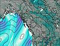
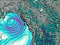
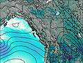
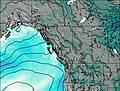
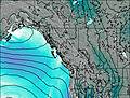
This table gives the weather forecast for Mallard Peak at the specific elevation of 1000 m. Our advanced weather models allow us to provide distinct weather forecasts for several elevations of Mallard Peak. To see the weather forecasts for the other elevations, use the tab navigation above the table. For a wider overview of the weather, consult the Weather Map of British-Columbia.
| Weather Station | Temp. | Weather | Wind | Gusts | Cloud / Visibility |
|---|---|---|---|---|---|
Jasper Warden Airport | |||||
Jasper Warden- Alta | |||||
Blue River Airport | |||||
Blue River Cs- BC | |||||
lightning 31km NNE of Jasper Park Lodge | |||||
lightning 32km SSW of Hinton | |||||
Willow Creek 1- Alta | |||||
lightning 139km N of Chase | |||||
lightning 30km N of Golden | |||||
lightning 37km NNW of Lake Louise |
* NOTE: not all weather observatories update at the same frequency which is the reason why some locations may show data from stations that are further away than known closer ones.