– Lat/Long: 40.12° N 20.43° E
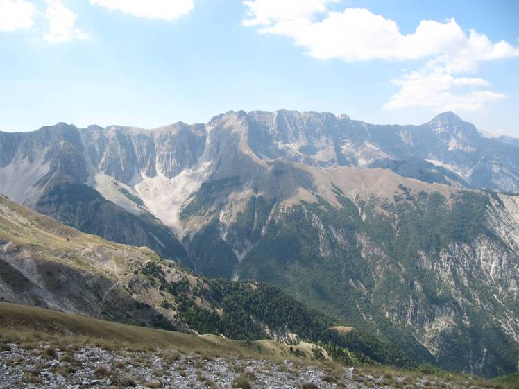
 Maja e Papingut
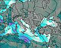
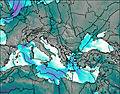
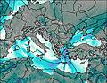
Weather Forecast, GreeceIssued: 1 am Mon 03 Aug Local TimeUpdates in: hr min sUpdate imminent
Issued: 1 am Mon 03 Aug Local Time
Updates in:
Update imminent hr min s

Issued: 1 am Mon 03 Aug Local Time
Updates in:
Update imminent hr min s
Days 1–3 Weather SummaryMostly dry. Warm (max 21°C on Wed afternoon, min 15°C on Mon morning). Wind will be generally light. | Days 4–6 Weather SummaryMostly dry. Warm (max 23°C on Sat afternoon, min 17°C on Thu night). Wind will be generally light. | |||||||||||||||||
Monday 3 | Tuesday 4 | Wednesday 5 | Thursday 6 | Friday 7 | Saturday 8 | |||||||||||||
AM | PM | night | AM | PM | night | AM | PM | night | AM | PM | night | AM | PM | night | AM | PM | night | |
clear | some clouds | clear | clear | cloudy | clear | clear | cloudy | clear | clear | cloudy | some clouds | clear | some clouds | clear | clear | some clouds | clear | |
Cloud base (m) | 4100 | 4200 | 4400 | 4250 | 4450 | 3550 | 4000 | 4200 | 3650 | 4500 | 4200 | |||||||
km/h | ||||||||||||||||||
 |  |  |  |  |  | |||||||||||||
— | — | — | — | — | — | — | — | — | — | — | — | — | — | — | — | — | — | |
mm | — | — | — | — | — | — | — | — | — | — | — | — | — | — | — | — | — | — |
max °C | 16 | 19 | 17 | 18 | 20 | 18 | 19 | 21 | 19 | 19 | 20 | 18 | 19 | 21 | 20 | 21 | 23 | 21 |
min °C | 15 | 18 | 16 | 16 | 18 | 18 | 18 | 20 | 18 | 18 | 18 | 17 | 17 | 20 | 19 | 19 | 23 | 21 |
chill °C | 15 | 18 | 16 | 16 | 18 | 18 | 18 | 20 | 18 | 18 | 18 | 17 | 17 | 20 | 19 | 19 | 23 | 21 |
Freezing level m | 4100 | 4400 | 4400 | 4250 | 4350 | 4450 | 4400 | 4550 | 4450 | 4400 | 4300 | 4400 | 4350 | 4550 | 4500 | 4600 | 4900 | 4700 |
5:37 | — | — | 5:37 | — | — | 5:39 | — | — | 5:39 | — | — | 5:41 | — | — | 5:41 | — | — | |
— | 7:50 | — | — | 7:49 | — | — | 7:47 | — | — | 7:46 | — | — | 7:45 | — | — | 7:45 | — | |
Loading...
Maja e Papingut Weather (Days 0-3):
The weather forecast for Maja e Papingut is: Mostly dry. Warm (max 21°C on Wed afternoon, min 15°C on Mon morning). Wind will be generally light.
Maja e Papingut Weather (Days 3-6):
Mostly dry. Warm (max 23°C on Sat afternoon, min 17°C on Thu night). Wind will be generally light.
This table gives the weather forecast for Maja e Papingut at the specific elevation of 2000 m. Our advanced weather models allow us to provide distinct weather forecasts for several elevations of Maja e Papingut. To see the weather forecasts for the other elevations, use the tab navigation above the table. For a wider overview of the weather, consult the Weather Map of Greece.
| Weather Station | Temp. | Weather | Wind | Gusts | Cloud / Visibility |
|---|---|---|---|---|---|
ERSEKA | |||||
Ioannina (Airport) | |||||
* NOTE: not all weather observatories update at the same frequency which is the reason why some locations may show data from stations that are further away than known closer ones.
Maja e Papingut Photos
View all
Pindos photos (114) |
Balkan Peninsula photos (1075) |
photos from mountains in Greece (690) |
all photos
 Upload new photo
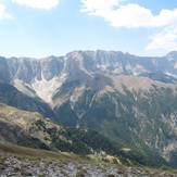
Maja e Papingut