
– Lat/Long: 68.83° S 90.62° W
 Lars Christensen Peak
Weather Forecast, AntarcticaIssued: 8 am Fri 19 Jun Local TimeUpdates in: hr min sUpdate imminent
Issued: 8 am Fri 19 Jun Local Time
Updates in:
Update imminent hr min s

Issued: 8 am Fri 19 Jun Local Time
Updates in:
Update imminent hr min s
Days 1–3 Weather SummaryModerate rain (total 15mm), heaviest on Fri night. Temperatures will be below freezing (max -1°C on Fri morning, min -6°C on Sun morning). Winds increasing (light winds from the NW on Fri morning, gales from the WSW by Sat night). | Days 4–6 Weather SummaryModerate rain (total 16mm), heaviest on Wed morning. Temperatures will be below freezing (max 0°C on Tue night, min -5°C on Mon morning). Winds increasing (moderate winds from the W on Mon afternoon, severe gales from the WNW by Wed night). | |||||||||||||||||
Friday 19 | Saturday 20 | Sunday 21 | Monday 22 | Tuesday 23 | Wednesday 24 | |||||||||||||
AM | PM | night | AM | PM | night | AM | PM | night | AM | PM | night | AM | PM | night | AM | PM | night | |
light rain | rain shwrs | light rain | light rain | light rain | mod. rain | light rain | light rain | rain shwrs | rain shwrs | some clouds | light rain | light rain | light rain | light rain | mod. rain | light rain | light rain | |
km/h | ||||||||||||||||||
 |  |  |  |  |  | |||||||||||||
— | — | — | — | — | — | — | — | — | — | — | — | — | — | — | — | — | — | |
mm | 0.3 | 0.1 | 4 | 0.6 | 1.9 | 6 | 1.6 | 0.3 | 0.6 | 0.2 | — | 3 | 1.1 | 0.2 | 4 | 6 | 0.3 | 1.3 |
max °C | -1 | -2 | -1 | -2 | -2 | -3 | -6 | -5 | -2 | -4 | -3 | -1 | -1 | -1 | 0 | -1 | -4 | -2 |
min °C | -1 | -2 | -2 | -2 | -2 | -5 | -6 | -6 | -4 | -5 | -4 | -2 | -1 | -1 | -1 | -5 | -4 | -4 |
chill °C | -5 | -8 | -9 | -7 | -8 | -16 | -18 | -16 | -12 | -16 | -13 | -9 | -10 | -9 | -10 | -14 | -12 | -15 |
Freezing level m | 0 | 0 | 0 | 0 | 0 | 0 | 0 | 0 | 0 | 0 | 0 | 0 | 0 | 0 | 0 | 0 | 0 | 0 |
Cloud base (m) | 250 | 400 | 400 | |||||||||||||||
12:00 | — | — | 12:00 | — | — | 12:00 | — | — | 12:00 | — | — | 12:00 | — | — | 12:00 | — | — | |
12:00 | — | — | 12:00 | — | — | 12:00 | — | — | 12:00 | — | — | 12:00 | — | — | 12:00 | — | — | |
Loading...
Lars Christensen Peak Weather (Days 0-3):
The weather forecast for Lars Christensen Peak is: Moderate rain (total 15mm), heaviest on Fri night. Temperatures will be below freezing (max -1°C on Fri morning, min -6°C on Sun morning). Winds increasing (light winds from the NW on Fri morning, gales from the WSW by Sat night).
Lars Christensen Peak Weather (Days 3-6):
Moderate rain (total 16mm), heaviest on Wed morning. Temperatures will be below freezing (max 0°C on Tue night, min -5°C on Mon morning). Winds increasing (moderate winds from the W on Mon afternoon, severe gales from the WNW by Wed night).
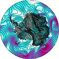
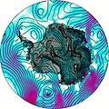
This table gives the weather forecast for Lars Christensen Peak at the specific elevation of 0 m. Our advanced weather models allow us to provide distinct weather forecasts for several elevations of Lars Christensen Peak. To see the weather forecasts for the other elevations, use the tab navigation above the table. For a wider overview of the weather, consult the Weather Map of Antarctica.