
– Lat/Long: 39.41° N 105.97° W
 Ken's Cabin
Weather Forecast, United StatesIssued: 11 am Sat 13 Sep Local TimeUpdates in: hr min sUpdate imminent
Issued: 11 am Sat 13 Sep Local Time
Updates in:
Update imminent hr min s

Issued: 11 am Sat 13 Sep Local Time
Updates in:
Update imminent hr min s
Days 1–3 Weather SummaryLight rain (total 5mm) at first, then becoming colder with a dusting of snow on Sat night. Freeze-thaw conditions (max 12°C on Mon afternoon, min -1°C on Sat night). Wind will be generally light. | Days 4–6 Weather SummaryMostly dry. Very mild (max 12°C on Thu afternoon, min 1°C on Tue night). Wind will be generally light. | |||||||||||||||||
Saturday 13 | Sunday 14 | Monday 15 | Tuesday 16 | Wednesday 17 | Thursday 18 | |||||||||||||
AM | PM | night | AM | PM | night | AM | PM | night | AM | PM | night | AM | PM | night | AM | PM | night | |
light rain | risk tstorm | snow shwrs | rain shwrs | some clouds | clear | clear | some clouds | clear | clear | rain shwrs | clear | clear | clear | clear | clear | clear | clear | |
km/h | ||||||||||||||||||
 |  |  |  |  |  | |||||||||||||
— | — | 1 | — | — | — | — | — | — | — | — | — | — | — | — | — | — | — | |
1.3 | 4 | — | 0.1 | — | — | — | — | — | — | 0.4 | — | — | — | — | — | — | — | |
max°C | 7 | 8 | 2 | 6 | 9 | 4 | 10 | 12 | 6 | 11 | 11 | 4 | 10 | 11 | 5 | 11 | 12 | 6 |
min°C | 5 | 6 | -1 | 1 | 9 | 2 | 7 | 10 | 3 | 8 | 9 | 1 | 6 | 11 | 2 | 7 | 12 | 4 |
3 | 4 | -4 | -3 | 6 | 0 | 5 | 7 | 1 | 6 | 7 | 1 | 5 | 8 | -1 | 5 | 10 | 3 | |
4200 | 4450 | 3600 | 3600 | 4650 | 3900 | 4350 | 4800 | 4150 | 4400 | 4750 | 3800 | 4350 | 4800 | 4050 | 4400 | 4900 | 4250 | |
Cloud base (m) | 4950 | 3350 | 3350 | 4500 | 5850 | 8800 | 6250 | 5900 | ||||||||||
6:43 | — | — | 6:43 | — | — | 6:45 | — | — | 6:46 | — | — | 6:47 | — | — | 6:48 | — | — | |
— | 7:14 | — | — | 7:13 | — | — | 7:10 | — | — | 7:09 | — | — | 7:07 | — | — | 7:06 | — | |
Loading...
Ken's Cabin Weather (Days 0-3):
The weather forecast for Ken's Cabin is: Light rain (total 5mm) at first, then becoming colder with a dusting of snow on Sat night. Freeze-thaw conditions (max 12°C on Mon afternoon, min -1°C on Sat night). Wind will be generally light.
Ken's Cabin Weather (Days 3-6):
Mostly dry. Very mild (max 12°C on Thu afternoon, min 1°C on Tue night). Wind will be generally light.
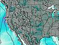
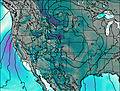
This table gives the weather forecast for Ken's Cabin at the specific elevation of 3499 m. Our advanced weather models allow us to provide distinct weather forecasts for several elevations of Ken's Cabin. To see the weather forecasts for the other elevations, use the tab navigation above the table. For a wider overview of the weather, consult the Weather Map of Colorado.
| Weather Station | Temp. | Weather | Wind | Gusts | Cloud / Visibility |
|---|---|---|---|---|---|
lightning 16km E of Breckenridge | |||||
Red Cliff Pass Airport | |||||
lightning 13km NNE of Leadville | |||||
lightning 4km NE of Frisco | |||||
lightning 13km ESE of Vail | |||||
Leadville Airport |
* NOTE: not all weather observatories update at the same frequency which is the reason why some locations may show data from stations that are further away than known closer ones.