
– Lat/Long: 53.61° N 119.93° W
 Interpass Ridge
Weather Forecast, CanadaIssued: 11 am Sun 19 Jul Local TimeUpdates in: hr min sUpdate imminent
Issued: 11 am Sun 19 Jul Local Time
Updates in:
Update imminent hr min s

Issued: 11 am Sun 19 Jul Local Time
Updates in:
Update imminent hr min s
Days 1–3 Weather SummaryModerate rain (total 12mm), heaviest on Sun afternoon. Very mild (max 17°C on Tue afternoon, min 7°C on Sun morning). Wind will be generally light. | Days 4–6 Weather SummaryLight rain (total 7mm), mostly falling on Thu night. Warm (max 20°C on Wed afternoon, min 7°C on Fri night). Winds increasing (light winds from the SSW on Wed night, fresh winds from the SW by Fri afternoon). | |||||||||||||||||
Sunday 19 | Monday 20 | Tuesday 21 | Wednesday 22 | Thursday 23 | Friday 24 | |||||||||||||
AM | PM | night | AM | PM | night | AM | PM | night | AM | PM | night | AM | PM | night | AM | PM | night | |
light rain | mod. rain | light rain | rain shwrs | light rain | some clouds | clear | some clouds | clear | clear | clear | some clouds | cloudy | rain shwrs | risk tstorm | rain shwrs | rain shwrs | light rain | |
Cloud base (m) | 1750 | 1750 | 1750 | 2000 | 2800 | 3000 | 3950 | 9100 | 4300 | 3250 | 3800 | 2950 | 3150 | 2850 | ||||
km/h | ||||||||||||||||||
 |  |  |  |  |  | |||||||||||||
— | — | — | — | — | — | — | — | — | — | — | — | — | — | — | — | — | — | |
mm | 1.9 | 6 | 4 | 0.2 | 0.1 | — | — | — | — | — | — | — | — | 3 | 3 | 0.5 | 0.1 | 0.8 |
max °C | 7 | 8 | 7 | 11 | 13 | 13 | 15 | 17 | 16 | 17 | 20 | 18 | 17 | 15 | 13 | 13 | 15 | 12 |
min °C | 7 | 7 | 7 | 9 | 13 | 10 | 12 | 17 | 12 | 15 | 19 | 14 | 16 | 13 | 10 | 11 | 14 | 7 |
chill °C | 4 | 7 | 5 | 7 | 13 | 10 | 12 | 17 | 12 | 15 | 19 | 14 | 16 | 12 | 8 | 9 | 12 | 3 |
Freezing level m | 3250 | 3200 | 3500 | 3350 | 3550 | 3750 | 3750 | 4000 | 4100 | 4050 | 4250 | 4350 | 4200 | 4050 | 4150 | 3650 | 3800 | 3550 |
5:54 | — | — | 5:54 | — | — | 5:56 | — | — | 5:58 | — | — | 6:00 | — | — | 6:01 | — | — | |
— | — | 10:15 | — | — | 10:15 | — | — | 10:14 | — | — | 10:12 | — | — | 10:10 | — | — | 10:08 | |
Loading...
Interpass Ridge Weather (Days 0-3):
The weather forecast for Interpass Ridge is: Moderate rain (total 12mm), heaviest on Sun afternoon. Very mild (max 17°C on Tue afternoon, min 7°C on Sun morning). Wind will be generally light.
Interpass Ridge Weather (Days 3-6):
Light rain (total 7mm), mostly falling on Thu night. Warm (max 20°C on Wed afternoon, min 7°C on Fri night). Winds increasing (light winds from the SSW on Wed night, fresh winds from the SW by Fri afternoon).
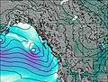
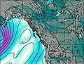
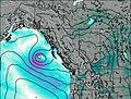
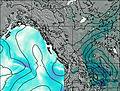
This table gives the weather forecast for Interpass Ridge at the specific elevation of 2000 m. Our advanced weather models allow us to provide distinct weather forecasts for several elevations of Interpass Ridge. To see the weather forecasts for the other elevations, use the tab navigation above the table. For a wider overview of the weather, consult the Weather Map of British-Columbia.
| Weather Station | Temp. | Weather | Wind | Gusts | Cloud / Visibility |
|---|---|---|---|---|---|
Hendrickson Creek- Alta | |||||
Jasper Warden Airport | |||||
Jasper Warden- Alta | |||||
Blue River Cs- BC | |||||
Blue River Airport | |||||
Quesnel Airport | |||||
Grande Praire Airport |
* NOTE: not all weather observatories update at the same frequency which is the reason why some locations may show data from stations that are further away than known closer ones.