
– Lat/Long: 4.05° N 114.93° E
 Gunung Mulu
Weather Forecast, MalaysiaIssued: 7 am Mon 03 Aug Local TimeUpdates in: hr min sUpdate imminent
Issued: 7 am Mon 03 Aug Local Time
Updates in:
Update imminent hr min s

Issued: 7 am Mon 03 Aug Local Time
Updates in:
Update imminent hr min s
Days 1–3 Weather SummaryHeavy rain (total 41mm), heaviest during Mon afternoon. Very mild (max 15°C on Mon afternoon, min 14°C on Mon morning). Wind will be generally light. | Days 4–6 Weather SummaryLight rain (total 6mm), mostly falling on Sat afternoon. Very mild (max 15°C on Thu afternoon, min 14°C on Thu morning). Wind will be generally light. | |||||||||||||||||
Monday 3 | Tuesday 4 | Wednesday 5 | Thursday 6 | Friday 7 | Saturday 8 | |||||||||||||
AM | PM | night | AM | PM | night | AM | PM | night | AM | PM | night | AM | PM | night | AM | PM | night | |
risk tstorm | risk tstorm | risk tstorm | risk tstorm | risk tstorm | risk tstorm | risk tstorm | risk tstorm | risk tstorm | rain shwrs | risk tstorm | risk tstorm | clear | risk tstorm | risk tstorm | risk tstorm | risk tstorm | risk tstorm | |
Cloud base (m) | 900 | 400 | 2550 | 600 | 5300 | 9450 | 350 | 2150 | 850 | 2300 | 650 | 5400 | ||||||
km/h | ||||||||||||||||||
 |  |  |  |  |  | |||||||||||||
— | — | — | — | — | — | — | — | — | — | — | — | — | — | — | — | — | — | |
mm | 4 | 6 | 10 | 1.9 | 4 | 9 | 3 | 1.8 | 1.5 | 0.1 | 1 | 0.6 | — | 1.2 | 1 | 0.2 | 1.8 | 0.1 |
max °C | 14 | 15 | 15 | 14 | 15 | 15 | 14 | 15 | 14 | 14 | 15 | 15 | 15 | 15 | 15 | 15 | 15 | 15 |
min °C | 14 | 15 | 14 | 14 | 15 | 14 | 14 | 15 | 14 | 14 | 15 | 15 | 15 | 15 | 14 | 14 | 15 | 15 |
chill °C | 14 | 15 | 14 | 14 | 15 | 14 | 14 | 15 | 14 | 14 | 15 | 15 | 15 | 15 | 14 | 14 | 15 | 15 |
Freezing level m | 4950 | 5000 | 4950 | 4950 | 5000 | 4950 | 4950 | 5050 | 4950 | 4950 | 4950 | 5000 | 5100 | 5150 | 5200 | 5100 | 5100 | 5150 |
6:16 | — | — | 6:16 | — | — | 6:16 | — | — | 6:16 | — | — | 6:16 | — | — | 6:16 | — | — | |
— | 6:35 | — | — | 6:34 | — | — | 6:34 | — | — | 6:34 | — | — | 6:34 | — | — | 6:34 | — | |
Loading...
Gunung Mulu Weather (Days 0-3):
The weather forecast for Gunung Mulu is: Heavy rain (total 41mm), heaviest during Mon afternoon. Very mild (max 15°C on Mon afternoon, min 14°C on Mon morning). Wind will be generally light.
Gunung Mulu Weather (Days 3-6):
Light rain (total 6mm), mostly falling on Sat afternoon. Very mild (max 15°C on Thu afternoon, min 14°C on Thu morning). Wind will be generally light.
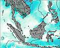
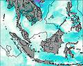
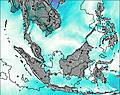
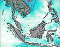
This table gives the weather forecast for Gunung Mulu at the specific elevation of 2376 m. Our advanced weather models allow us to provide distinct weather forecasts for several elevations of Gunung Mulu. To see the weather forecasts for the other elevations, use the tab navigation above the table. For a wider overview of the weather, consult the Weather Map of Malaysia.
| Weather Station | Temp. | Weather | Wind | Gusts | Cloud / Visibility |
|---|---|---|---|---|---|
Miri Airport | |||||
lightning 48km SSW of Miri | |||||
lightning 41km NW of Labuan | |||||
lightning 49km NNW of Bandar Labuan | |||||
Bintulu Airport | |||||
Juwata Airport | |||||
Tawa / alimantan Airport |
* NOTE: not all weather observatories update at the same frequency which is the reason why some locations may show data from stations that are further away than known closer ones.