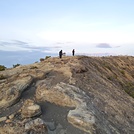
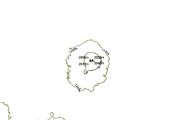
– Lat/Long: 6.89° S 108.40° E

IdGunung Ciremai or Cereme – Climbing, Hiking & Mountaineering information

Placeholder

Gunung Ciremai or Cereme mountain guide

Ciremay Crater, Gunung Ciremai or Cereme photo

Gunung Ciremai or Cereme

Photo credit: Iwan Syah

Ciremay Crater, Gunung Ciremai or Cereme photo

Gunung Ciremai or Cereme

Photo credit: Iwan Syah

Sadarehe, Gunung Ciremai or Cereme photo

Gunung Ciremai or Cereme

Photo credit: Iwan Syah

Ciremai crater, Gunung Ciremai or Cereme photo

Gunung Ciremai or Cereme

Photo credit: Iwan Syah

  • Elevation: 3070 m
  • Difficulty: Walk up
  • Best months to climb: March, April, May, June, July, August, September, October, November
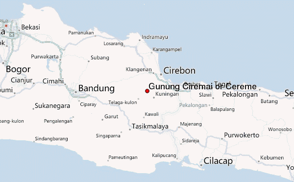
  • Convenient center: Kuningan

Gunung Ciremai or Cereme Climbing Notes

Septian Aditya from INDONESIA writes:

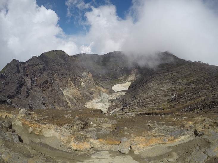
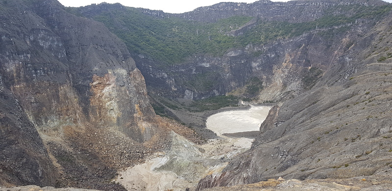
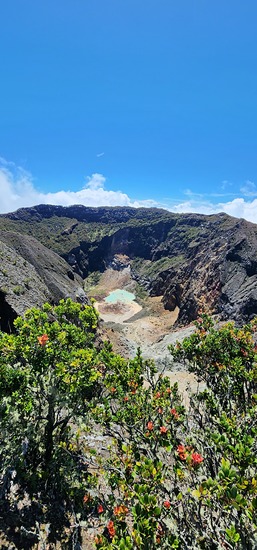
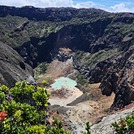
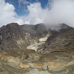
highest peak in western java.

It has 3 main route:
- linggajati (650 m above sea level) : thoughest route
- palutungan (1000 m above sea level) : longest route
- apuy (1200 m above sea level) : shortest route

using the linggajati route we can reach the top within 10 hours hike.

2013-11-22

Click here to submit your own climbing note for Gunung Ciremai or Cereme

Gunung Ciremai or Cereme Location Map

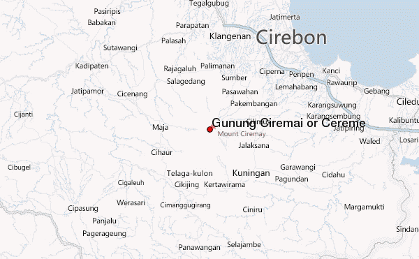
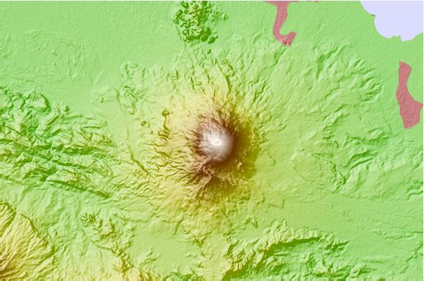
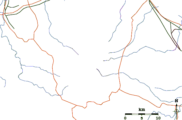
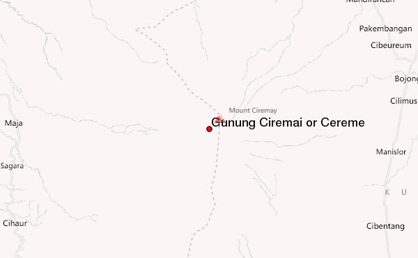
Select Gunung Ciremai or Cereme Location Map Detail:


Latest Gallery Images for Gunung Ciremai or Cereme

visit the
gallery
or click to view
Pos 8 kawah burungPos 8 kawah burungCrater top of sadarehePuncak Apuy

Upload your photo of Gunung Ciremai or Cereme

Select a mountain summit from the menu
Select a Mountain Summit
Surf breaks located close to Gunung Ciremai or Cereme Mountain peaks around Gunung Ciremai or Cereme Roads and rivers around Gunung Ciremai or Cereme

Use this relief map to navigate to mountain peaks in the area of Gunung Ciremai or Cereme.

10 other mountain peaks closest to Gunung Ciremai or Cereme:

1. Mount Cereme (3078 m) 0.0 km
2. Karaha Crater (1155 m) 43.5 km
3. Kawahkaraha (1155 m) 47.0 km
4. Talagabodas (2201 m) 50.7 km
5. Tampomas (1684 m) 51.5 km
6. Mount Tampomas (1684 m) 51.5 km
7. Galunggung (2168 m) 55.5 km
8. Guntur (2249 m) 68.3 km
9. Kawahkamojang (1730 m) 71.2 km
10. Kamojang (1730 m) 71.2 km